 English
 Spanish
 French
 Chinese
 Russian
 Portuguese
 Latest Activation
Charter activations
Flood in Sri Lanka
Torrential rain in Sri Lanka caused floods and landslides in the last two weeks of December 2014.
39 people were killed in the disaster, and over 100,000 were forced to evacuate. It has been estimated that over a million people were affected by the disaster.
The southeastern area of the country was the worst affected, particularly the Badulla District, but the floods were not isolated to this area alone. Coastal areas of the country experienced heavy flooding, and thousands of hectares of crops were destroyed by the flood waters.
| Tipo de evento: | Flood |
| Local do evento: | Sri Lanka |
| Data da Ativação da Carta: | 29 December 2014 |
| Tempo de Ativação da Carta: | 14:22:00 |
| Zona de Tempo da Ativação da Carta: | UTC+01:00 |
| Requisitante da Carta: | UNITAR/UNOSAT on behalf of WFP |
| Gerenciamento de projeto: | UNITAR/UNOSAT |
Products
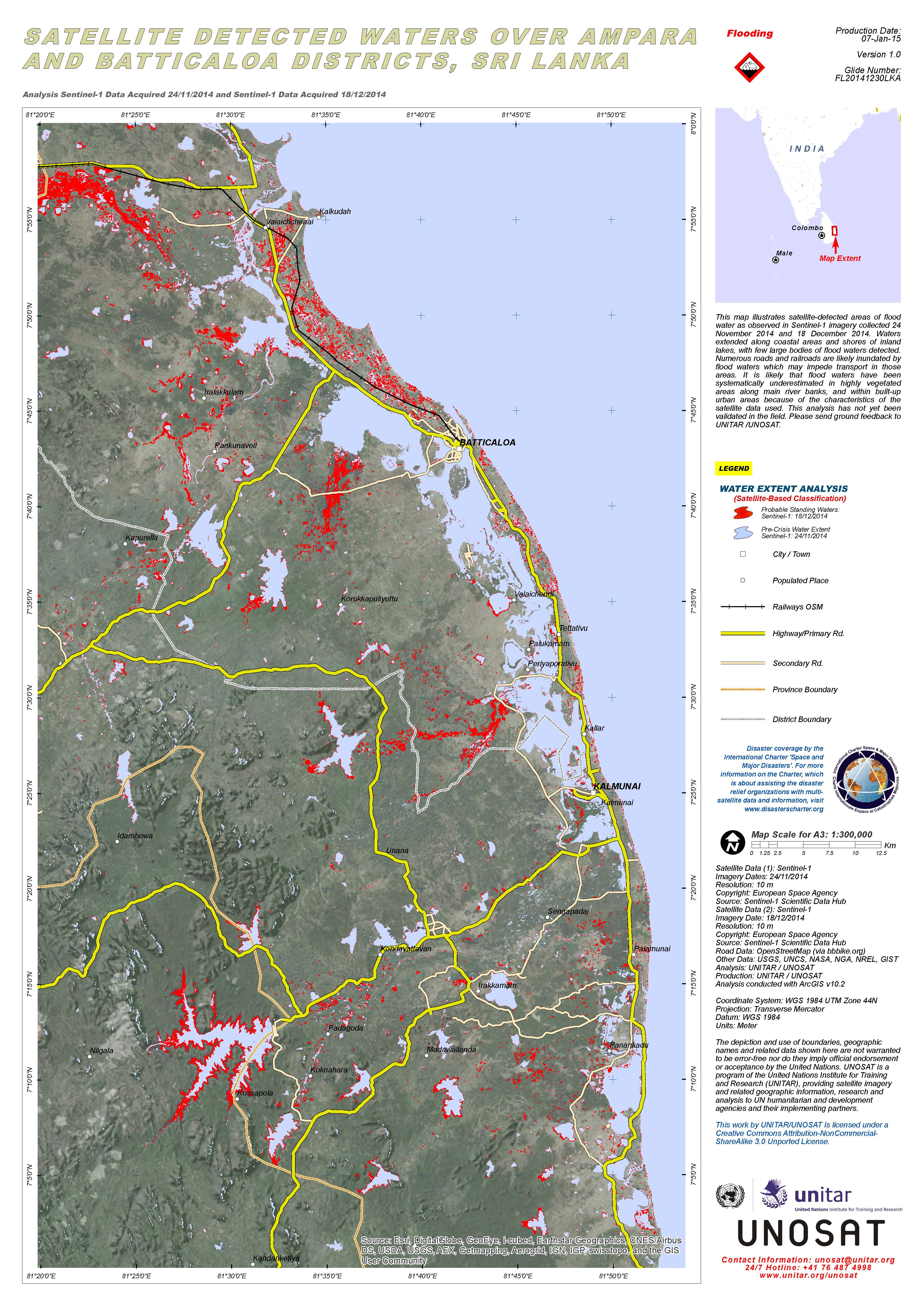
Satellite detected waters over Ampara and Batticaloa Districts, Sri Lanka
Direitos autorais: © Copernicus / ESA 2014
Map produced by UNITAR/UNOSAT
Information about the Product
Adquirida: 24/11/2014 and 18/12/2014
Fonte: Sentinel-1
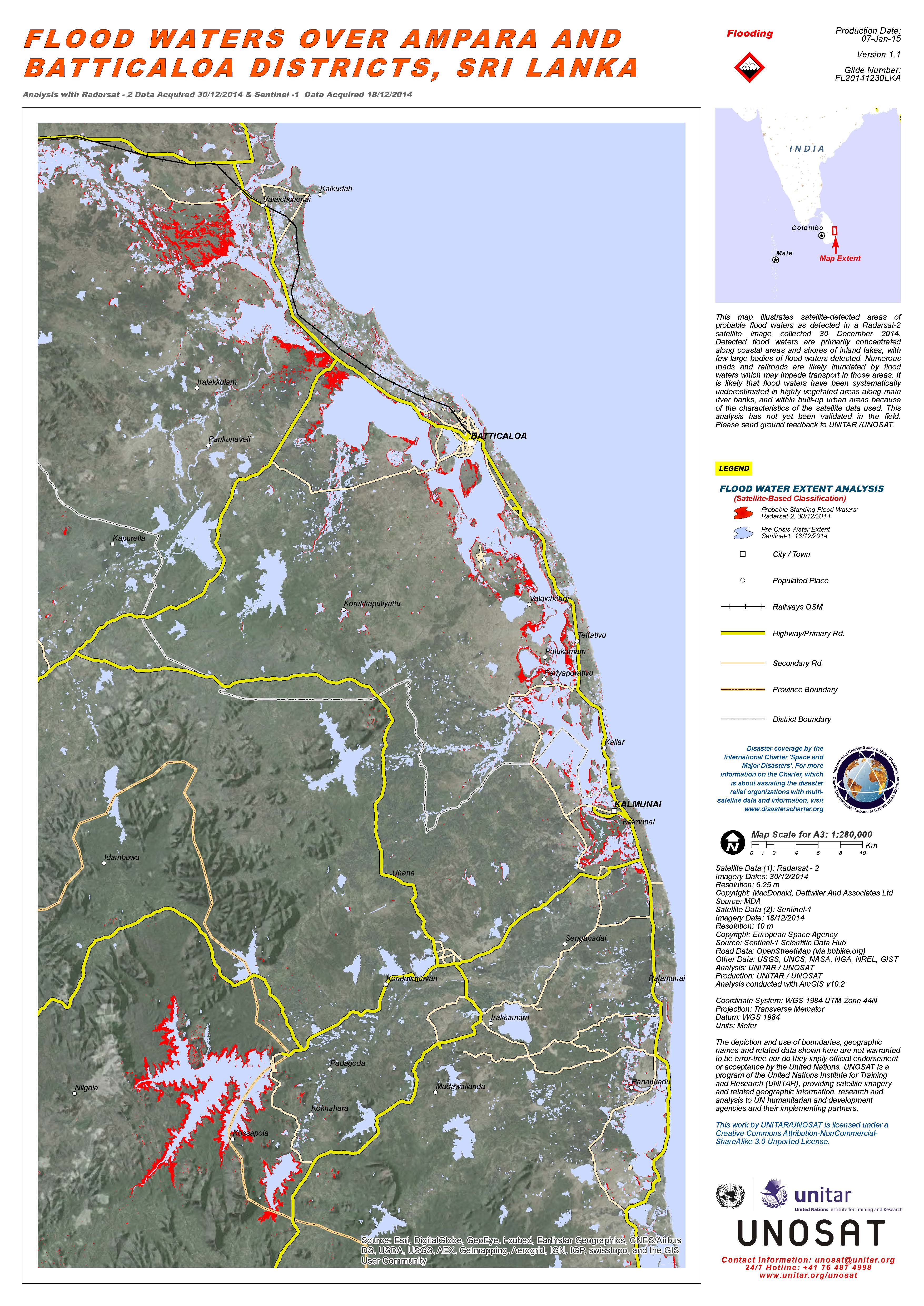
Flood waters over Ampara and Batticaloa Districts, Sri Lanka
Direitos autorais: RADARSAT-2 Data and Products © MacDonald, Dettwiler and Associates Ltd. (2014) - All Rights Reserved. RADARSAT is an official trademark of the Canadian Space Agency.
Sentinel-1 © Copernicus / ESA 2014
Map produced by UNITAR/UNOSAT
Information about the Product
Adquirida: RADARSAT-2: 30/12/2014
Sentinel-1: 18/12/2014
Fonte: RADARSAT-2 / Sentinel-1
 Voltar ao arquivo completo da Ativação

