 English
 Spanish
 French
 Chinese
 Russian
 Portuguese
 Latest Activation
Charter activations
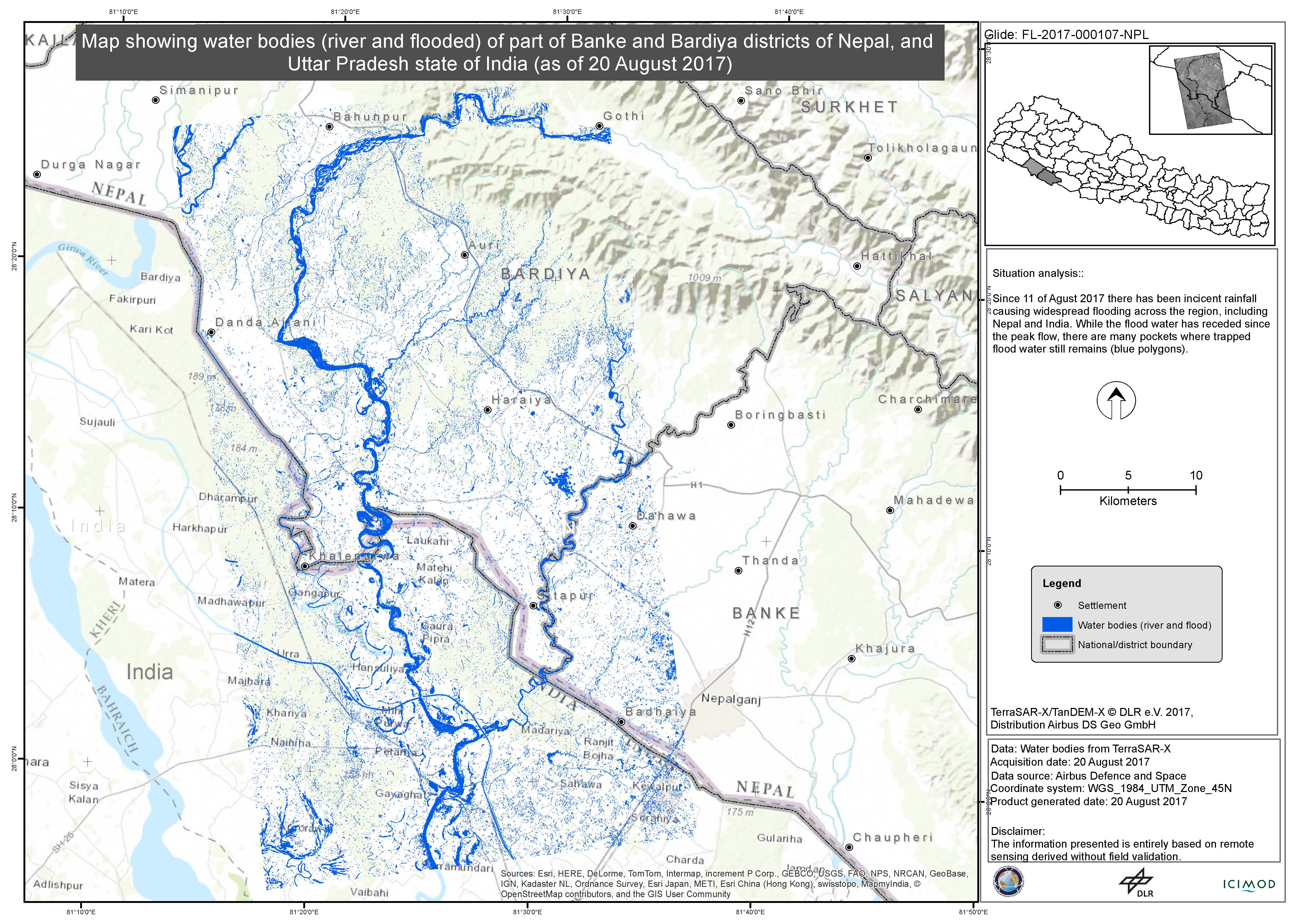
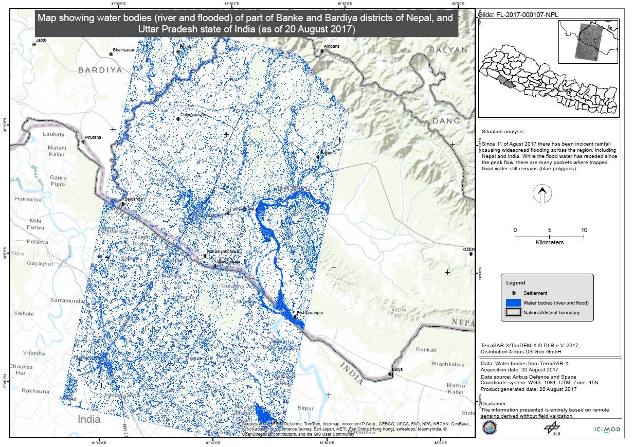
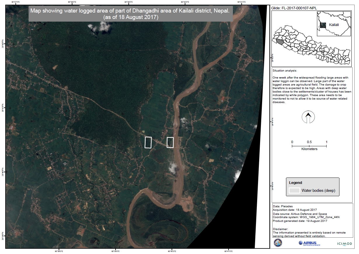
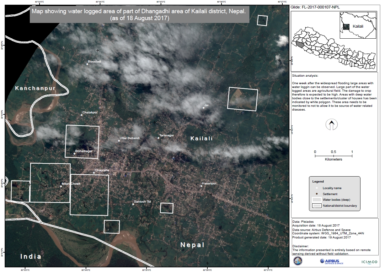
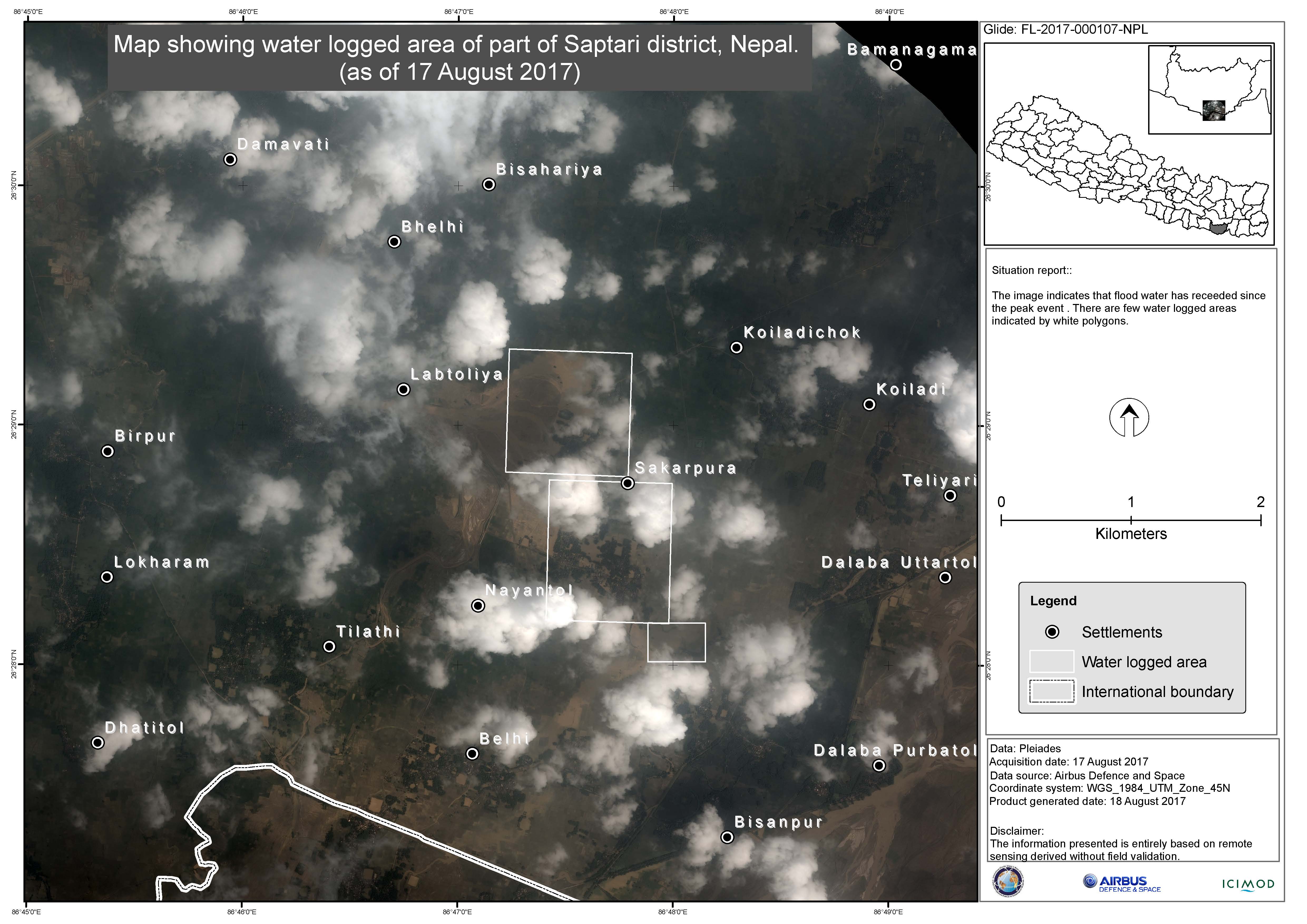
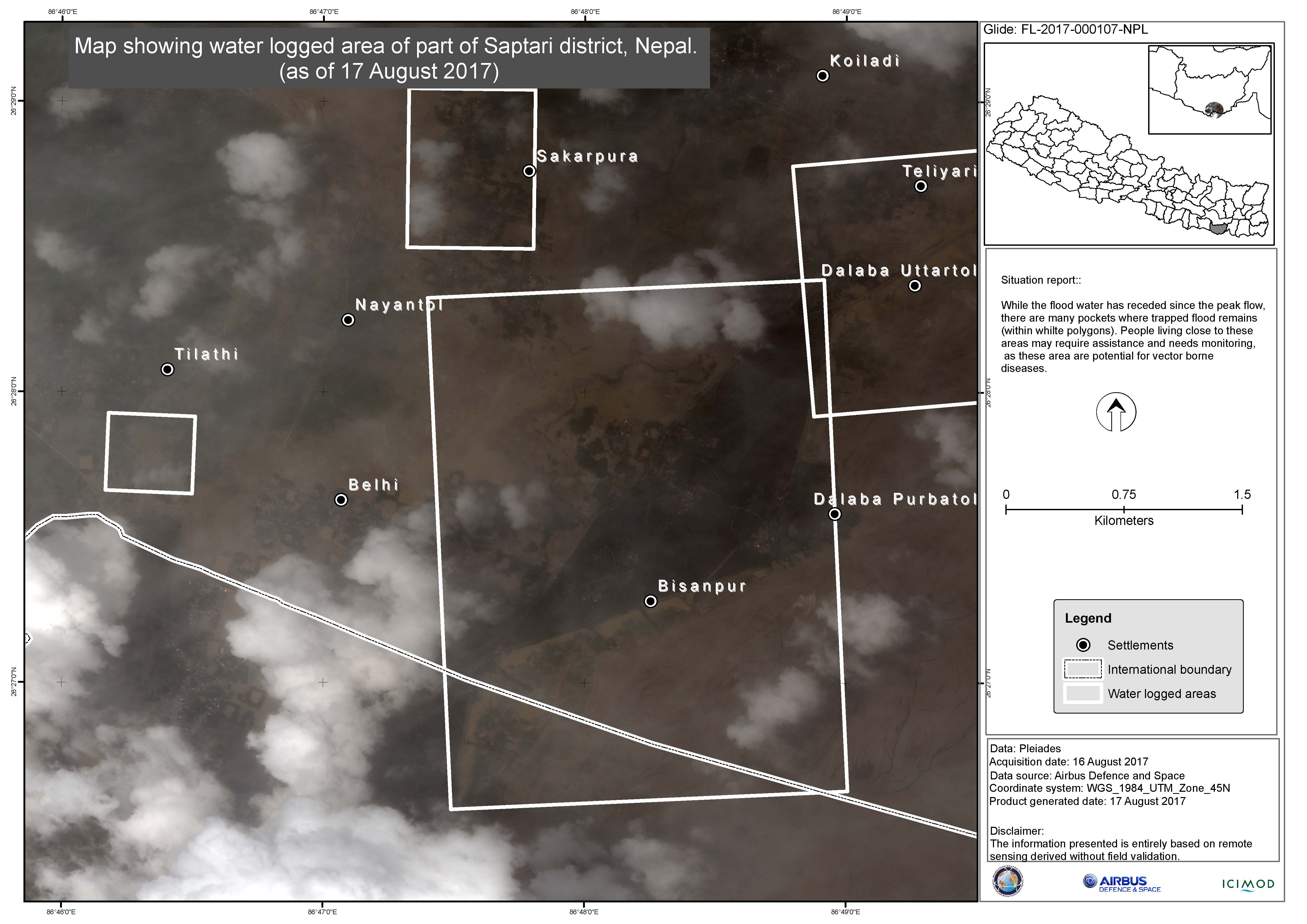
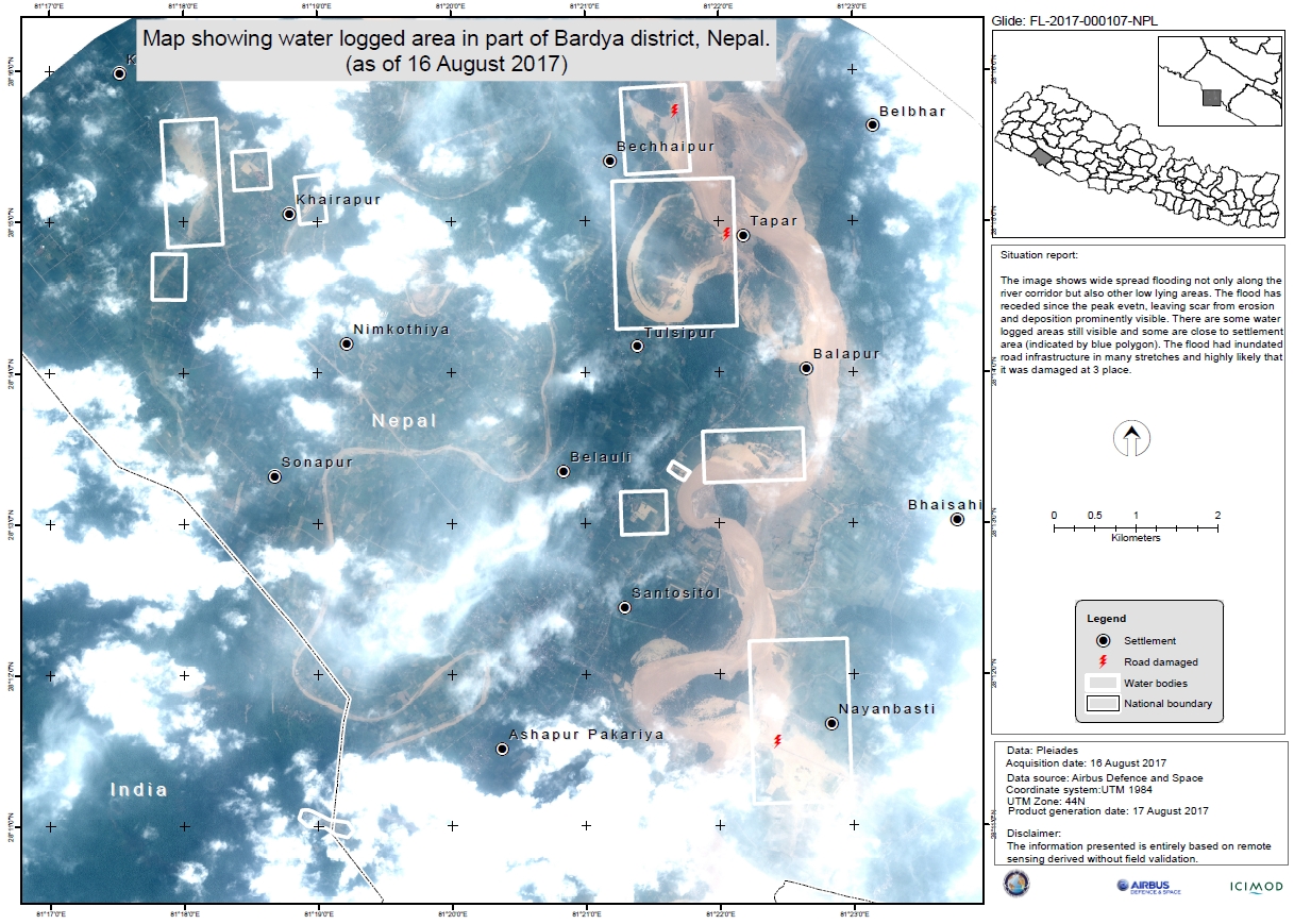
Flood in Nepal
At least 141 people have died in Nepal following floods and landslides.
It is estimated that 27 districts in the country are affected, and tens of thousands of people have been forced to evacuate their homes.
The disaster follows three days of monsoon rains. Authorities were able to warn many at risk in advance, prompting the evacuation of thousands of people before they could be placed in danger.
Estimates suggest as many as 50,000 homes could be flooded, and 3000 destroyed. The agricultural heartland of the country is also affected, leading to concerns about future limits on food production after damage to the crops.
27,000 relief and rescue personnel have been deployed by the government.
The toll from the disaster is expected to rise as rescue personnel reach isolated villages.
| Tipo de evento: | Flood and landslides |
| Local do evento: | Nepal |
| Data da Ativação da Carta: | 15 August 2017 |
| Tempo de Ativação da Carta: | 11:03:00 |
| Zona de Tempo da Ativação da Carta: | UTC+02:00 |
| Requisitante da Carta: | UNOOSA on behalf of UN Resident Coordinator's (UNRC) office in Kathmandu, Nepal |
| ID da Ativação: | 544 |
| Gerenciamento de projeto: | International Centre for Integrated Mountain Development (ICIMOD) |
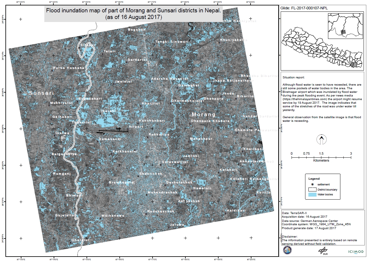
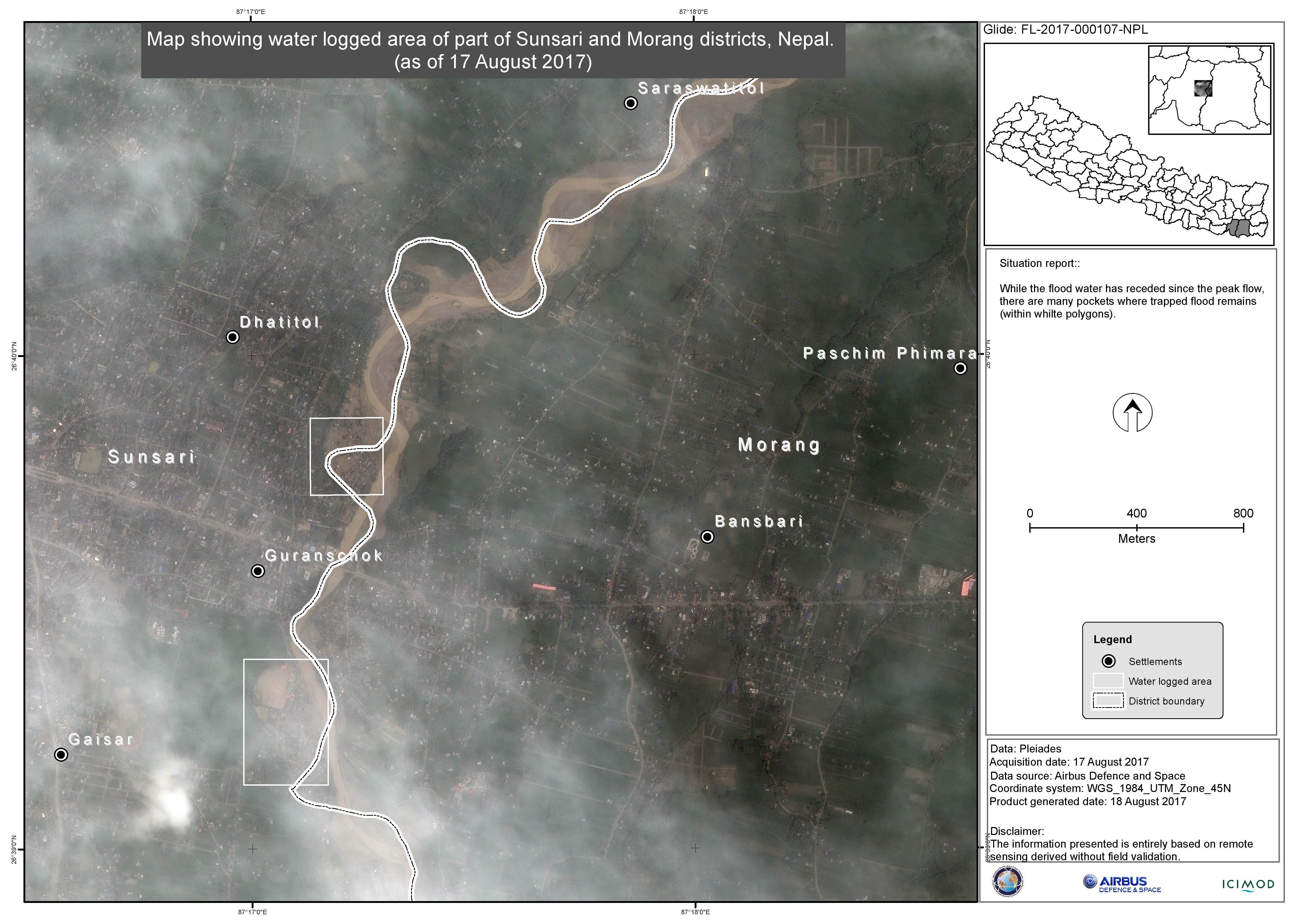
Products
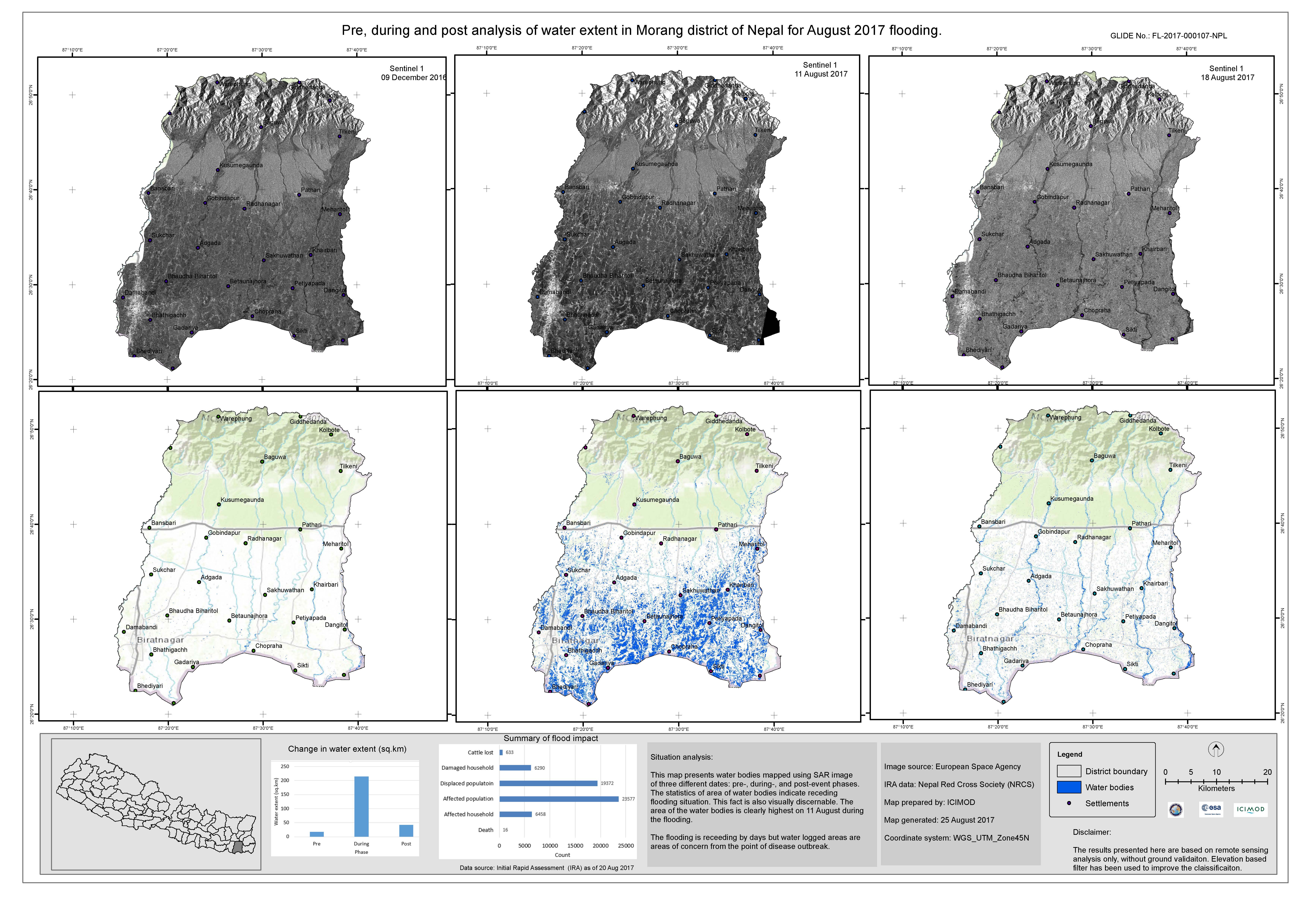
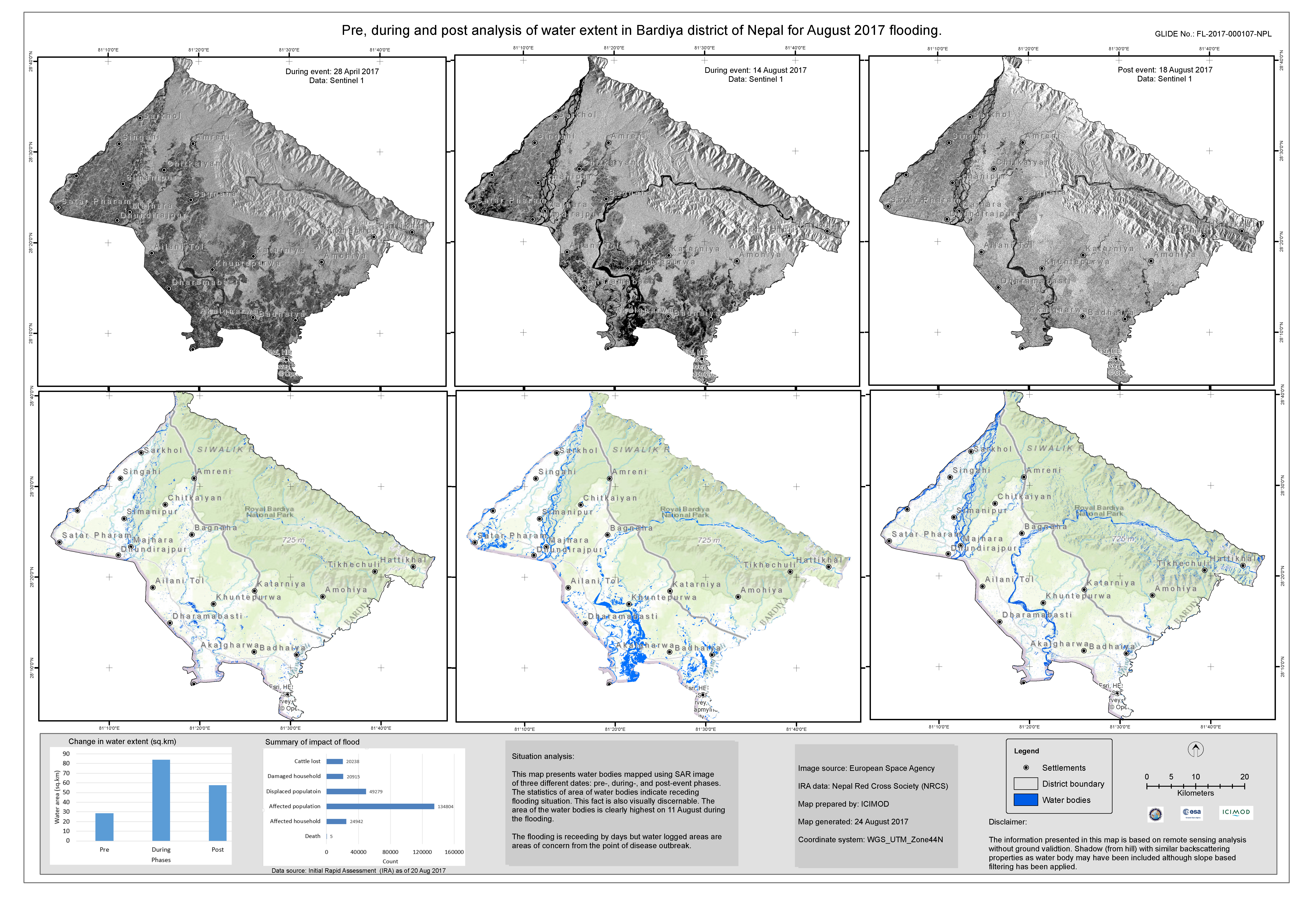
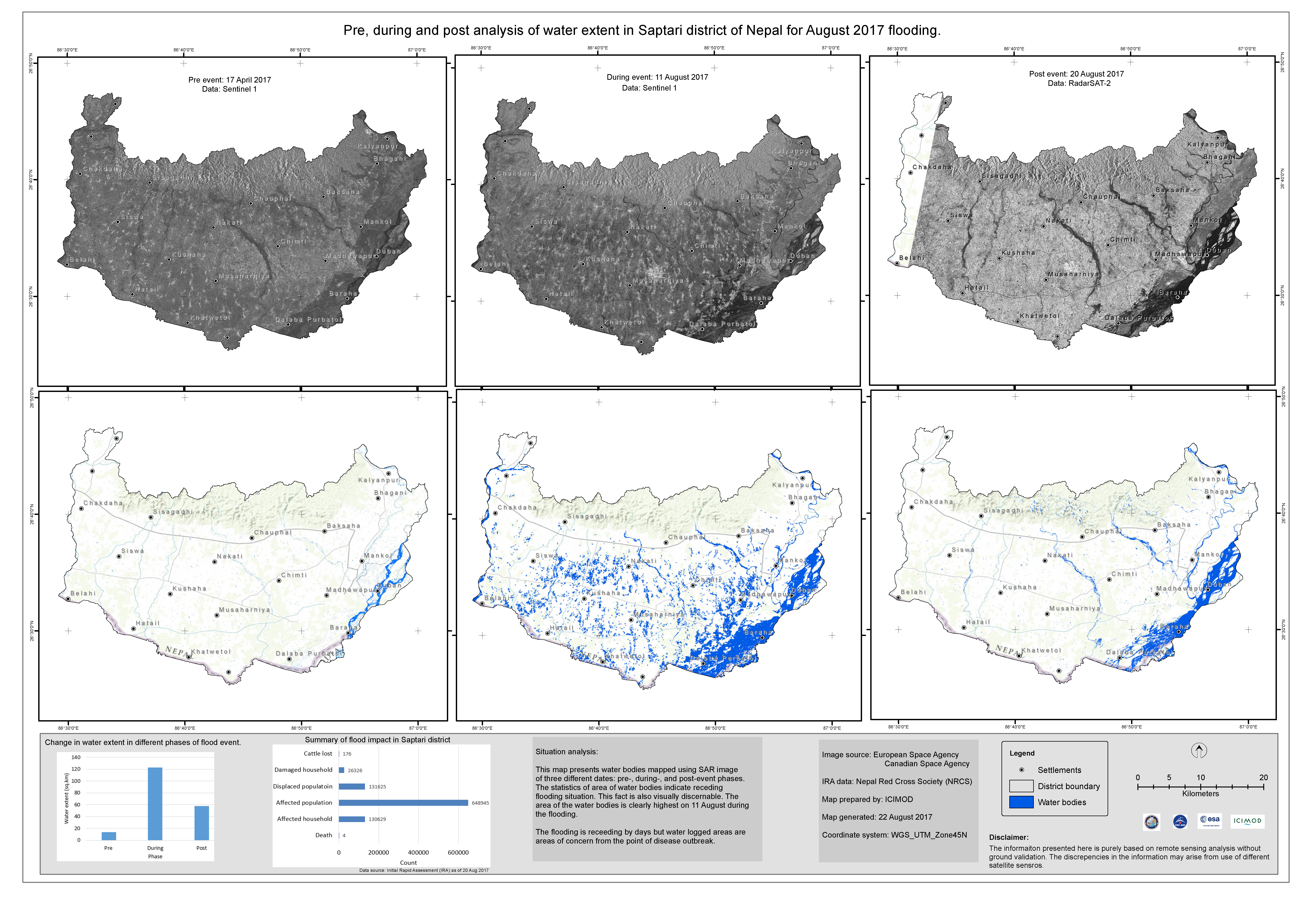
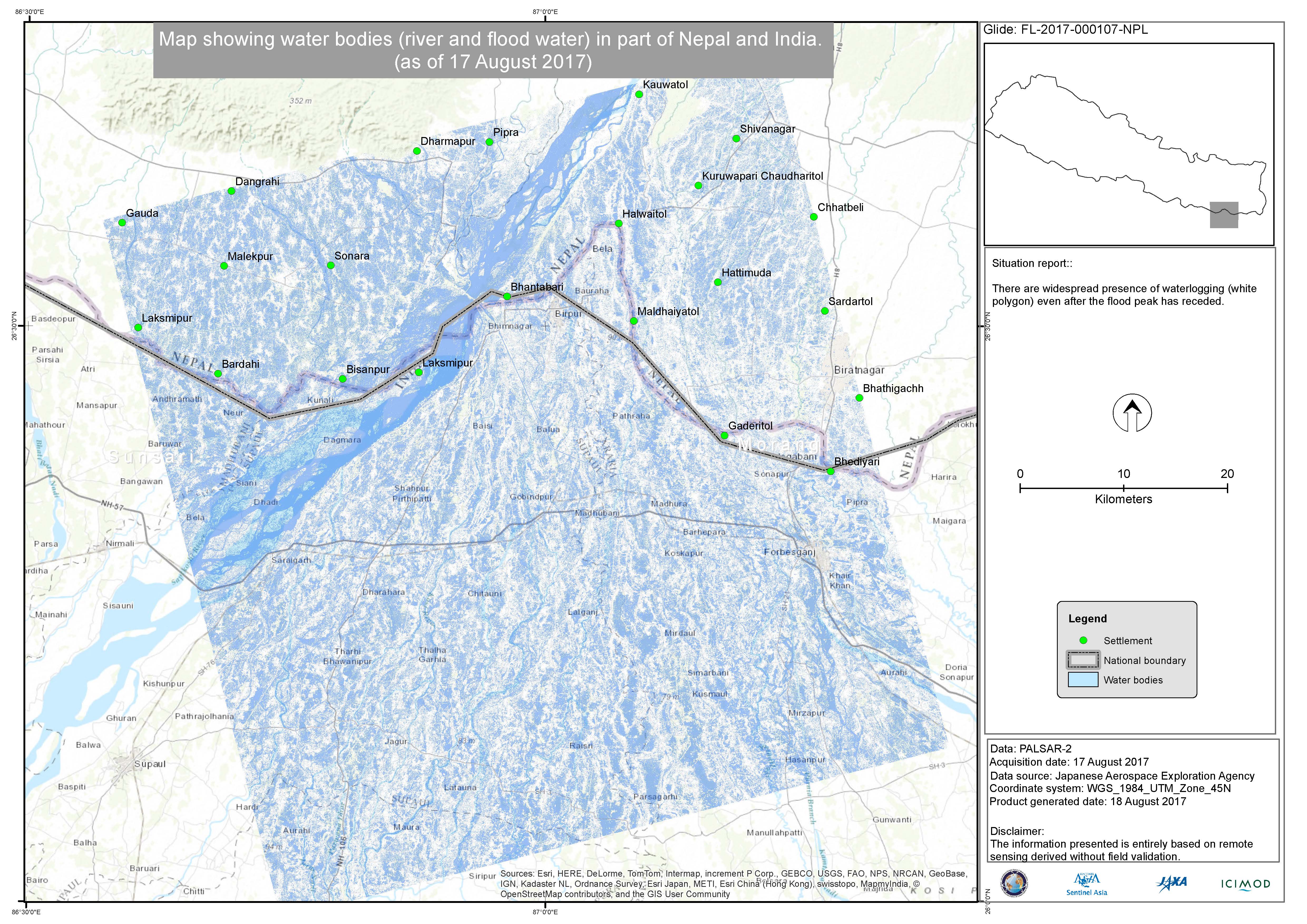
Pre, during and post analysis of water extent in Saptari district
Direitos autorais: Sentinel-1 © Copernicus Sentinel data (2017)
RADARSAT-2 Data and Products © MacDonald, Dettwiler and Associates Ltd. (2016) - All Rights Reserved. RADARSAT is an official trademark of the Canadian Space Agency.
Map produced by ICIMOD
Information about the Product
Adquirida: Sentinel-1: 17/04/2017 and 11/08/2017
RADARSAT-2: 20/08/2017
Fonte: Sentinel-1 / RADARSAT-2

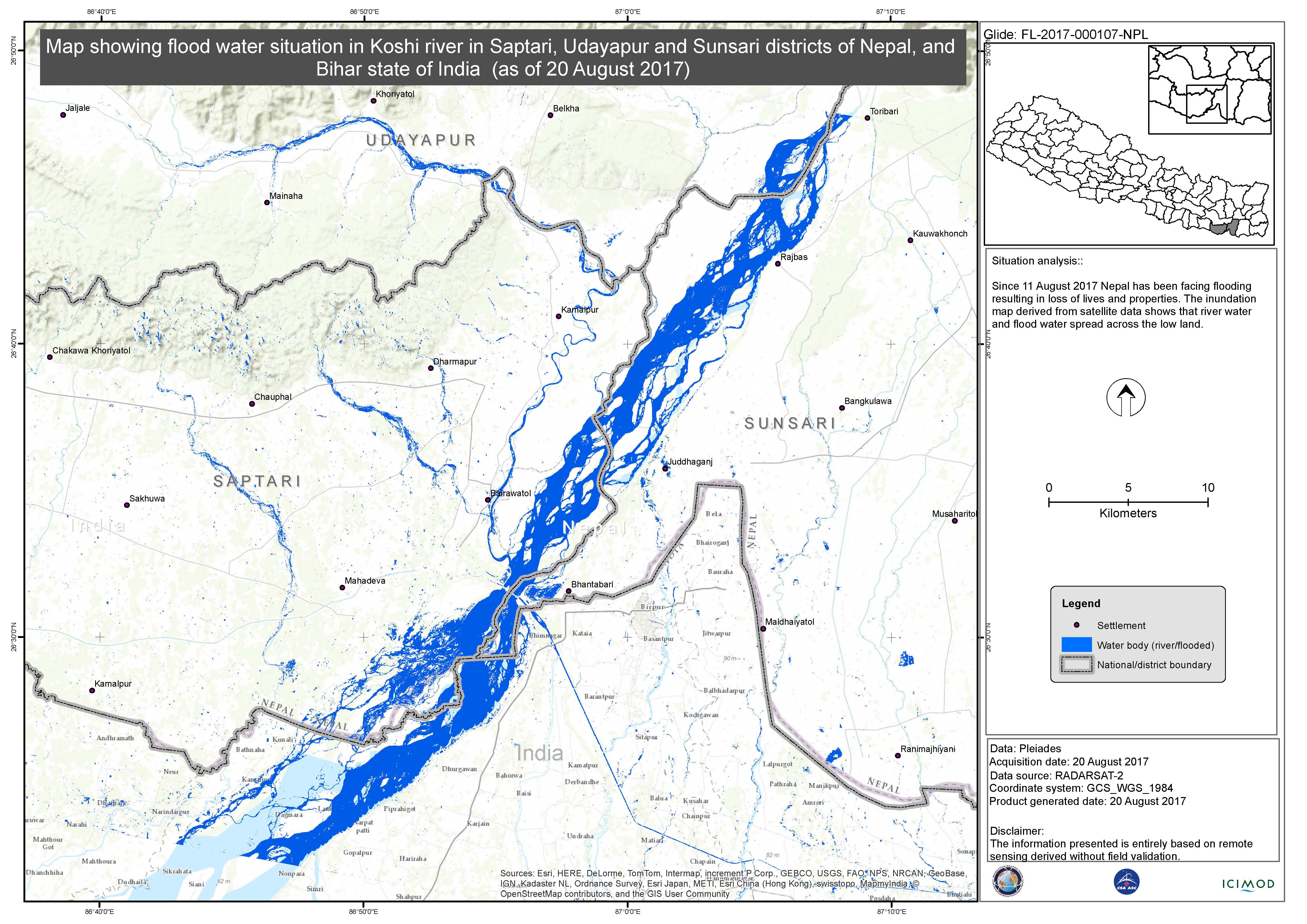
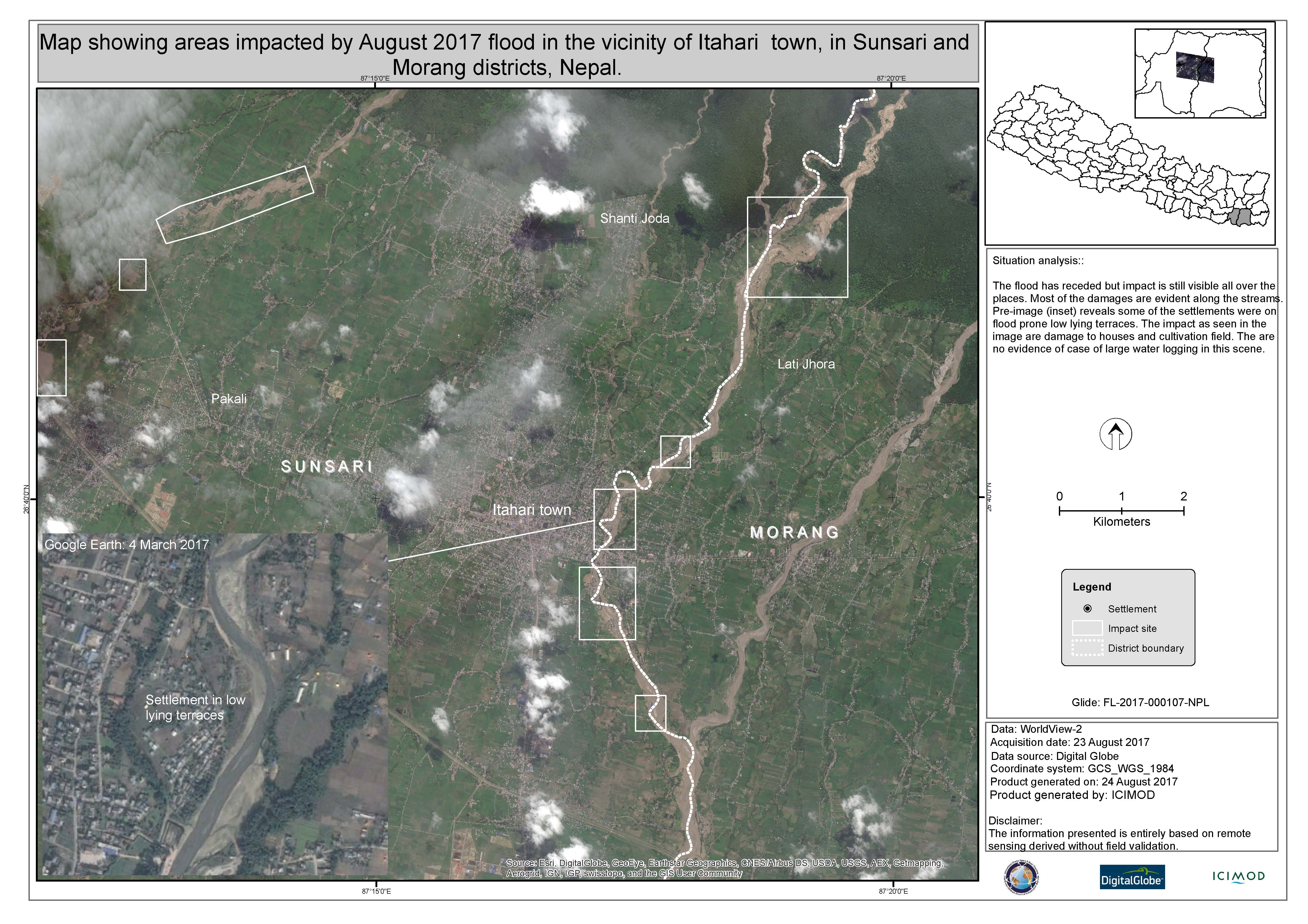
Flood analysis in Saptari, Udayapur and Sansari Districts, Nepal
Direitos autorais: Pleiades © CNES (2017) - Distribution: Airbus Defence and Space, all rights reserved
RADARSAT-2 Data and Products © MacDonald, Dettwiler and Associates Ltd. (2016) - All Rights Reserved. RADARSAT is an official trademark of the Canadian Space Agency.
Map produced by ICIMOD
Information about the Product
Adquirida: Pleiades: 20/08/2017
RADARSAT-2: 20/08/2017
Fonte: Pleiades/RADARSAT-2
 Voltar ao arquivo completo da Ativação

