 English
 Spanish
 French
 Chinese
 Russian
 Portuguese
 Latest Activation
Charter activations
Flood in Iran
Western and southwestern parts of Iran are suffering major flooding following days of heavy rain.
Over 2500 people have been evacuated from several provinces and over a hundred cities are reported to have suffered damage and flooding.
The flooding has struck the provinces of Lorestan, Ilam, Kermanshah, Fars, Khuzestan, Chaharmahal, Bakhtiari and Kurdistan.
The disaster has cut electricity supplies and water to thousands of people, and dams throughout the region are close to their limit as the rain continues to raise water levels ever higher.
| Tipo de evento: | Flood |
| Local do evento: | Islamic Republic of Iran |
| Data da Ativação da Carta: | 15 April 2016 |
| Tempo de Ativação da Carta: | 15:57:55 |
| Zona de Tempo da Ativação da Carta: | UTC+02:00 |
| Requisitante da Carta: | UNOOSA/UN-SPIDER on behalf of Iranian Space Agency |
| Gerenciamento de projeto: | UN-SPIDER |
Products
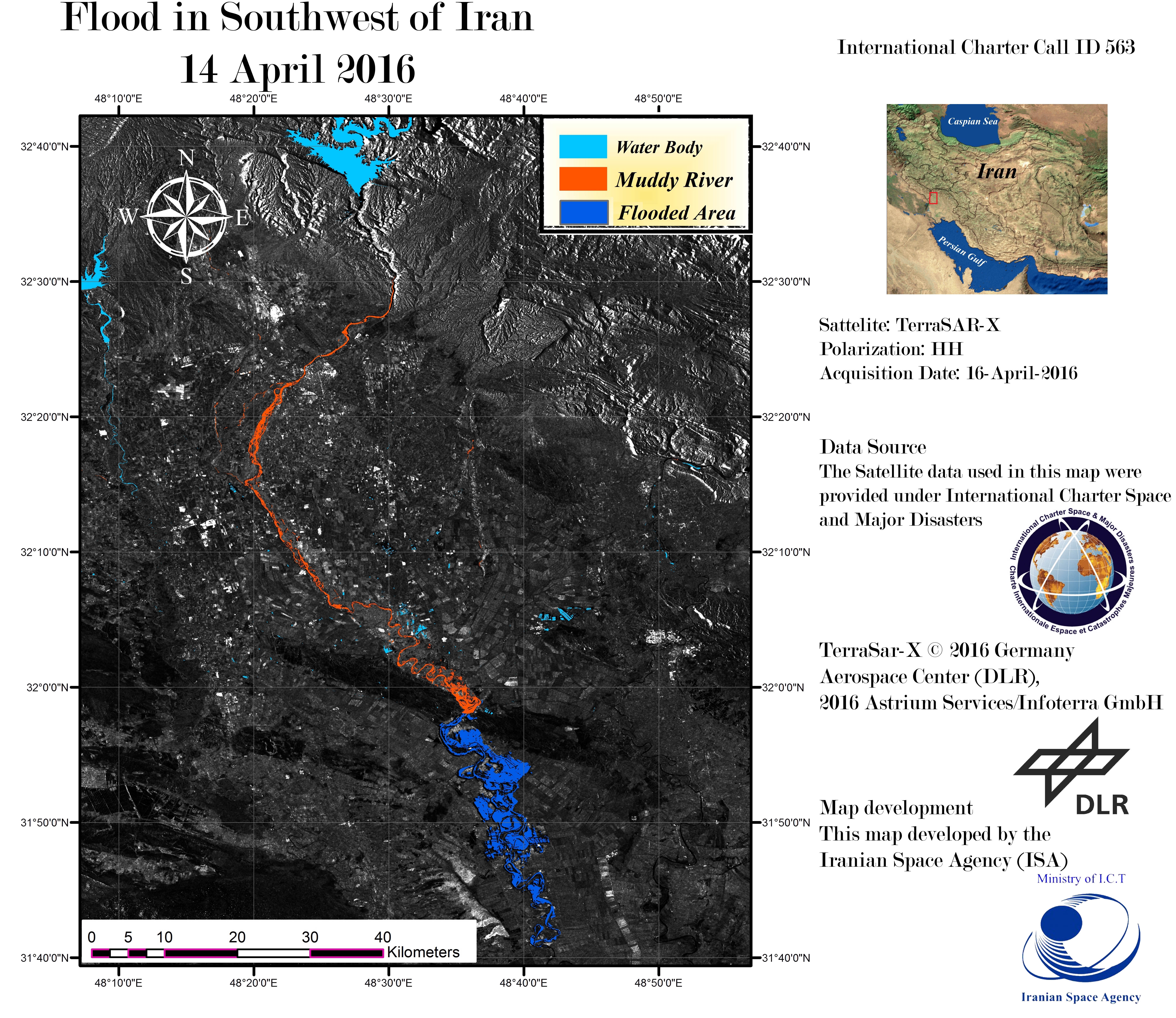
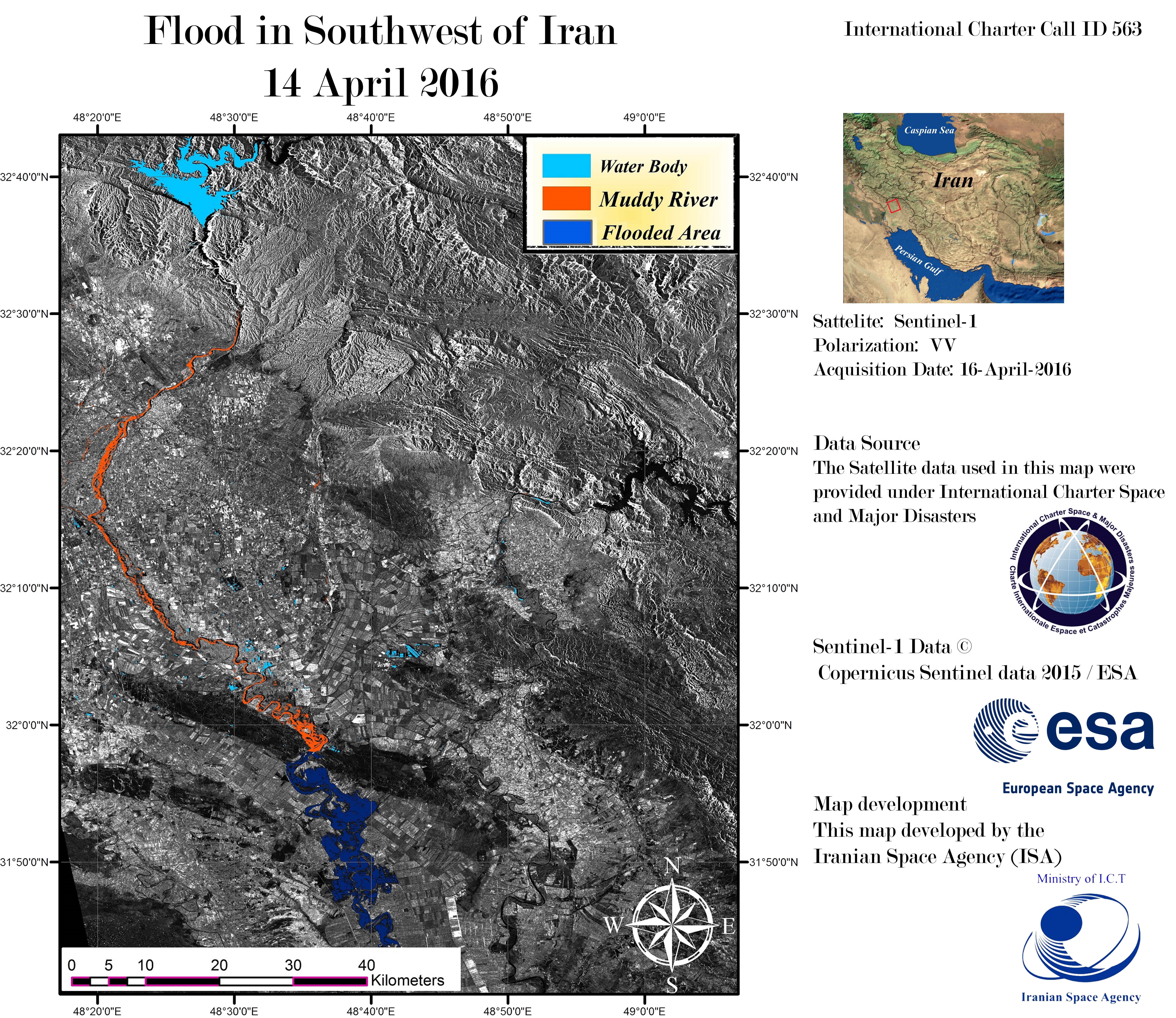
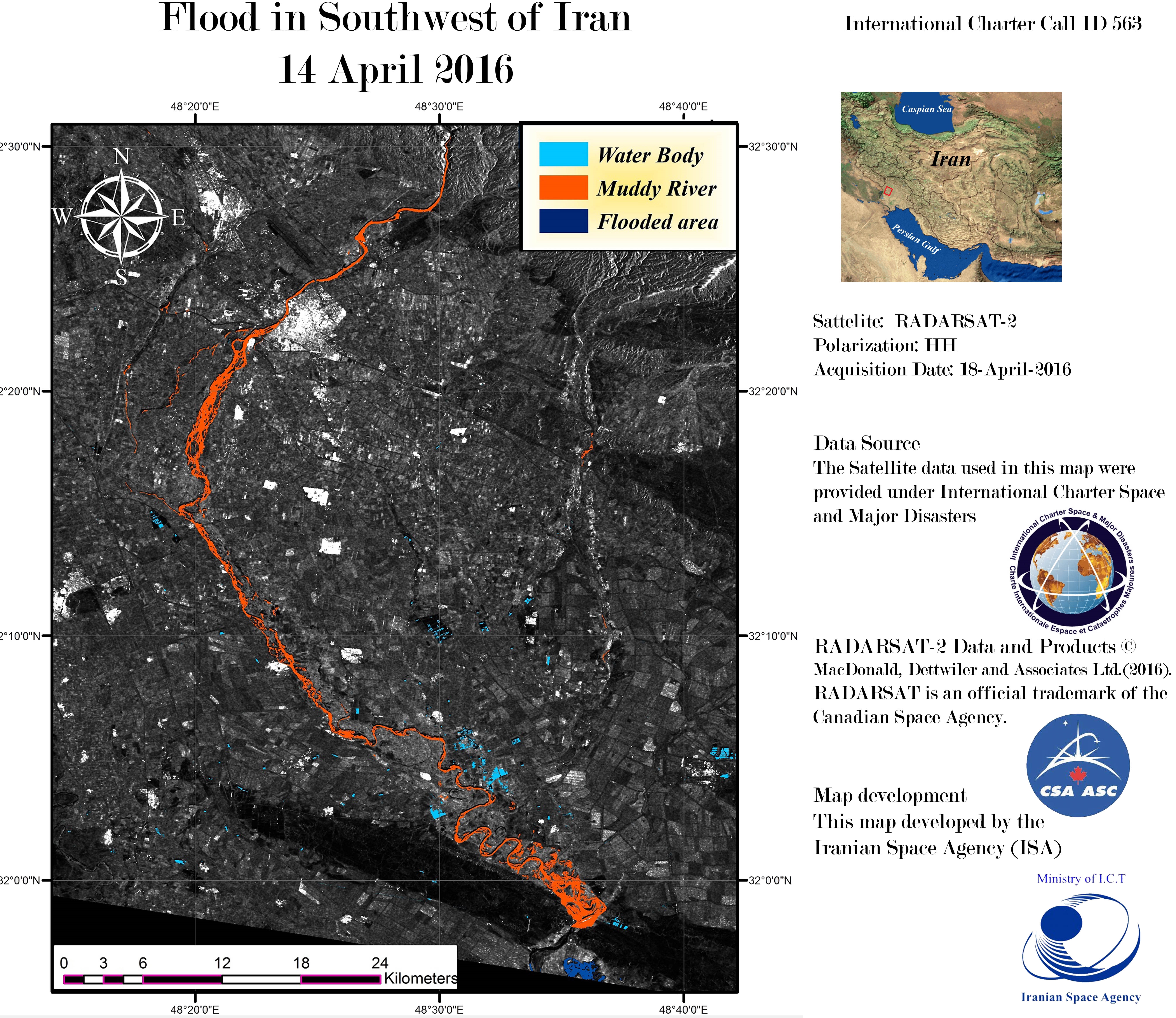
Flooding in South West Iran
Direitos autorais: RADARSAT-2 Data and Products © MacDonald, Dettwiler and Associates Ltd. (2016) - All Rights Reserved. RADARSAT is an official trademark of the Canadian Space Agency.
Map produced by ISA
Information about the Product
Adquirida: 18/04/2016
Fonte: RADARSAT-2
 Voltar ao arquivo completo da Ativação

