 English
 Spanish
 French
 Chinese
 Russian
 Portuguese
 Latest Activation
Charter activations
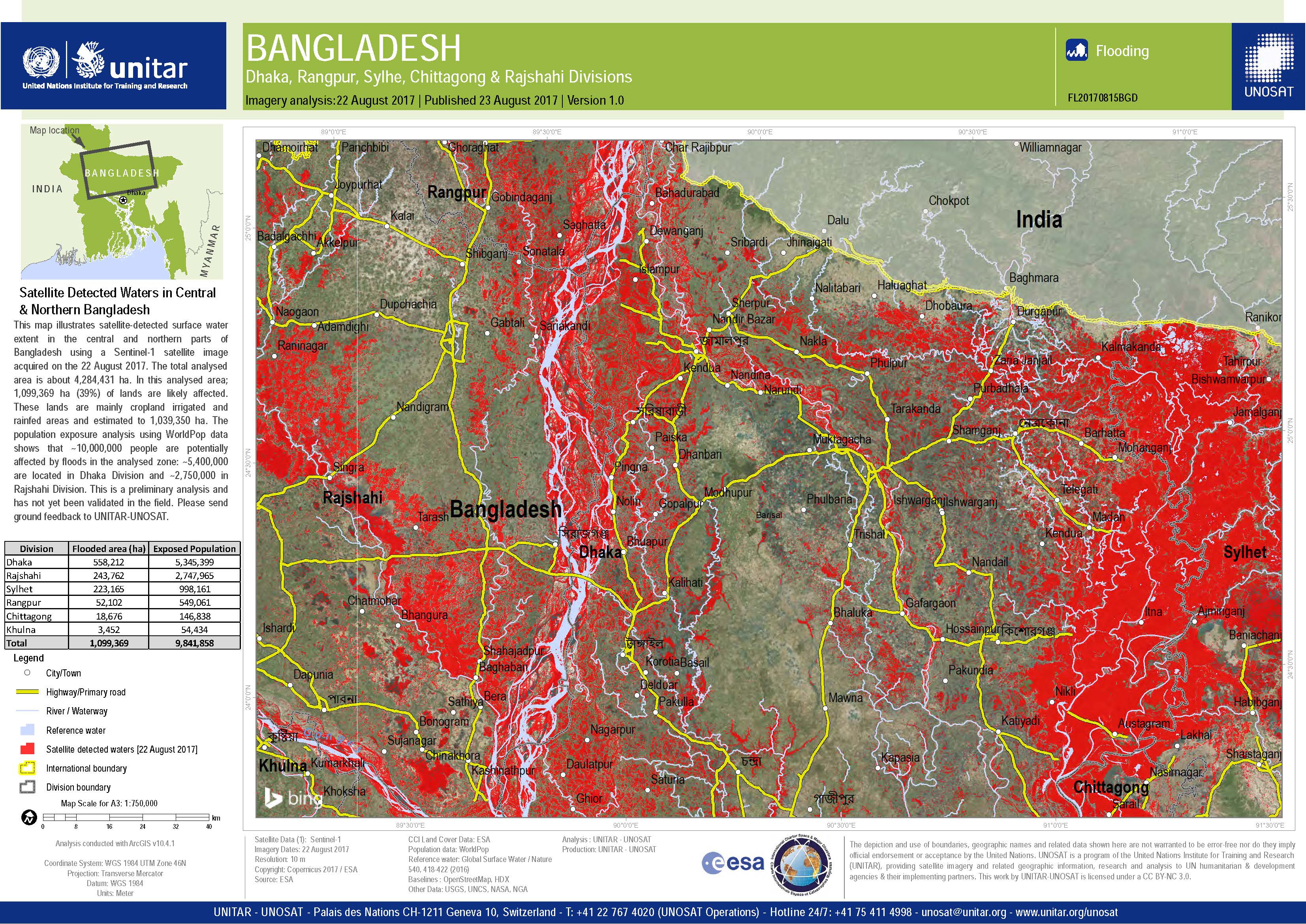
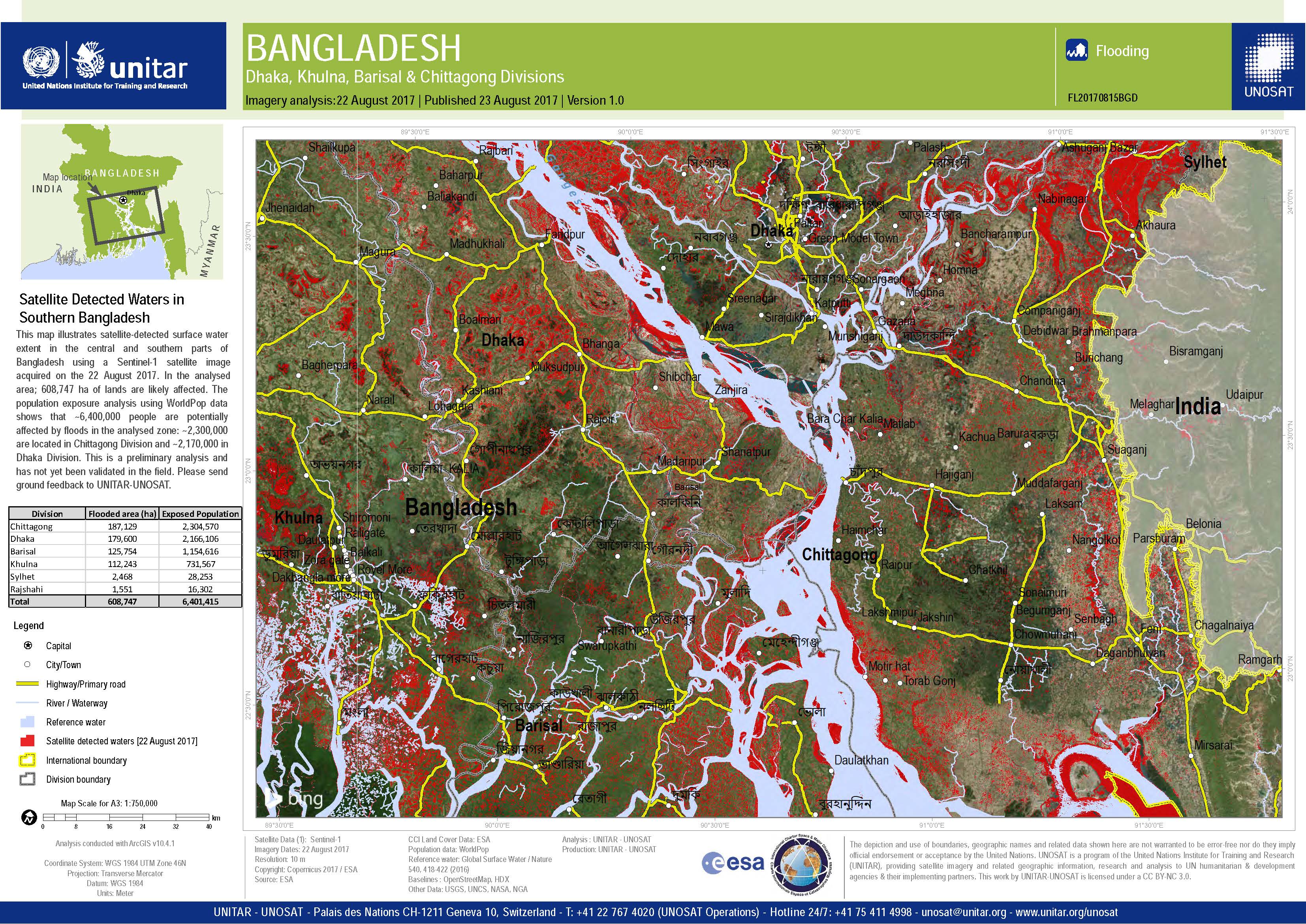
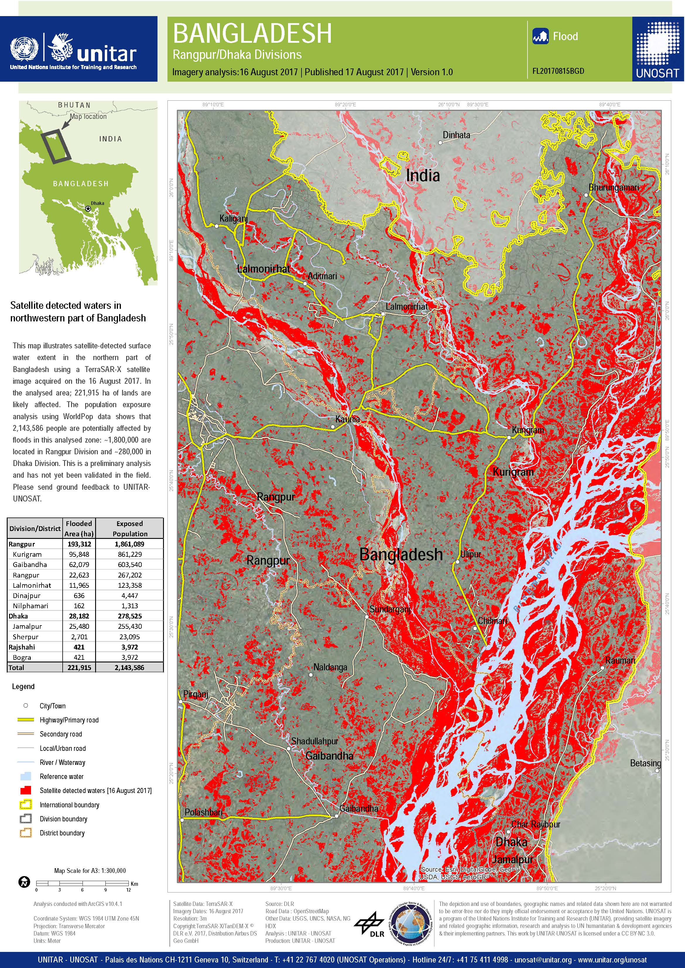
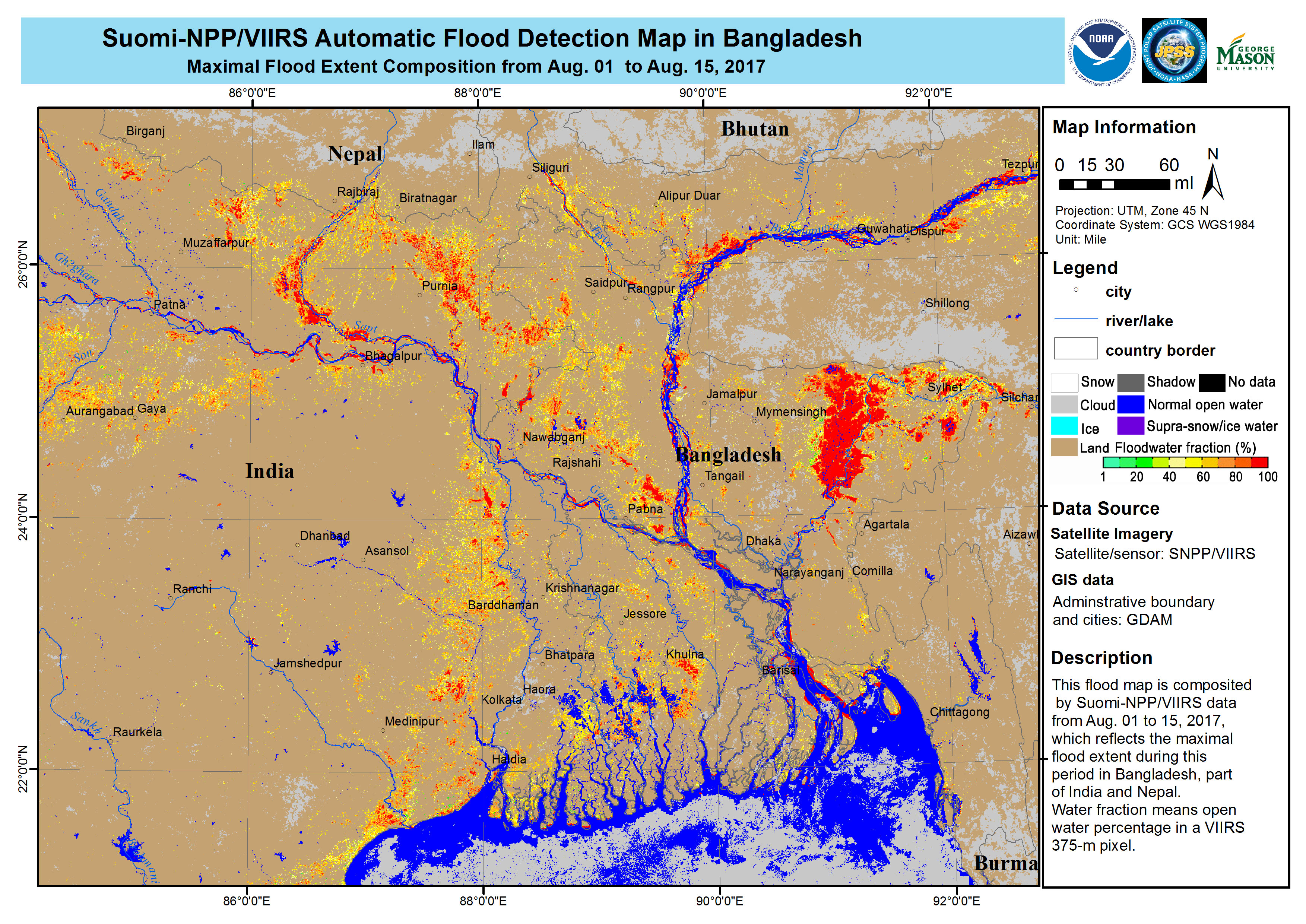
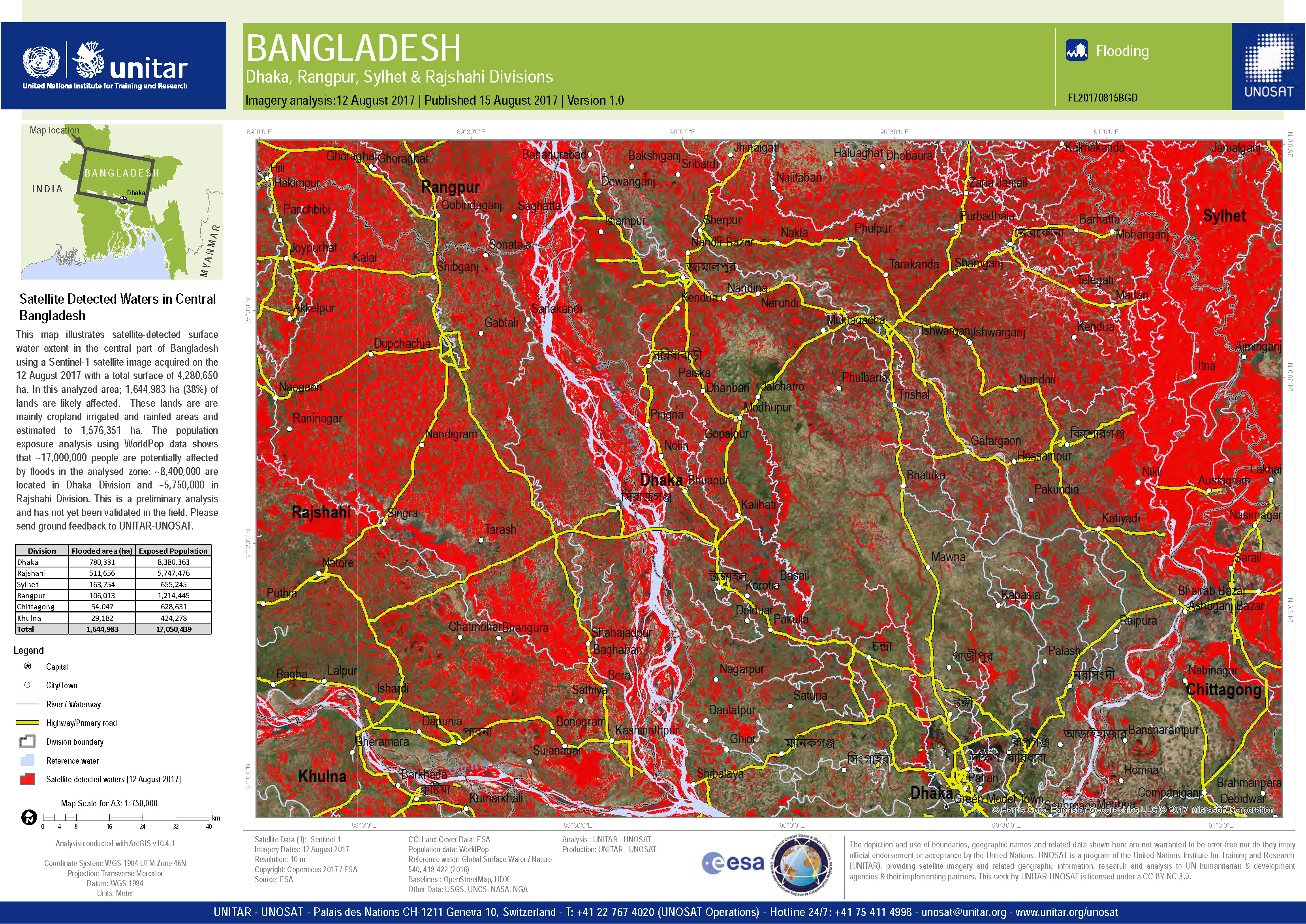
Flood in Bangladesh
Floods in Bangladesh have left 140 people dead and affected more than 8 million.
Hundreds of thousands of people have been forced to leave their homes and seek shelter. It is estimated that 700,000 homes have been damaged or destroyed.
The disaster occurred when monsoon rains struck the region, causing flooding further upstream in neighbouring countries such as Nepal. Flood waters flowed down overburdened rivers into Bangladesh, affecting almost a third of the nation.
The government of Bangladesh had been monitoring the situation in other countries, however, and took steps to prepare for the expected flooding.
It has been reported that the water level of the Brahmaputra River has reached a level not exceeded for a hundred years.
There are concerns for the long-term food security of Bangladesh due to agricultural damage. Estimates suggest 10,000 hectares of crops may have been destroyed in the floods, with as many as 600,000 hectares damaged.
The floods follow in a relatively short time frame from those which affected Bangladesh in May and June.
| Tipo de evento: | Flood |
| Local do evento: | Bangladesh |
| Data da Ativação da Carta: | 15 August 2017 |
| Tempo de Ativação da Carta: | 15:00:00 |
| Zona de Tempo da Ativação da Carta: | UTC+09:00 |
| Requisitante da Carta: | UNITAR/UNOSAT on behalf of United Nations Office for the Coordination of Humanitarian Affairs | Regional Office for Asia and the Pacific |
| ID da Ativação: | 545 |
| Gerenciamento de projeto: | UNITAR/UNOSAT |
Products
 Voltar ao arquivo completo da Ativação

