 English
 Spanish
 French
 Chinese
 Russian
 Portuguese
 Latest Activation
Charter activations
Flood in Afghanistan
According to assessments conducted to date, floods have affected approximately 10,000 households in five provinces in the Northern region (Jawzjan, Faryab, Balkh, Samangan and Sari Pul) and four provinces in the Northeastern region (Kunduz, Baghlan, Takhar and Badakhshan). Flooding in the north and northeast is expected to continue and worsen, due to heavy rains and to snow melting.
| Tipo de evento: | Flood |
| Local do evento: | Afghanistan |
| Data da Ativação da Carta: | 19/05/2009 |
| Requisitante da Carta: | UNOOSA on behalf of OCHA Afghanistan |
| Gerenciamento de projeto: | SERTIT |
Products

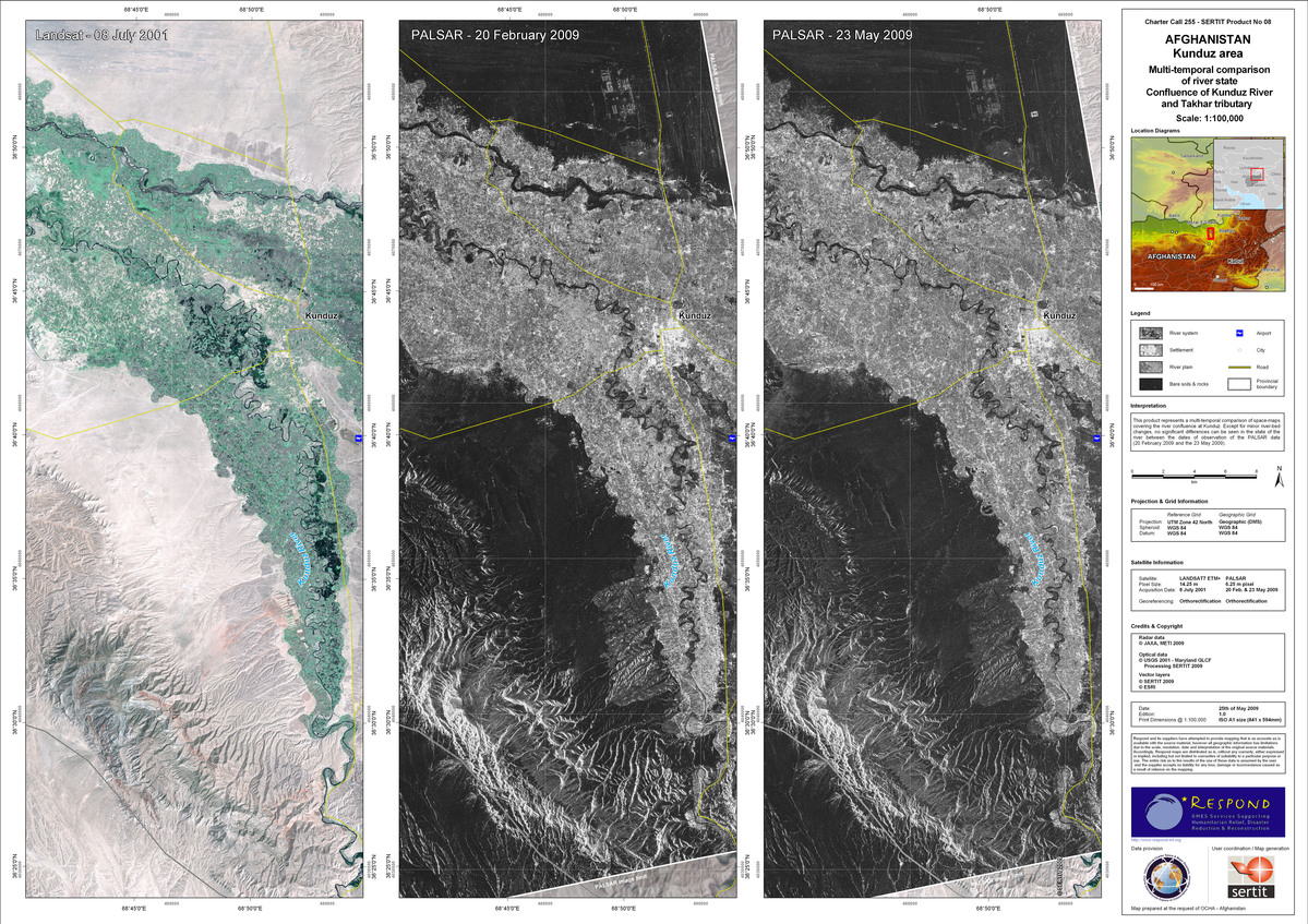
Afghanistan - Kunduz area, confluence of Kunduz River and Takhar tributary
Direitos autorais: JAXA, METI 2009, USGS 2001, SERTIT 2009, ESRI Image processing, map created 25/05/2009 by SERTIT
Information about the Product
Adquirida: 08/07/2001, 20/02/2009, 23/05/2009
Fonte: LANDSAT7 ETM+, 14.25m/pixel, PALSAR 6.25m/pixel


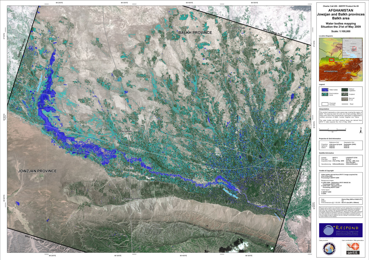
Afghanistan - Jowzjan and Balkh provinces Balkh area
Direitos autorais: CNES 2009, SPOT IMAGE SA, SERTIT 2009, ESRI, USGS 2001 Image processing, map created 22/05/2009 by SERTIT
Information about the Product
Adquirida: 31/07/2001, 03/05/2009, 21/05/2009, 29/06/2009
Fonte: SPOT 5, 5m/pixel, LANDSAT7 ETM+, 14.25m/pixel


Afghanistan - Balkh, Kunduz, Takhar and Baghlan areas
Direitos autorais: NASDRA 2008, DMCii, SERTIT 2009, USGS 2001, ESRI Tratamiento de imagenes, mapa creado 21/05/2009 por SERTIT
Information about the Product
Adquirida: 22/06/2008, 2001
Fonte: LANDSAT7 ETM+, 14.25m/pixel, DMC NigeriaSat-1, 32m/pixel


 Voltar ao arquivo completo da Ativação

