 English
 Spanish
 French
 Chinese
 Russian
 Portuguese
 Latest Activation
Charter activations
Flooding in India
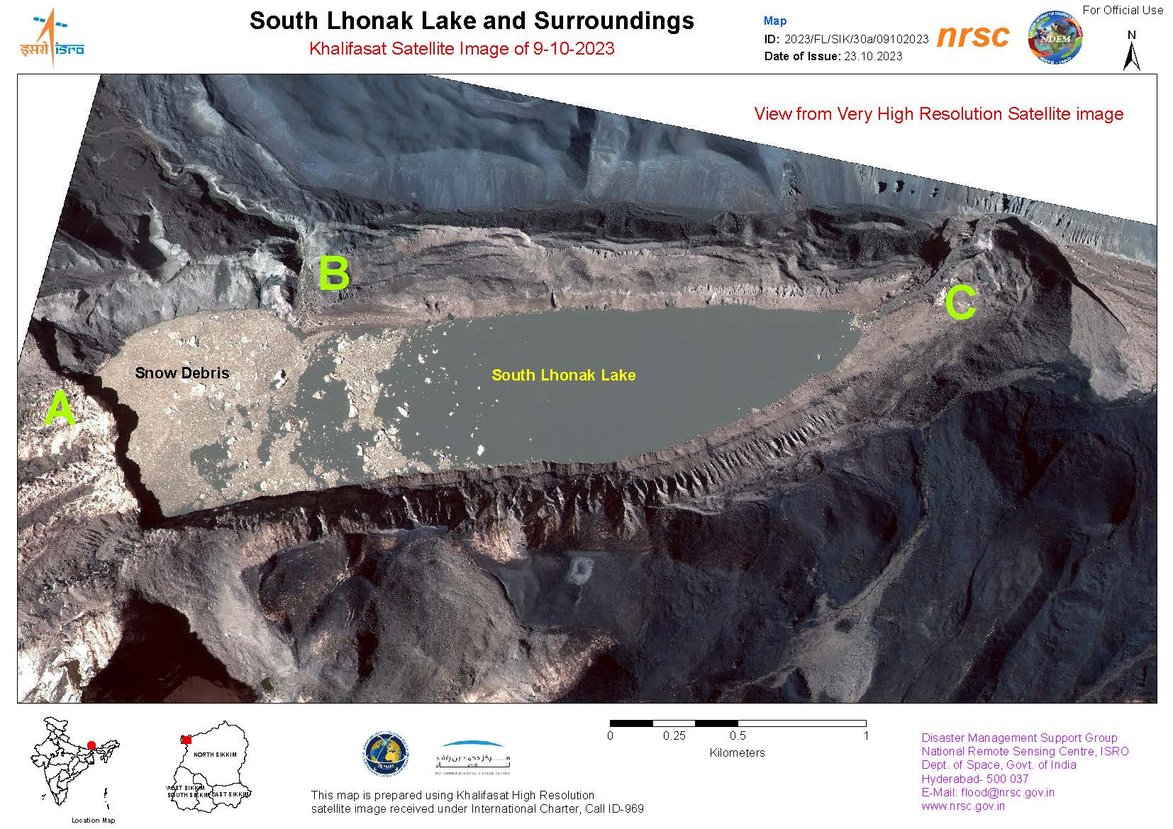
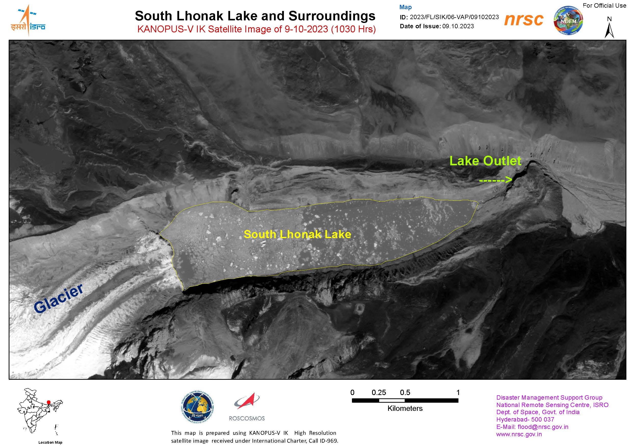
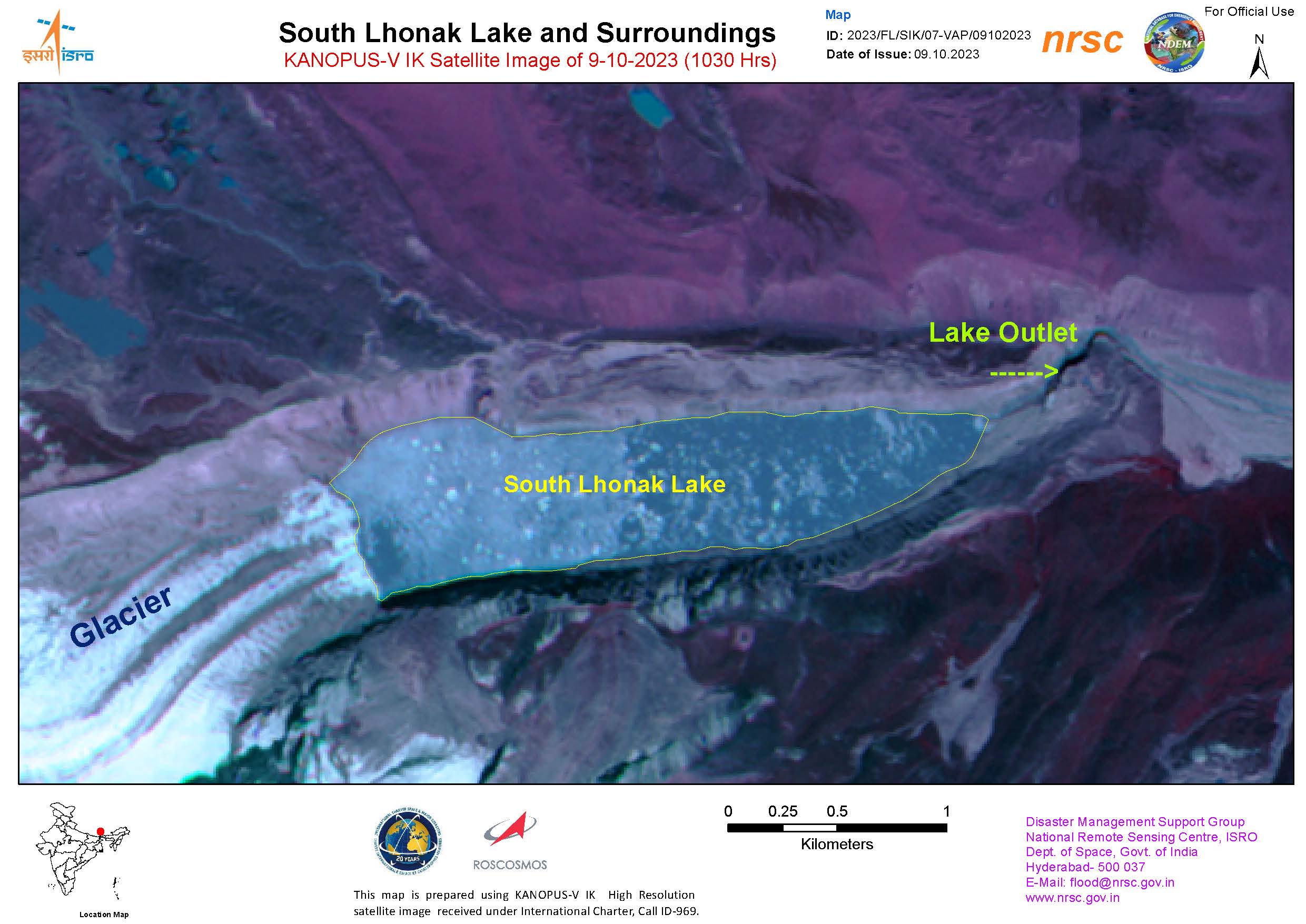
A glacial lake has burst its banks in the Himalayan region of India. The Lhonak Lake, located in the mountainous state of Sikkim, burst through a dam after heavy rainfall and an avalanche on 4 October. This, consequently, caused major flooding around the Teesta River.
Currently, 47 casualties and at least 150 missing have been reported. 15 bridges and dozens of roads have been washed away or submerged, cutting off certain parts of the north-eastern state. The only highway that connects the state to the rest of India was damaged, significantly hindering rescue and relief efforts. Bad weather has also made rescue operations very challenging.
4000 tourists have been left stranded in Lachung and Lachen, in the northern part of the state, due to limited access routes as floods have washed roads away. 3,900 people have been moved to 26 relief camps that have been set up by the state.
Scientists have previously warned about the rapid melting of Himalayan glaciers for decades, saying the pace at which they are losing ice is a threat to the whole world, not just Asia. More specifically, experts warned about the possibility of Lhonak Lake bursting several times over the past 20 years and cautioned that it was sensitive to extreme weather events.
| Tipo de evento: | Floods |
| Local do evento: | India |
| Data da Ativação da Carta: | 2023-10-07 |
| Tempo de Ativação da Carta: | 15:58 |
| Zona de Tempo da Ativação da Carta: | UTC+05:30 |
| Requisitante da Carta: | ISRO |
| ID da Ativação: | 842 |
| Gerenciamento de projeto: | AV SureshBabu (NRSC) |
Products
Areas affected by Flooding around the Chungthang Dam
Direitos autorais: © (2023) DigitalGlobe, Inc., Longmont CO USA 80503. DigitalGlobe and the DigitalGlobe logos are trademarks of DigitalGlobe, Inc. The use and/or dissemination of this data and/or of any product in any way derived there from are restricted. Unauthorized use and/or dissemination is prohibited
Map produced by the National Remote Sensing Centre, ISRO.
Information about the Product
Adquirida: 13/10/2023
Fonte: WorldView-2
Categoria: Reference Map
Areas affected by Flooding around the Chungthang Dam and its Surroundings
Direitos autorais: © (2023) DigitalGlobe, Inc., Longmont CO USA 80503. DigitalGlobe and the DigitalGlobe logos are trademarks of DigitalGlobe, Inc. The use and/or dissemination of this data and/or of any product in any way derived there from are restricted. Unauthorized use and/or dissemination is prohibited
Map produced by the National Remote Sensing Centre, ISRO.
Information about the Product
Adquirida: 13/10/2023
Fonte: WorldView-2
Categoria: Reference Map
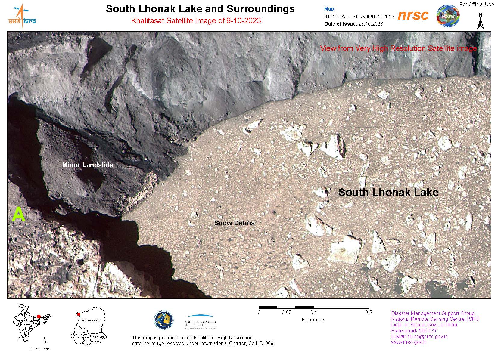
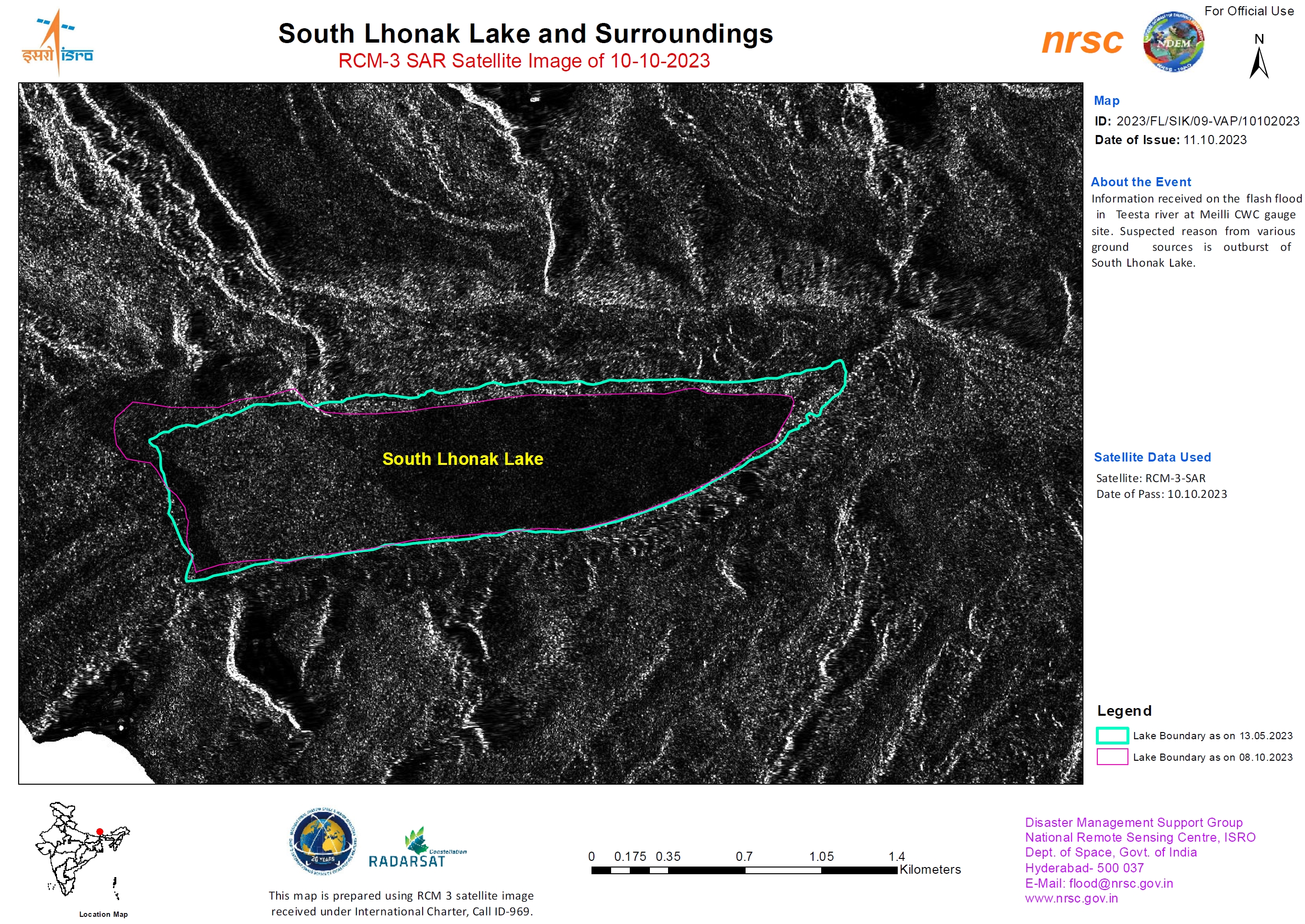
Areas affected by Flooding around the South Lhonak Lake, India
Direitos autorais: RADARSAT Constellation Mission Imagery © Government of Canada (2023) - RADARSAT is an official mark of the Canadian Space Agency.
Map produced by the National Remote Sensing Centre, ISRO.
Information about the Product
Adquirida: 10/10/2023
Fonte: RCM
Categoria: Reference Map
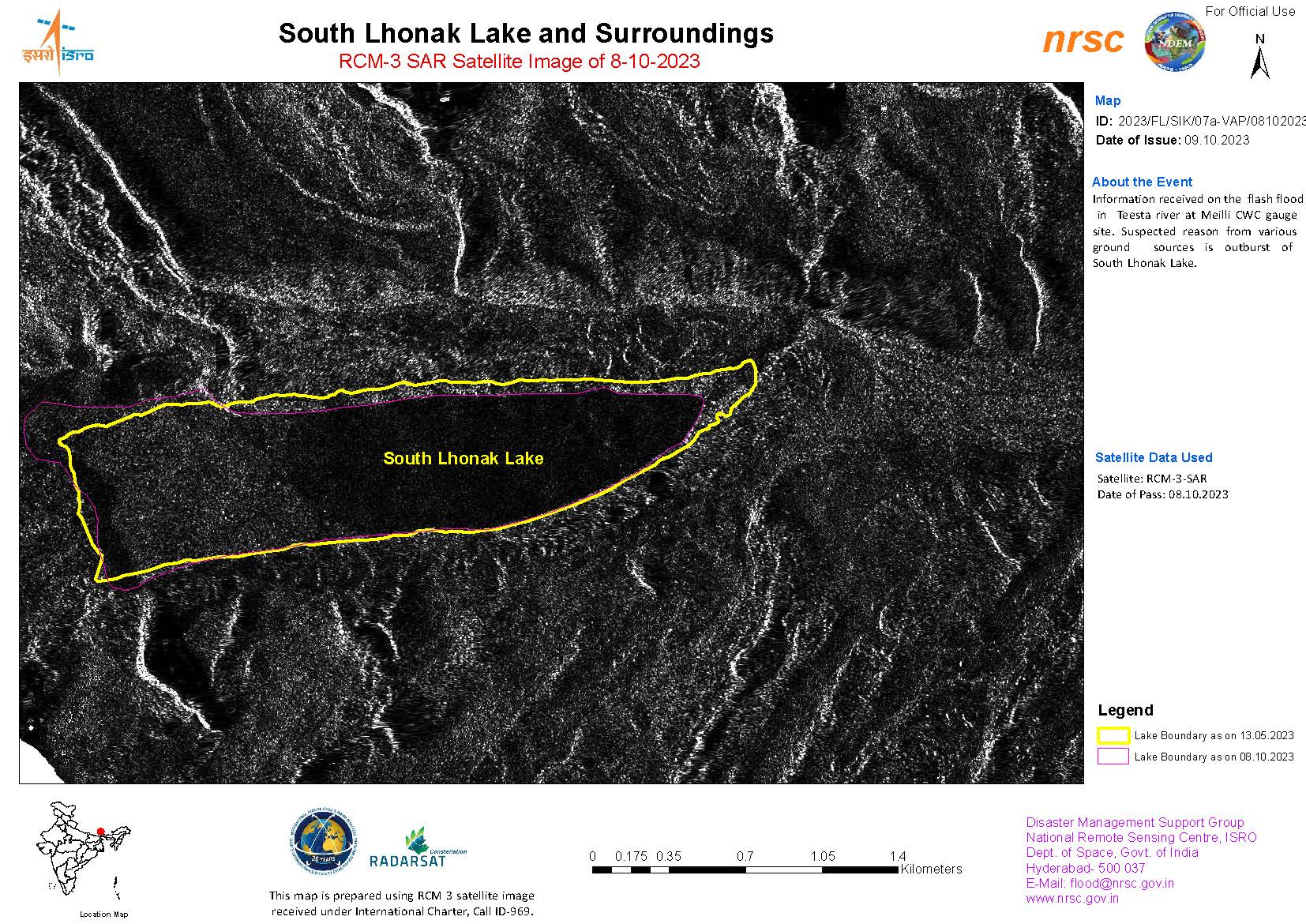
Affected areas in South Lhonak Lake and Surroundings
Direitos autorais: RADARSAT Constellation Mission Imagery © Government of Canada (2023) - RADARSAT is an official mark of the Canadian Space Agency
Map produced by the National Remote Sensing Centre, ISRO.
Information about the Product
Adquirida: 08/10/2023
Fonte: RCM
Categoria: Reference Map
 Voltar ao arquivo completo da Ativação

