 English
 Spanish
 French
 Chinese
 Russian
 Portuguese
 Latest Activation
Charter activations
Earthquake in northern Iran
A strong earthquake (Magnitude 6.3) hit at about 5:10 p.m an area 70 kilometers (45 miles) north of Tehran (U.S. Geological Survey and the Geological Survey of Iran). At least 23 people died and dozens were injured, officials report.
| Tipo de evento: | Earthquake |
| Local do evento: | Iran |
| Data da Ativação da Carta: | 28/05/2004 |
| Requisitante da Carta: | German Federal Foreign Office |
| Gerenciamento de projeto: | DLR |
Products
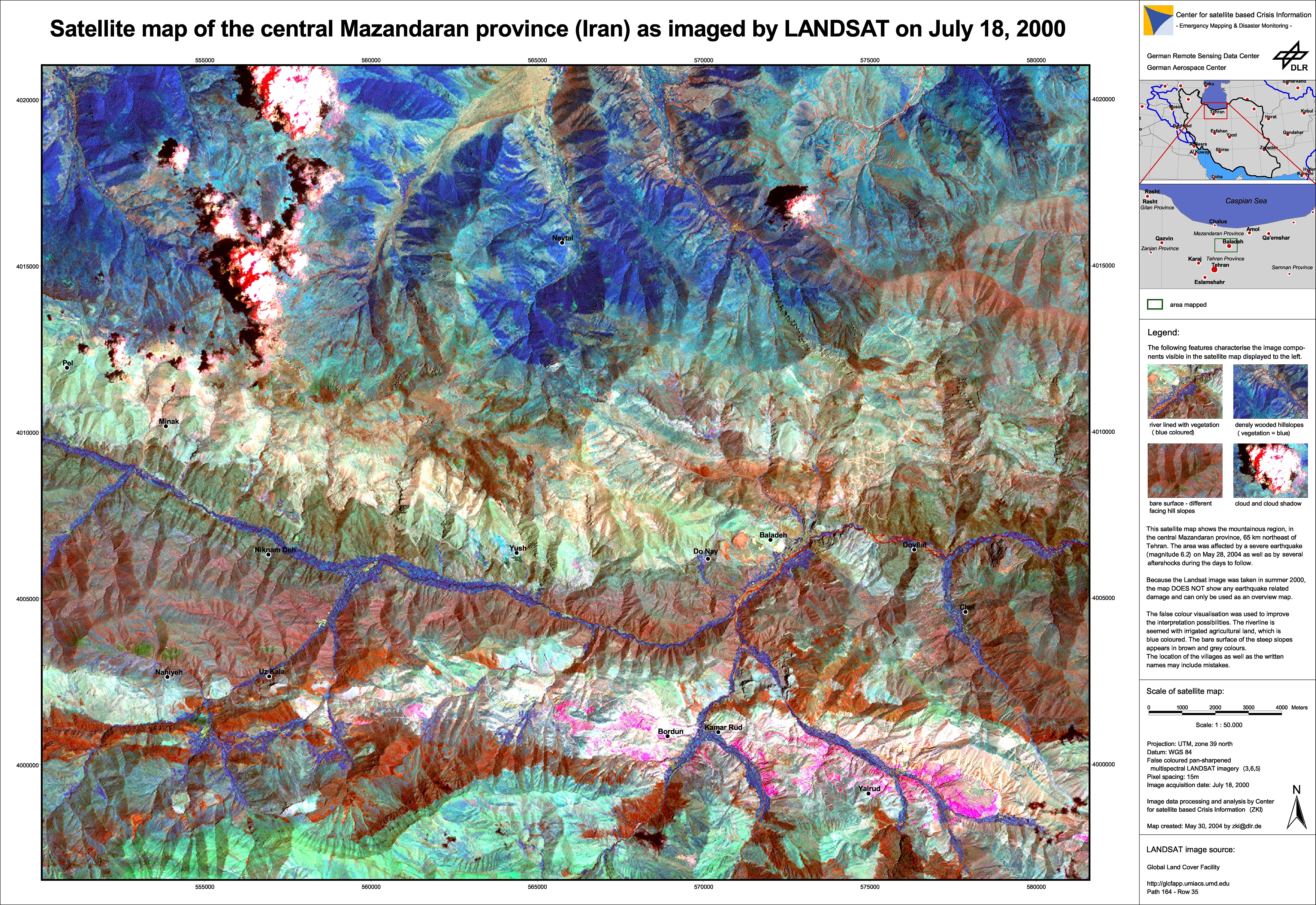
Pre-disaster overview satellite map of the Baladeh region This satellite map displays the region of Baladeh, in Northern Iran (Geographic coordinates: 36° 12' N, 51° 48'E) as imaged by Landsat satellite on July 18, 2000. The region was hit by an earthquake on May 28, 2004 in the afternoon. Because the Landsat image was taken in summer 2000, the map DOES NOT show any earthquake related damage and can only be used as an overview map.
Information about the Product
Adquirida: 18/07/2000
Fonte: Landsat
 Voltar ao arquivo completo da Ativação

