 English
 Spanish
 French
 Chinese
 Russian
 Portuguese
 Latest Activation
Charter activations
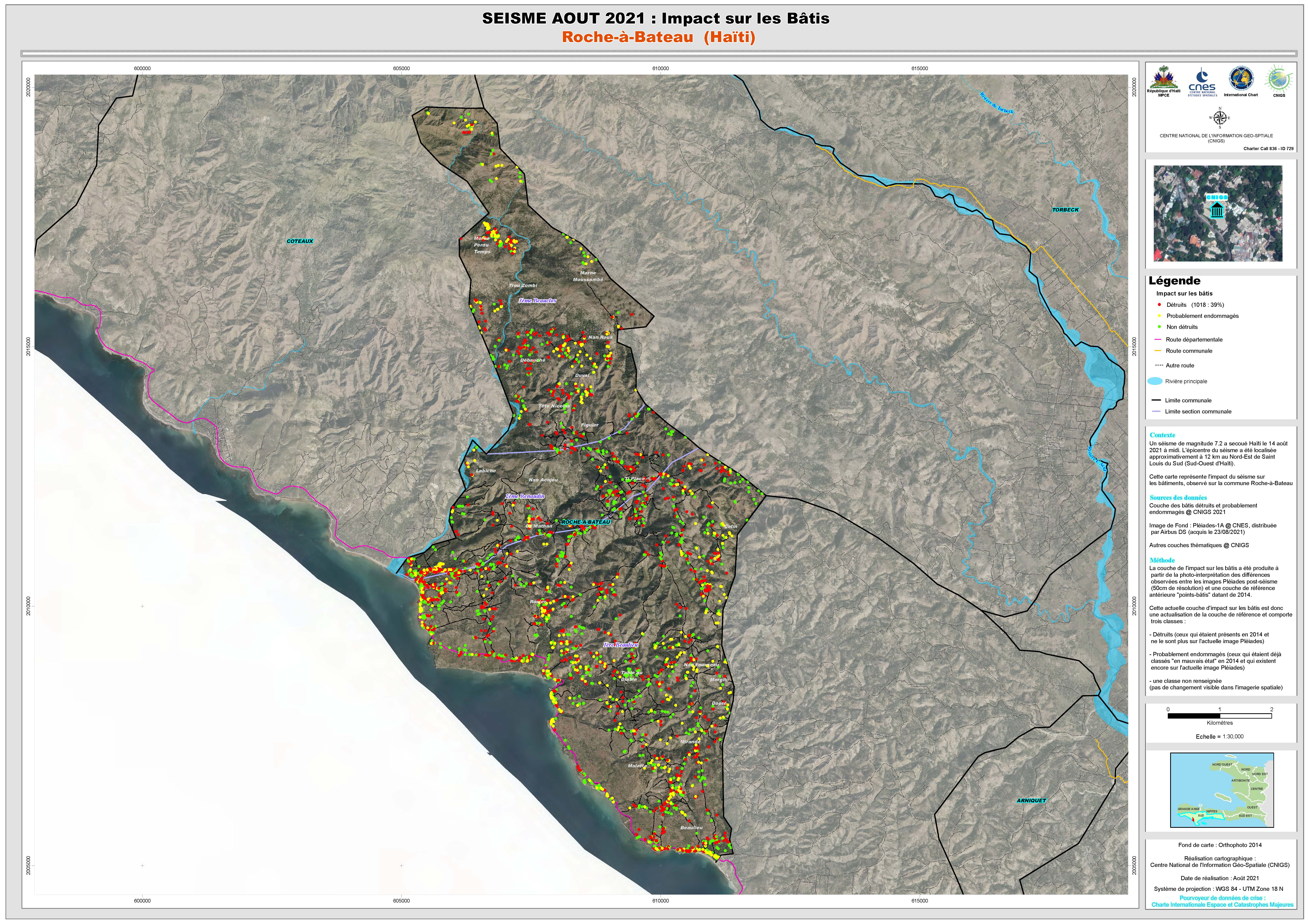
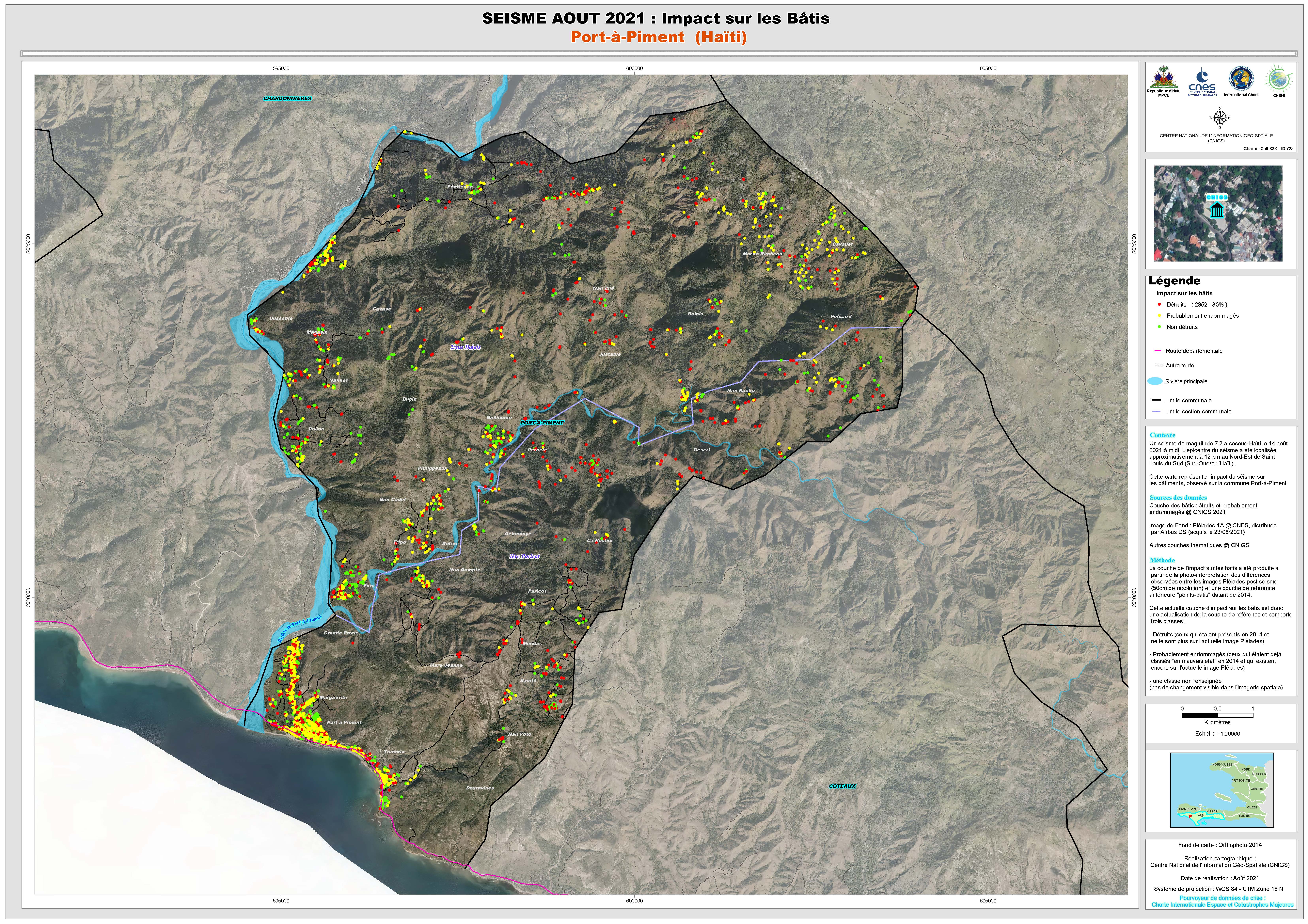
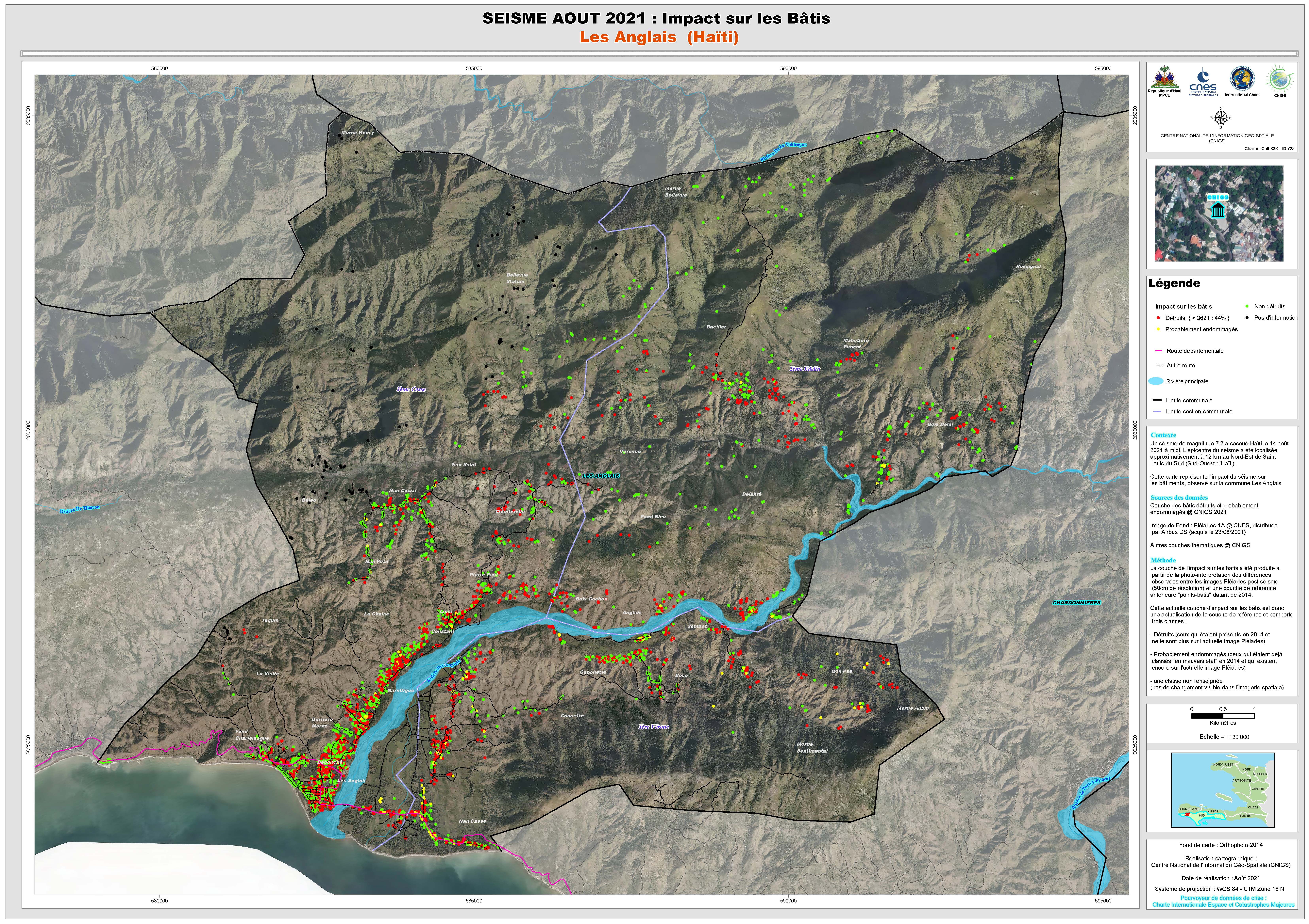
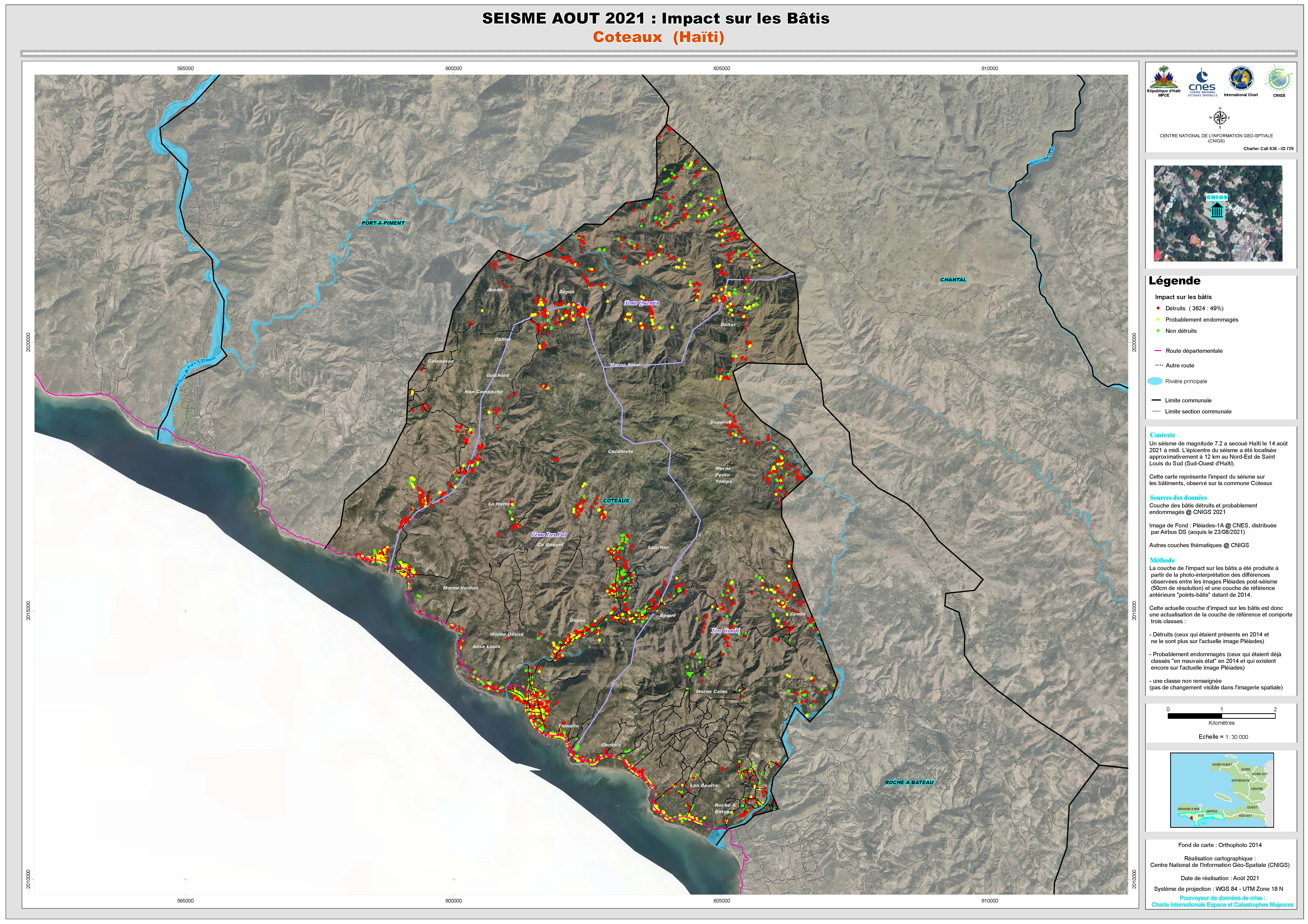
Earthquake in Haiti
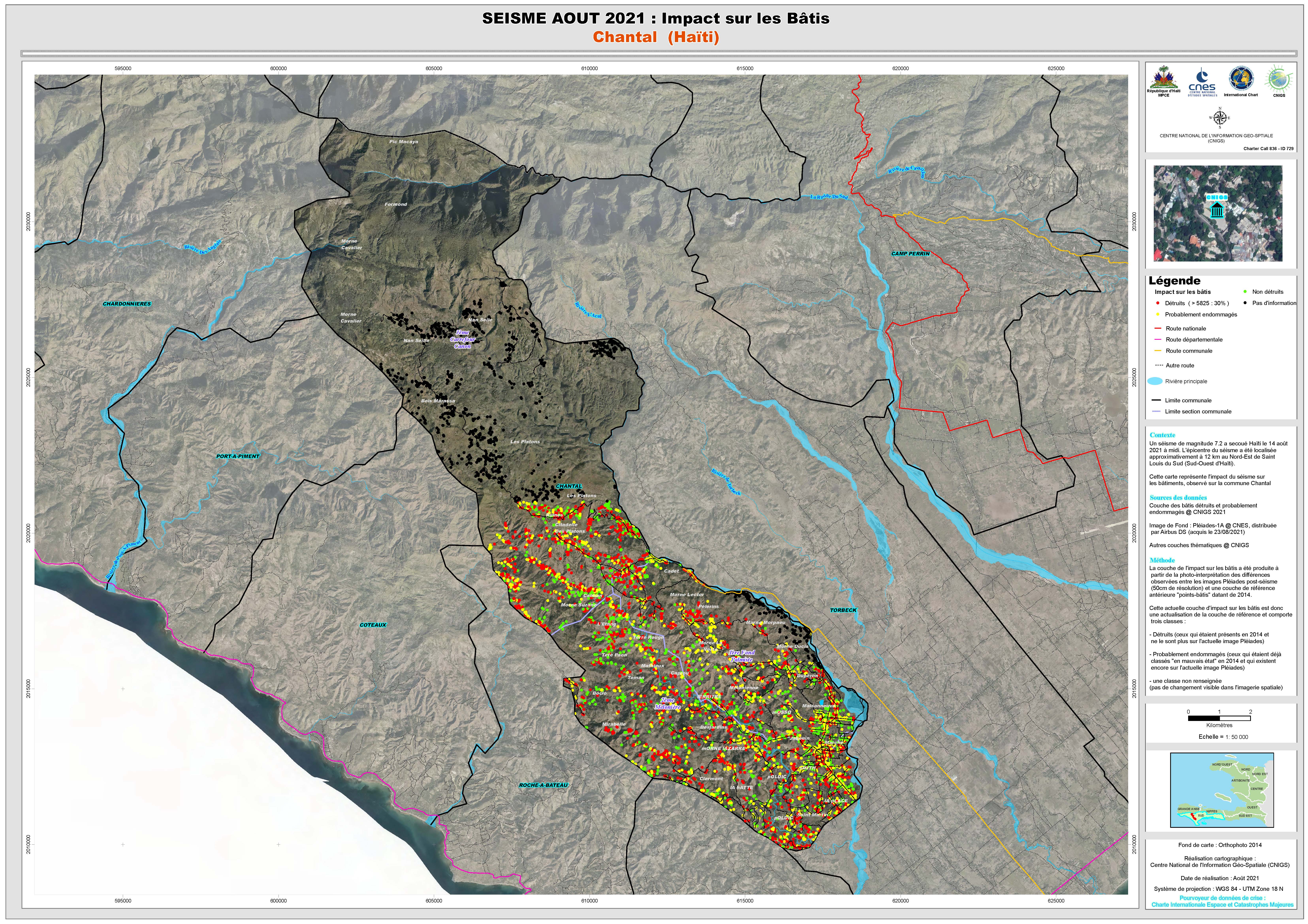
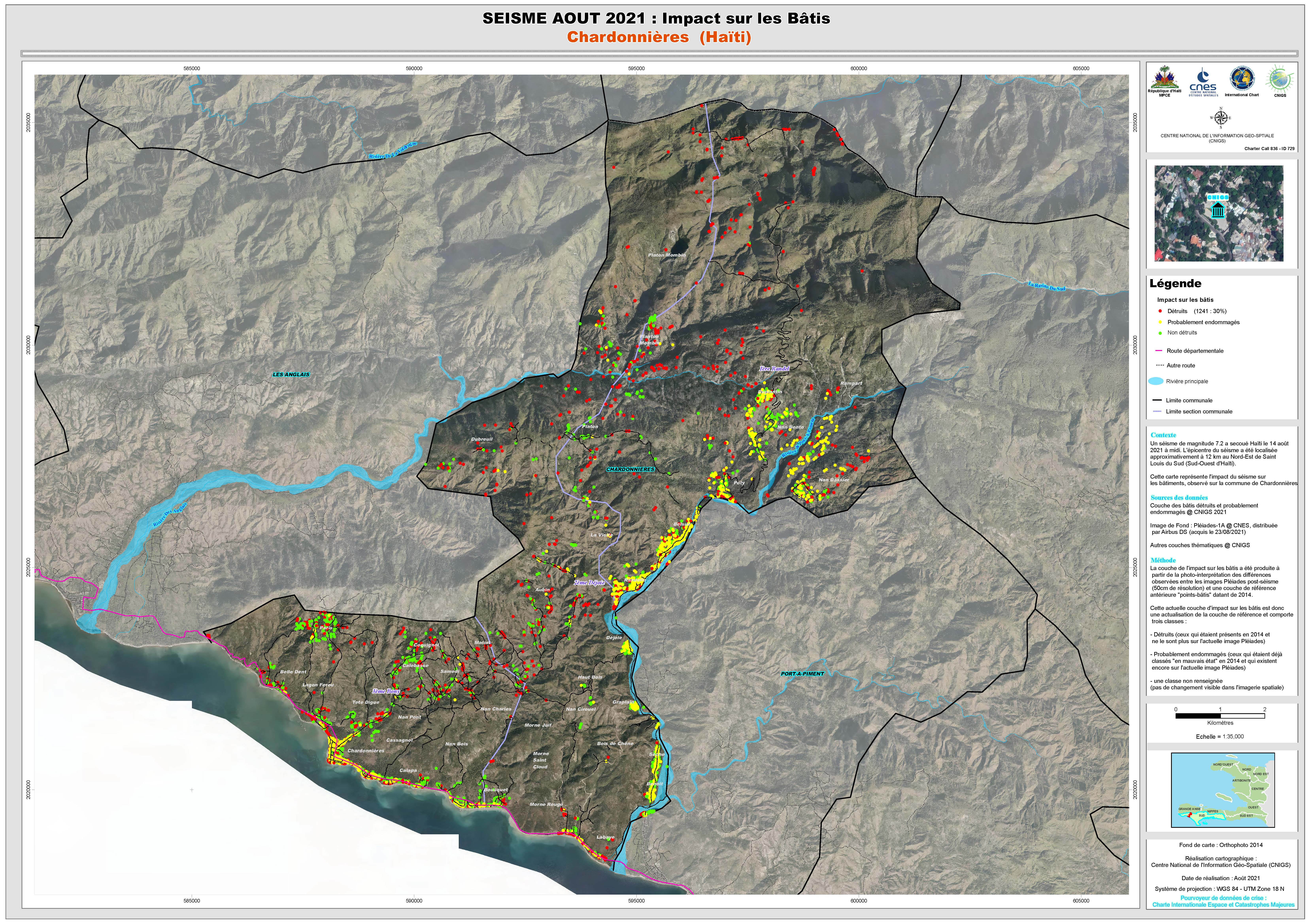
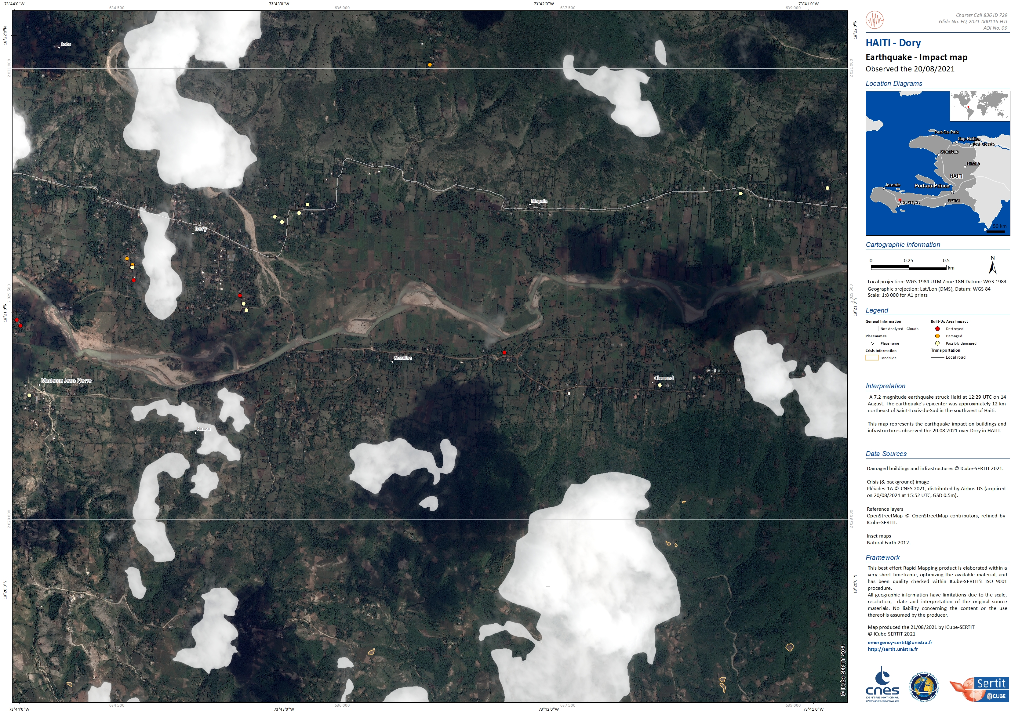
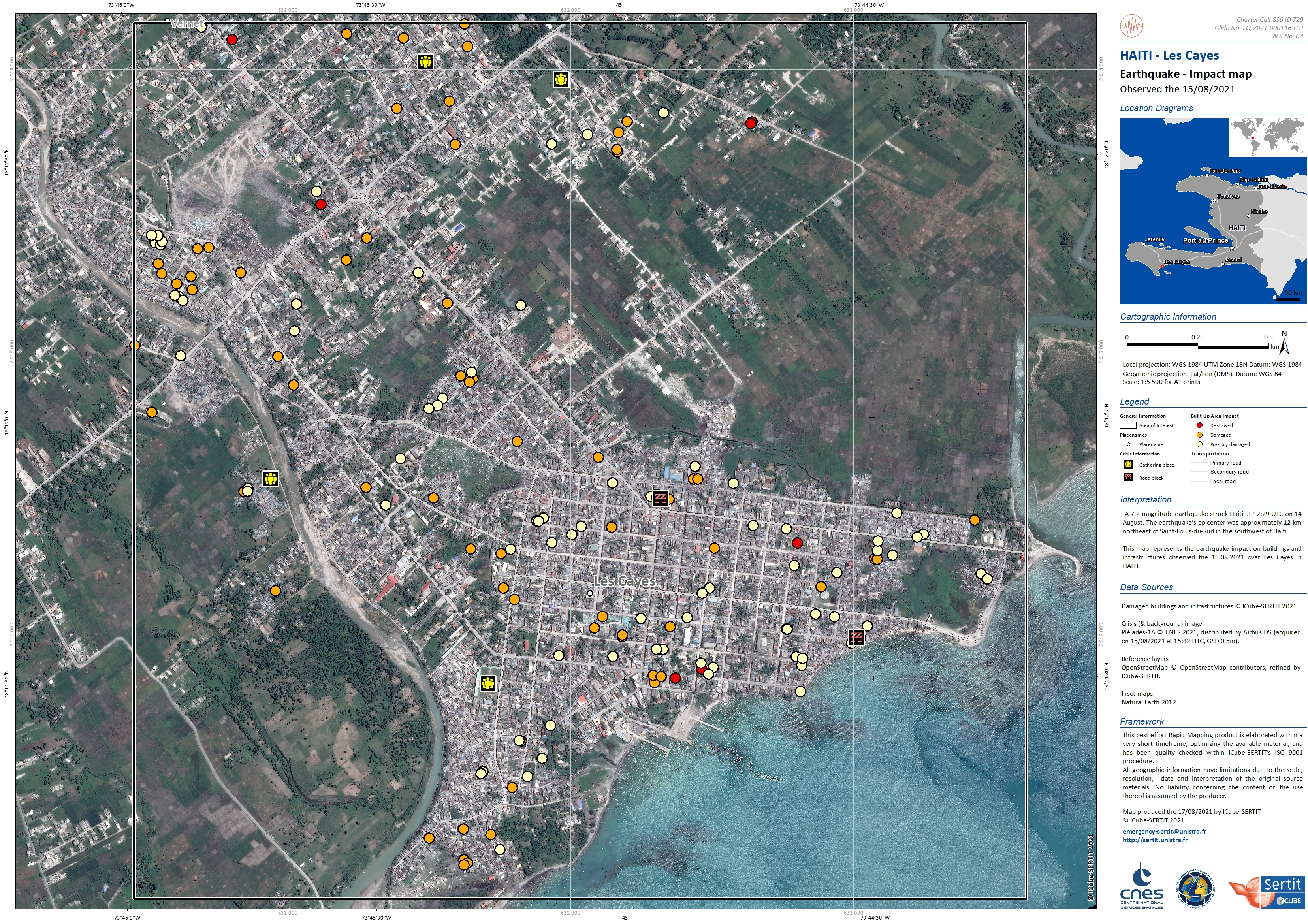
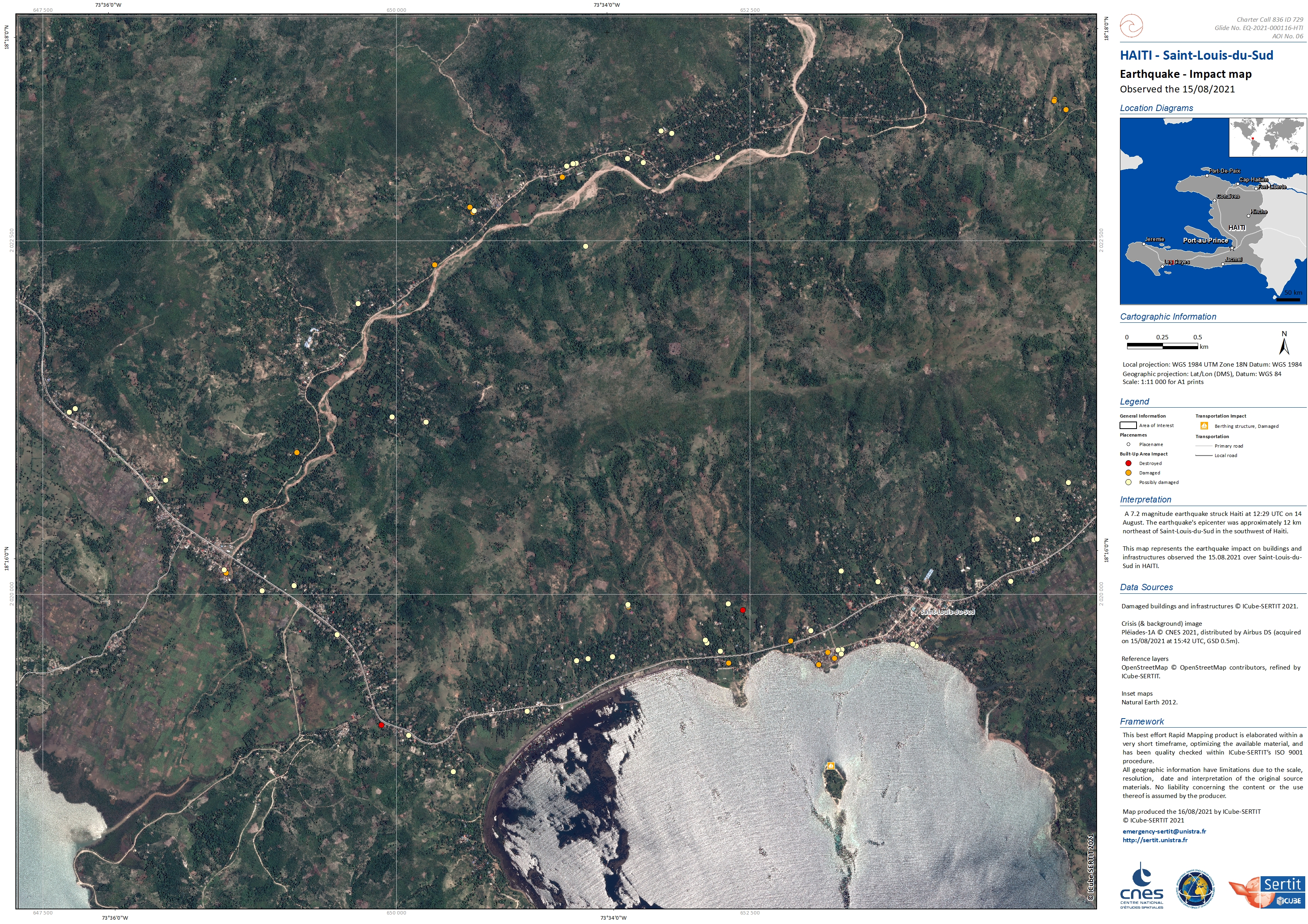
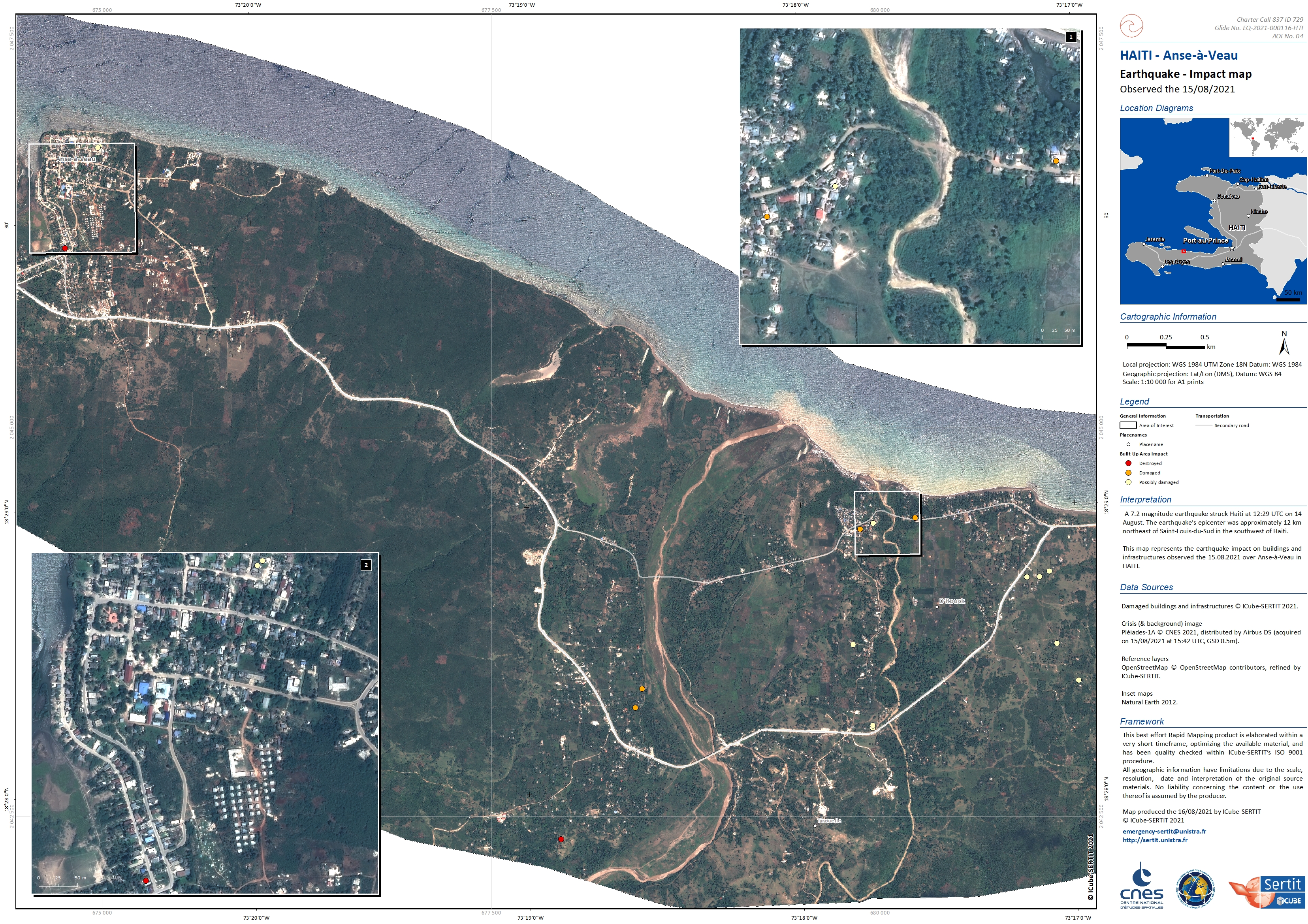
A 7.2 magnitude earthquake struck Haiti at 12:29 UTC on 14 August. At least 1941 people have been reported killed with almost 10,000 injured. It is estimated that 1.2 million people have been affected.
Magnitude 7 earthquakes are at the higher range on the Richter scale, and indicate a major earthquake that is expected to cause serious damage.
The earthquake's epicenter was approximately 12 km northeast of Saint-Louis-du-Sud in the southwest of Haiti. The southwest of the country suffered the most damage. USGS reported several magnitude 5 aftershocks in the hours that followed.
Tens of thousands of homes have been reported destroyed with a similar number of homes damaged. Some roads have also been blocked, delaying or preventing supplies from reaching some of the affected areas. Hospitals are beyond capacity, with some suffering damage from the earthquake.
International aid has ben dispatched with supplies and personnel to help with disaster recovery.
Tropical Storm Grace passed Haiti on 16 and 17 August, adding flash floods and landslides to the disaster.
Related Resources
| Tipo de evento: | Earthquake |
| Local do evento: | Haiti |
| Data da Ativação da Carta: | 2021-08-14 |
| Tempo de Ativação da Carta: | 22:20 |
| Zona de Tempo da Ativação da Carta: | UTC+02:00 |
| Requisitante da Carta: | Direction de la Protection Civile de Haiti UNITAR on behalf of UN Operations and Crisis Center (UNOCC) CENAPRED |
| ID da Ativação: | 729 |
| Gerenciamento de projeto: | ICube-SERTIT |
Products

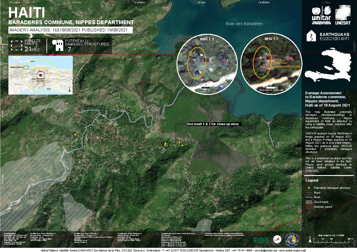
Damage assessment in Baraderes commune, Nippes department, Haiti
Direitos autorais: Kanopus-V © NTs OMZ, All Rights Reserved
WorldView-3 © (2021) DigitalGlobe, Inc., Longmont CO USA 80503. DigitalGlobe and the DigitalGlobe logos are trademarks of DigitalGlobe, Inc. The use and/or dissemination of this data and/or of any product in any way derived there from are restricted. Unauthorized use and/or dissemination is prohibited
Map produced by UNITAR/UNOSAT
Information about the Product
Adquirida: Kanopus-V: 16/08/2021 and 18/08/2021
WorldView-3: 18/05/2021 and 16/08/2021
Fonte: Kanopus-V / WorldView-3
Categoria: Grading Map
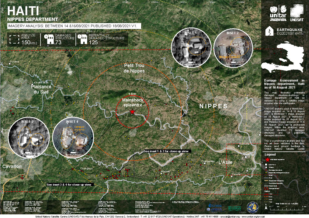
Damage assessment in Nippes department, Haiti
Direitos autorais: Includes Pleiades material © CNES (2021), Distribution Airbus DS.
WorldView-2 and WorldView-3 © (2021) DigitalGlobe, Inc., Longmont CO USA 80503.
DigitalGlobe and the DigitalGlobe logos are trademarks of DigitalGlobe, Inc. The use and/or dissemination of this data and/or of any product in any way derived there from are restricted. Unauthorized use and/or dissemination is prohibited.
Map produced by UNITAR and UNOSAT
Information about the Product
Adquirida: Pleiades: 15/08/2021 and 16/08/2021
WorldView-2: 14/08/2021
WorldView-3: 16/08/2021
Fonte: Pleiades, WorldView-2 and WorldView-3
Categoria: Grading Map
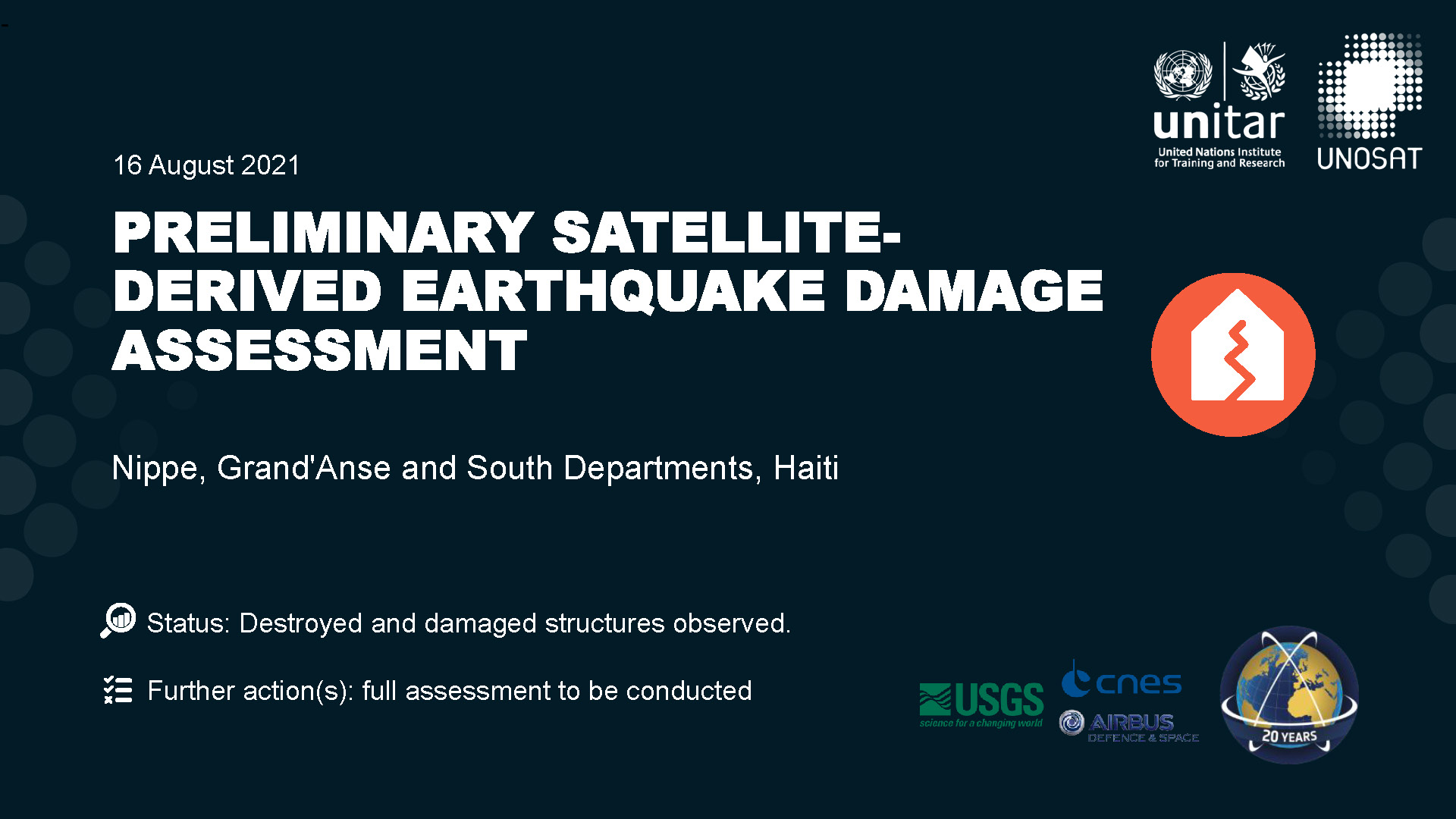
Preliminary satellite-derived earthquake damage assessment, Nippe, Grand'Anse and South Departments, Haiti
Download the full report
Direitos autorais: Includes Pleiades material © CNES (2021), Distribution Airbus DS.
WorldView-2 and WorldView-3 © (2021) DigitalGlobe, Inc., Longmont CO USA 80503. DigitalGlobe and the DigitalGlobe logos are trademarks of DigitalGlobe, Inc. The use and/or dissemination of this data and/or of any product in any way derived there from are restricted. Unauthorized use and/or dissemination is prohibited
Report produced by UNITAR/UNOSAT
Information about the Product
Adquirida: Pleiades: 15/08/2021
WorldView-3: 29/12/2019, 14/10/2020, 18/05/2021
WorldView-2: 29/12/2019, 13/07/2021, 24/07/2021
Fonte: Pleiades / WorldView-2 and WorldView-3
Categoria: Dossier
 Voltar ao arquivo completo da Ativação

