 English
 Spanish
 French
 Chinese
 Russian
 Portuguese
 Latest Activation
Charter activations
Cyclone Roanu in Bangladesh
Cyclone Roanu struck Bangladesh on 21 May, leaving 26 dead and affecting hundreds of thousands of people.
The storm brought heavy rains which caused floods and landslides across the coast of the country in fifteen districts. It also brought a storm surge 2 m in height, which was responsible for most of the deaths when dams overflowed.
Roanu and the resulting floods and landslides tore through wooden homes and buried some villages. It is estimated that as many of 80,000 buildings were damaged and the storm also disrupted power and blocked some roads. In addition to the damage buildings suffered, the storm took a toll on agriculture, sweeping away crops and killing livestock.
Bangladesh often experiences cyclones during its storm season, and half a million people were evacuated to emergency shelters before Roanu arrived. The storm dissipated on 23 May, but it will take time for the affected districts to recover from the damage and tens of thousands of people currently lack clean water and food following the disaster. Bangladesh is receiving relief and international aid to help the victims.
| Tipo de evento: | Ocean Storm - Cyclone |
| Local do evento: | Bangladesh |
| Data da Ativação da Carta: | 25 May 2016 |
| Tempo de Ativação da Carta: | 07:25:00 |
| Zona de Tempo da Ativação da Carta: | UTC+02:00 |
| Requisitante da Carta: | ADRC on behalf of SPARRSO |
| Gerenciamento de projeto: | AIT |
Products
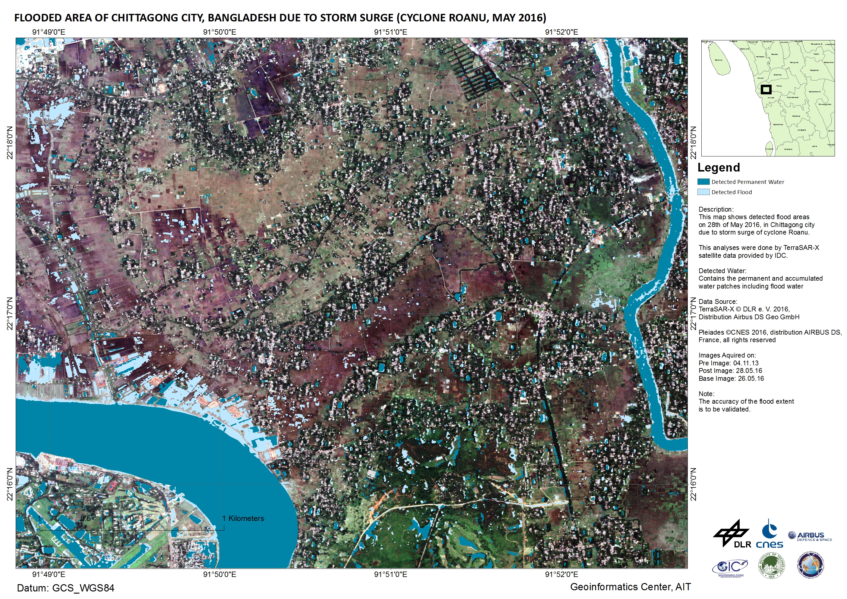
Flooded area in Chittagong City, Bangladesh due to the storm surge
Direitos autorais: TerraSAR-X © DLR e. V. 2016, Distribution: Airbus DS Geo GmbH
Pleiades © CNES 2016 - Distribution: Airbus Defence and Space, all rights reserved
Map produced by Geoinformatics Center, AIT
Information about the Product
Adquirida: Pre-disaster: 04/11/2013
Post-disaster: 28/05/2016
Base image: 26/05/2016
Fonte: TerraSAR-X / Pleiades
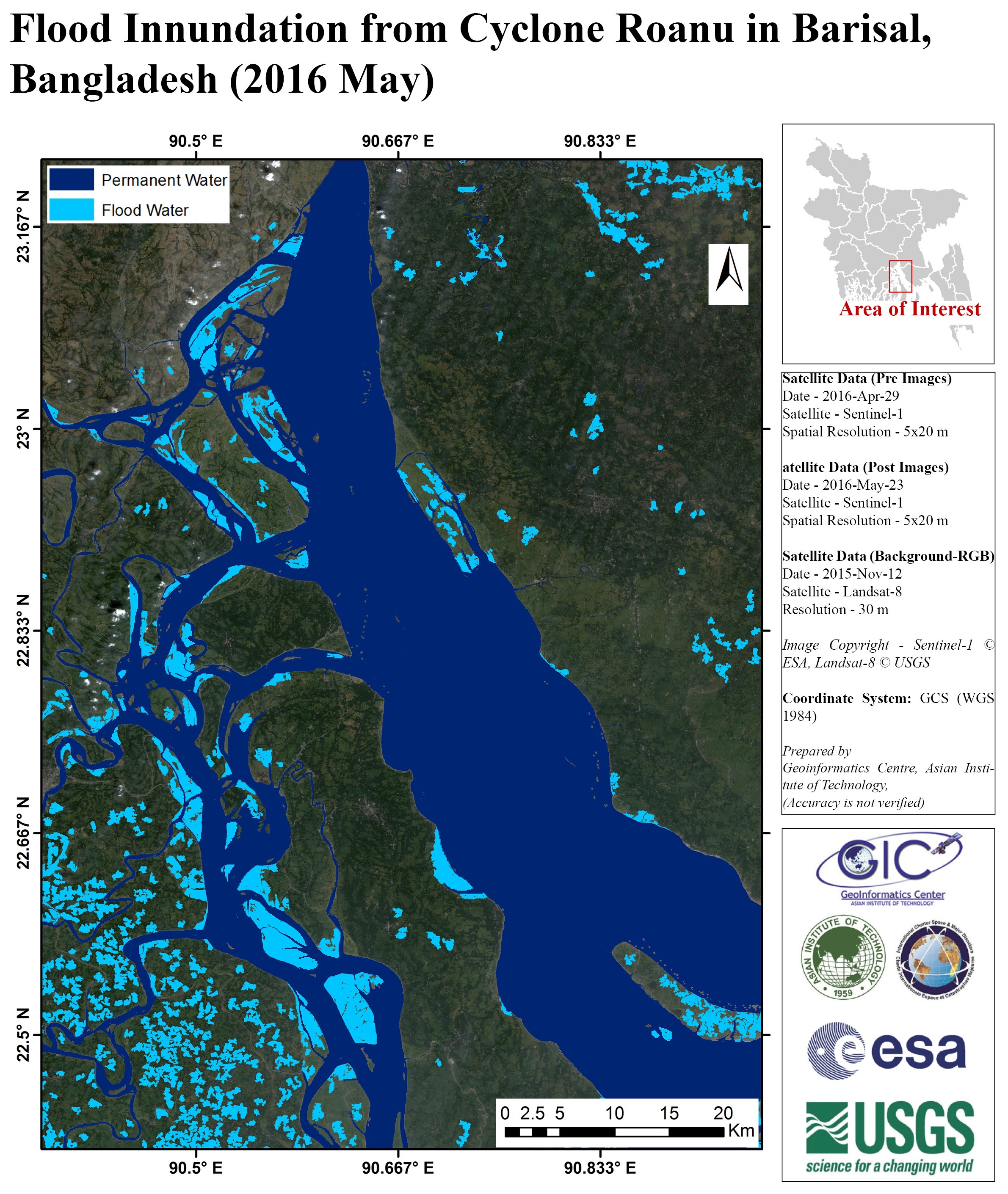
Flood impact map of Barisal, Bangladesh
Direitos autorais: Landsat 8 data and products © USGS (2016) - All rights reserved
Sentinel-1: Copernicus Sentinel data 2016
Map produced by AIT
Information about the Product
Adquirida: Landsat 8: 12/11/2015
Sentinel-1: 29/04/2016 and 23/05/2016
Fonte: Landsat 8 / Sentinel-1
 Voltar ao arquivo completo da Ativação

