 English
 Spanish
 French
 Chinese
 Russian
 Portuguese
 最新宪章启动
Charter activations
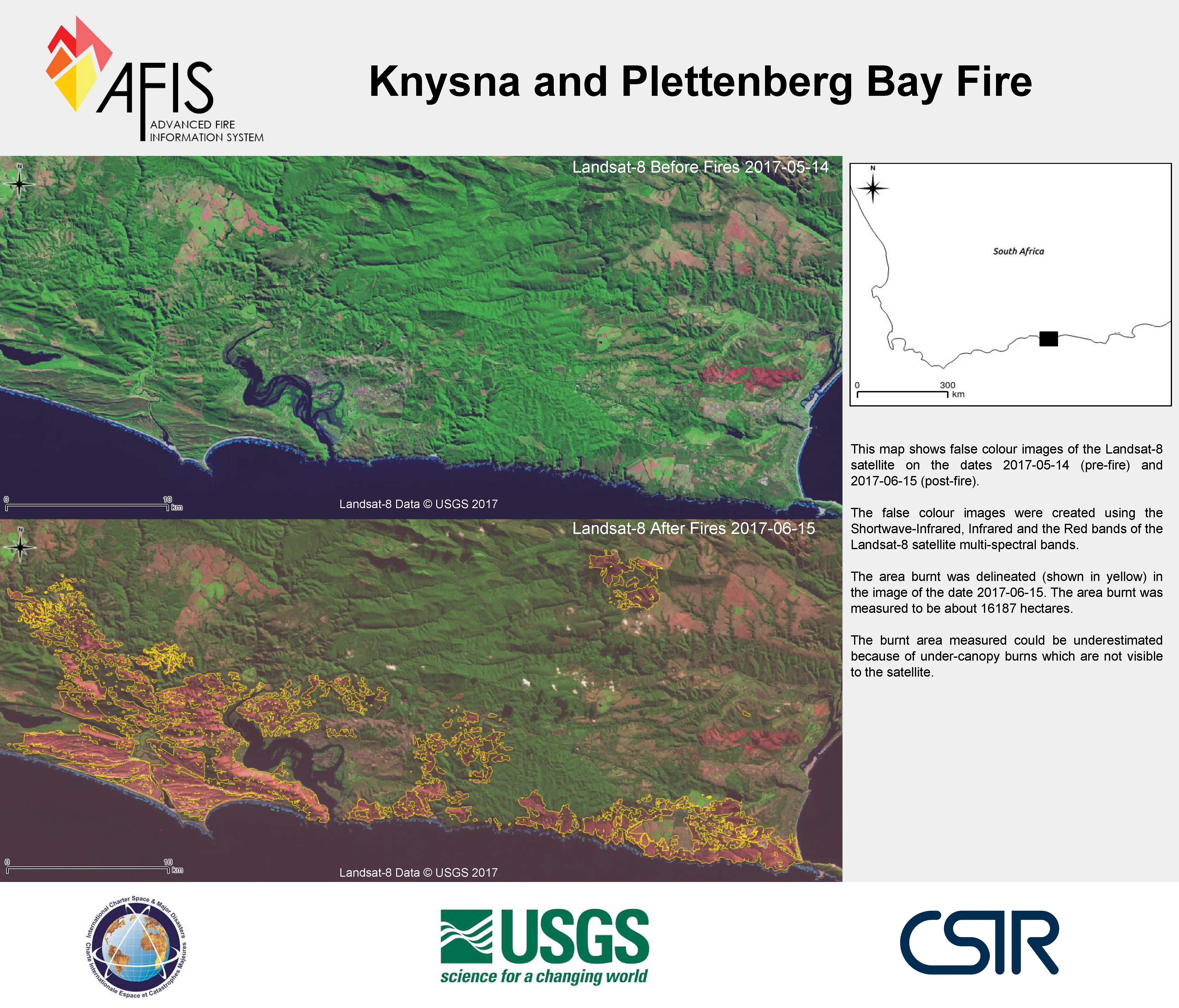
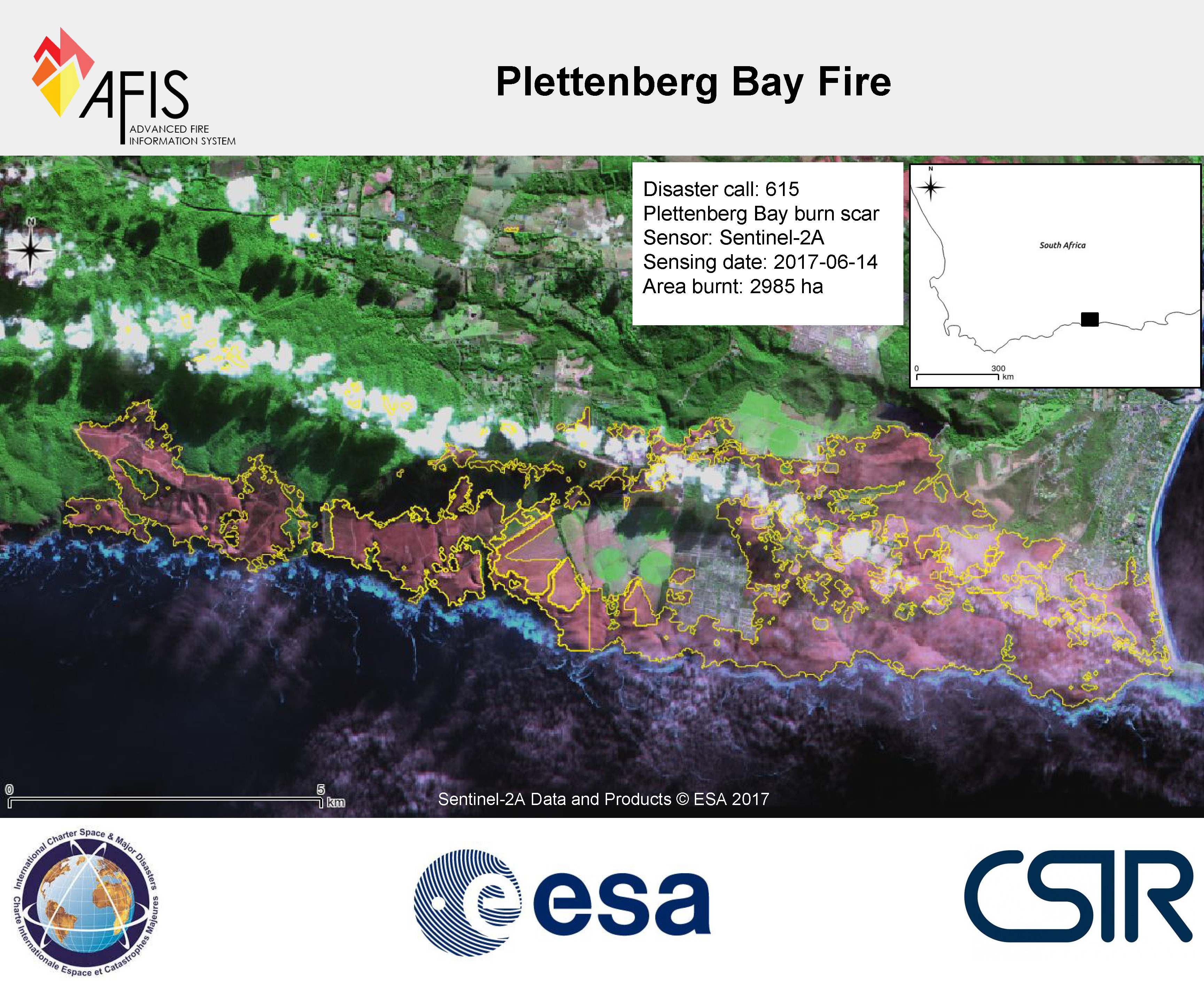
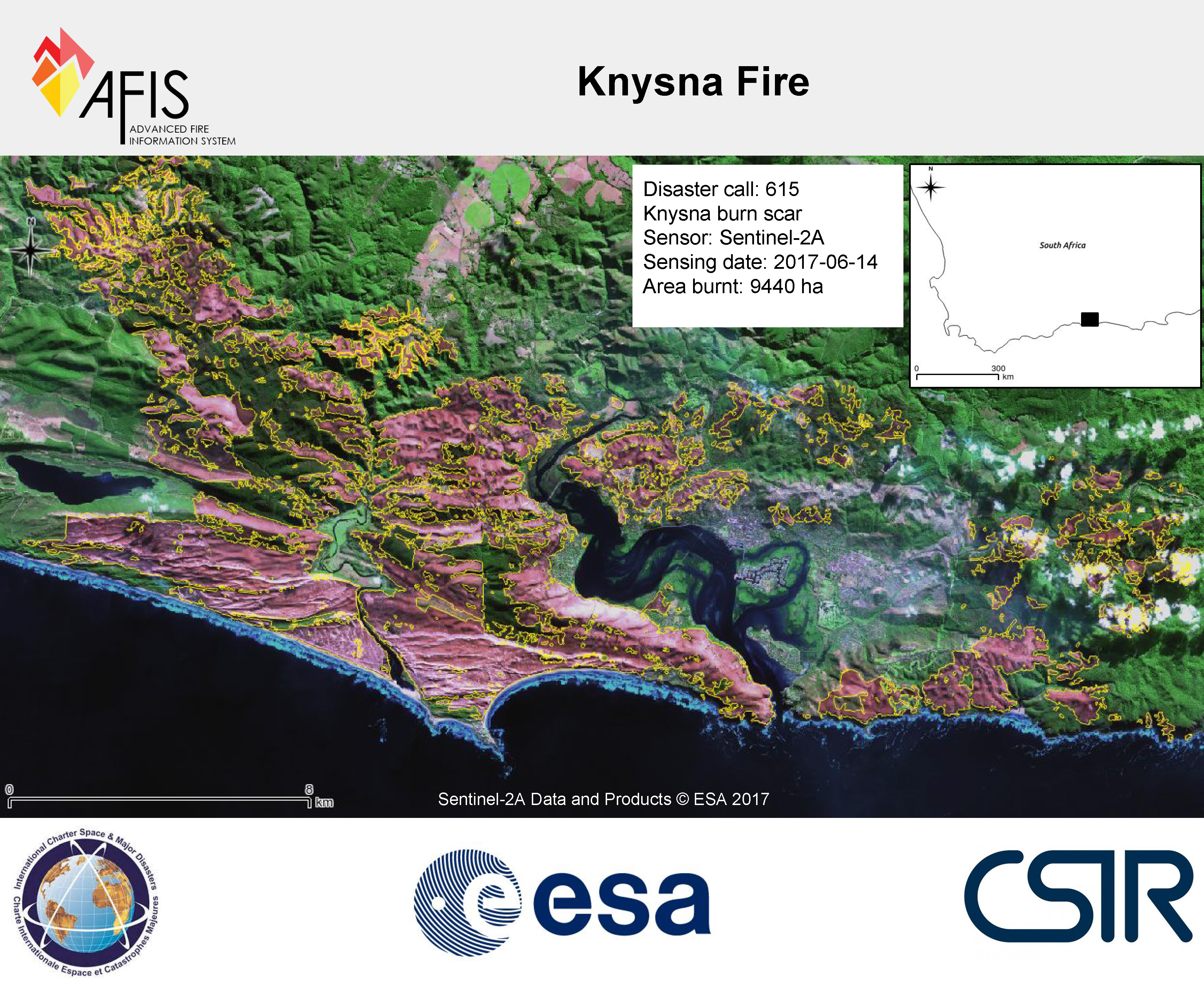
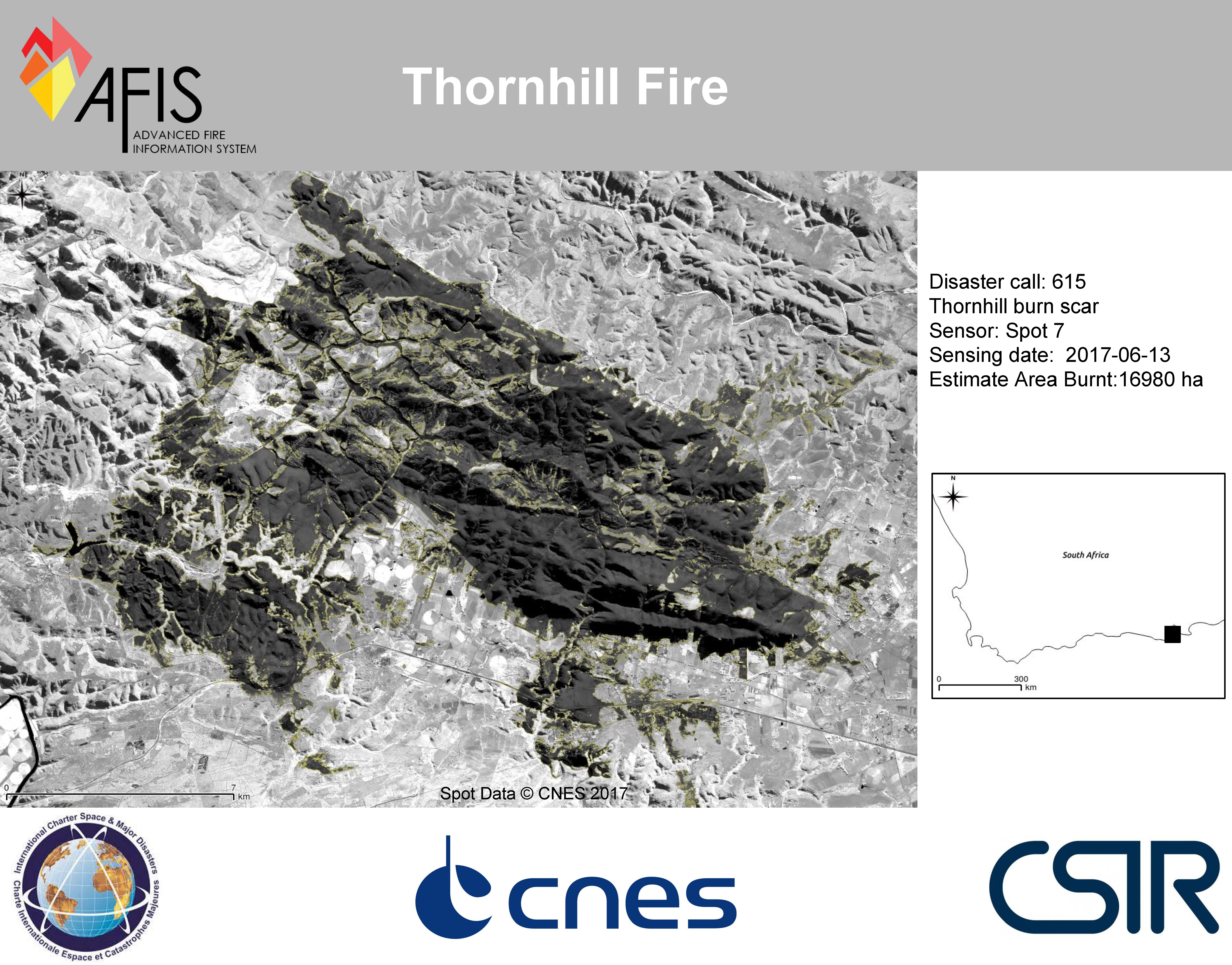
南非火灾
野火已经摧毁了南非的西开普省和南开普省。火灾已造成9人死亡,上千人无家可归。
这场灾难已被描述为该地区经历的最严重的火灾。
虽然火灾的确切原因尚未确定,但火灾始于该地区在三十年来经历的最严重的风暴之后。6月6日晚,这场风暴袭击了南非海岸,并带来强大的风力,从而引发了大火的蔓延。这是西开普省在一个多世纪以来经历的最严重的干旱。
有10,000人被疏散,1000多名消防员努力阻止了火灾。一段时间,火线延伸了100公里,而且,持续的强风使得火灾的方向不可预测,难以控制。两名消防员为了试图阻止火苗蔓延而遇难,但相信经过四天的工作,6月11日,火灾被成功地遏制。然而,在当局完成损害评估并确认安全之前,居民被告知不得返回家园。
克尼斯纳镇特别受到影响,近500栋建筑物遭到毁坏。许多受灾人员在毁灭性的火灾中失去了所有物品。
| 事件类型: | 野火 |
| 事件地点: | 南非 |
| 启动宪章的日期: | 2017年6月12日 |
| 宪章启动时间: | 08:43:00 |
| 宪章启动时区: | UTC-05:00 |
| 宪章要求者: | 美国地质调查局代表:西开普省政府降低灾害风险指挥部 |
| 启动ID: | 536 |
| 项目经理: | 西开普省政府降低灾害风险指挥部 |
Products
 返回完整的响应档案

