 English
 Spanish
 French
 Chinese
 Russian
 Portuguese
 Latest Activation
Charter activations
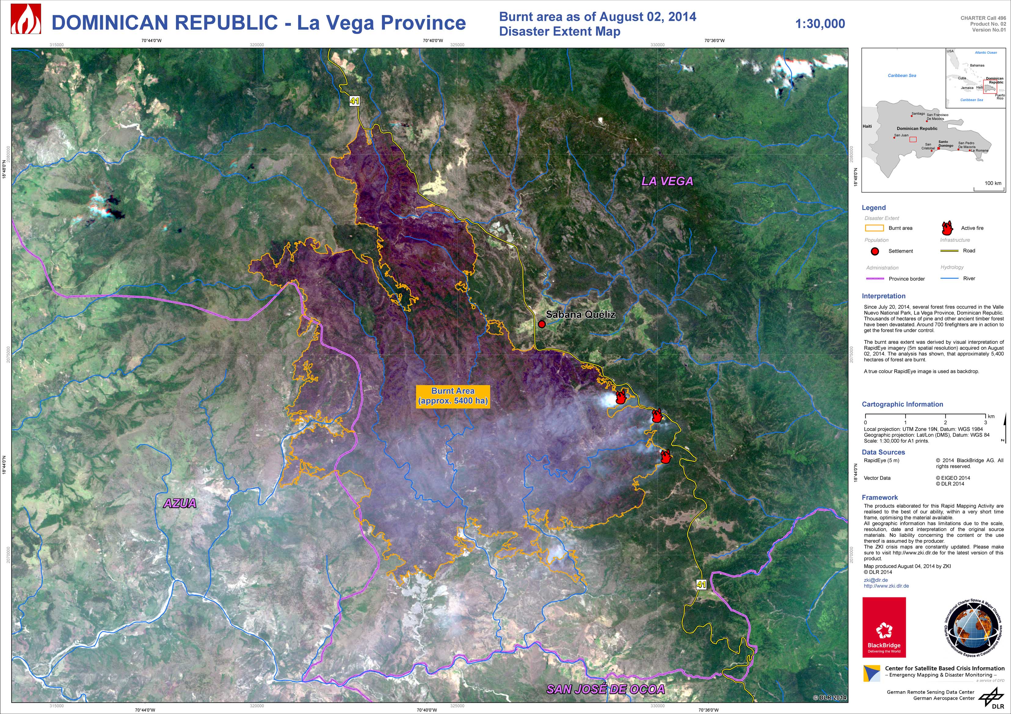
Fire in La Vega, Dominican Republic
A wildfire broke out in the La Vega Province of the Dominican Republic on 20 July 2014. Since then it has burnt down over 4,000 hectares of trees and efforts to contain the blaze are ongoing.
The fire is located in Valle Nuevo National Park, in Constanza, which is situated in the Cordillera Central Mountains. The mountainous terrain is proving difficult for the hundreds of firefighters and volunteers to traverse, making it harder to stop the spread of the fire. Further hampering efforts is a lack of equipment to fight the fires, and the Dominican government has asked for international aid. The United States will reportedly deploy aircraft to help quench the flames from above.
Hundreds of trees are being cut down to attempt to create a firewall and stop the fire from spreading to nearby towns and cities. Despite their efforts, it is expected that the national park may be closed for months after the fire has ended due to the damage caused by the flames.
It is not yet clear what started the fire, or the full extent of the blaze.
| Type of Event: | Fire |
| Location of Event: | La Vega Province, Dominican Republic |
| Date of Charter Activation: | 30 July 2014 |
| Charter Requestor: | USGS on behalf of Centro de Operaciones de Emergencias of the Dominican Republic (COE) |
| Project Management: | DLR |
Products

 Back to the full activation archive

