 English
 Spanish
 French
 Chinese
 Russian
 Portuguese
 Latest Activation
Charter activations
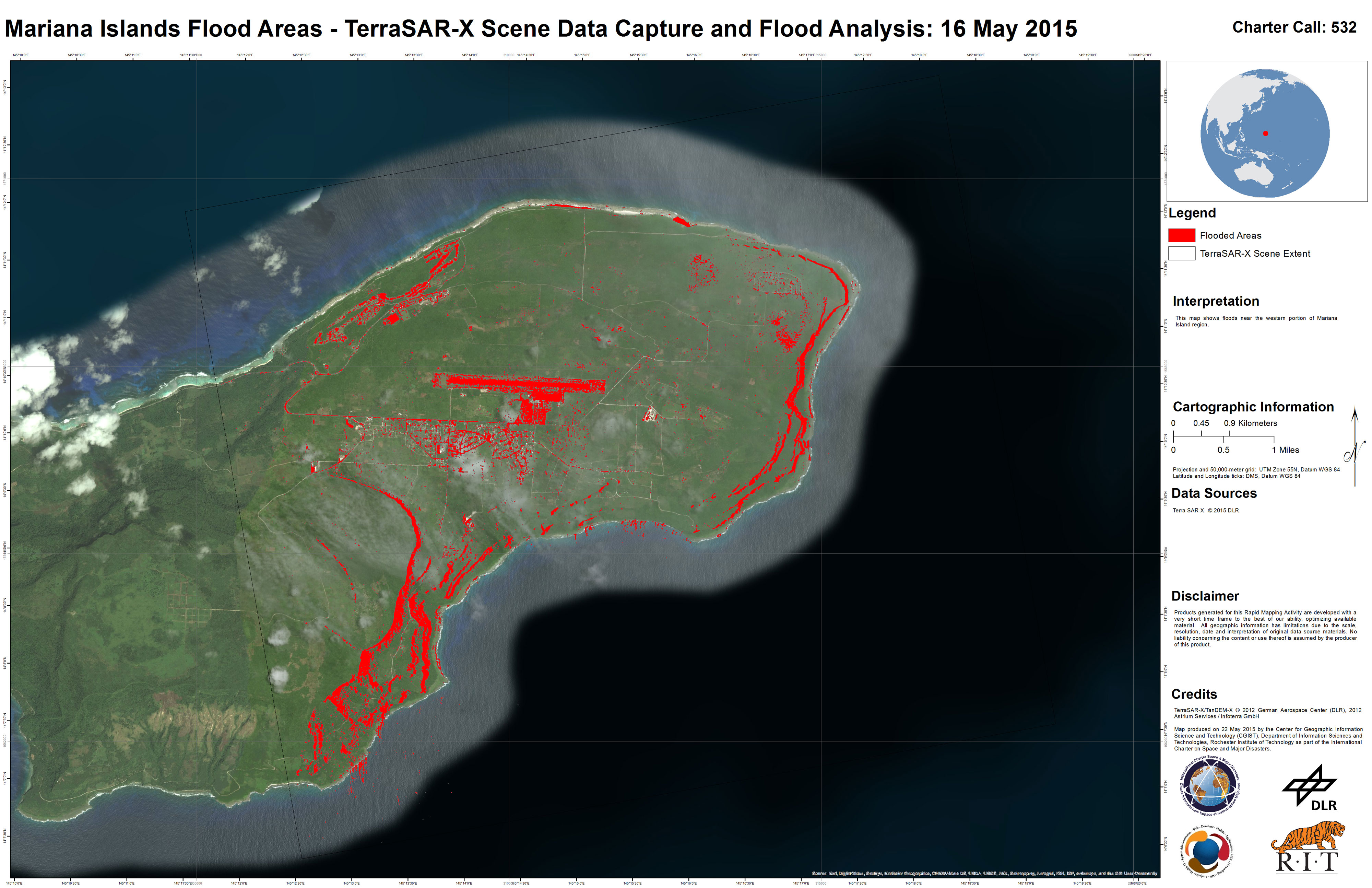
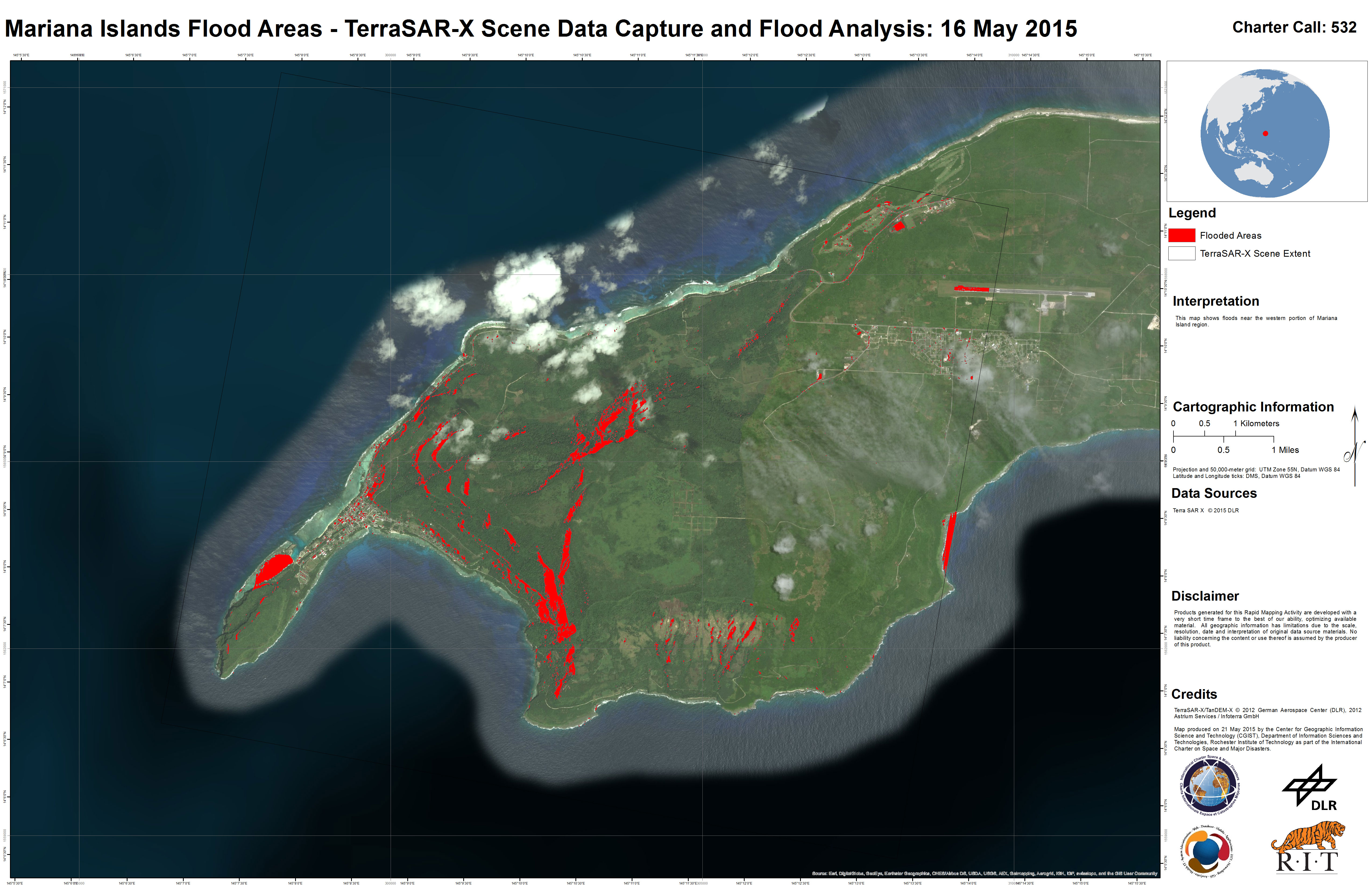
Typhoon Dolphin in the Northern Mariana Islands
Typhoon Dolphin passed over the Northern Mariana Islands on 15 May 2015, bringing torrential rain and strong winds to the island of Guam.
Hundreds of people were evacuated and took refuge in shelters in advance of the storm.
The storm passed through the Rota Channel, between the islands of Guam and Rota in a north-western direction, and was estimated at Category 2 strength at the time.
Typhoon Dolphin is expected to strengthen over the following days, possibly reaching Category 5 intensity. It is not forecast to pass over any other inhabited areas, however.
A warning has been issued for flash flooding in Guam, as a precaution following the torrential rain. Weather conditions are forecast to improve in Guam and the neighbouring islands from 16 May, but strong winds are still possible over the next few days.
| Type of Event: | Ocean Storm - Typhoon |
| Location of Event: | Guam, Northern Mariana Islands |
| Date of Charter Activation: | 15 May 2015 |
| Time of Charter Activation: | 17:43:51 |
| Time zone of Charter Activation: | UTC-12:00 |
| Charter Requestor: | USGS on behalf of FEMI |
| Project Management: | Pacific Disaster Center (PDC) |
Products
 Back to the full activation archive
