 English
 Spanish
 French
 Chinese
 Russian
 Portuguese
 Последняя Активация
Charter activations
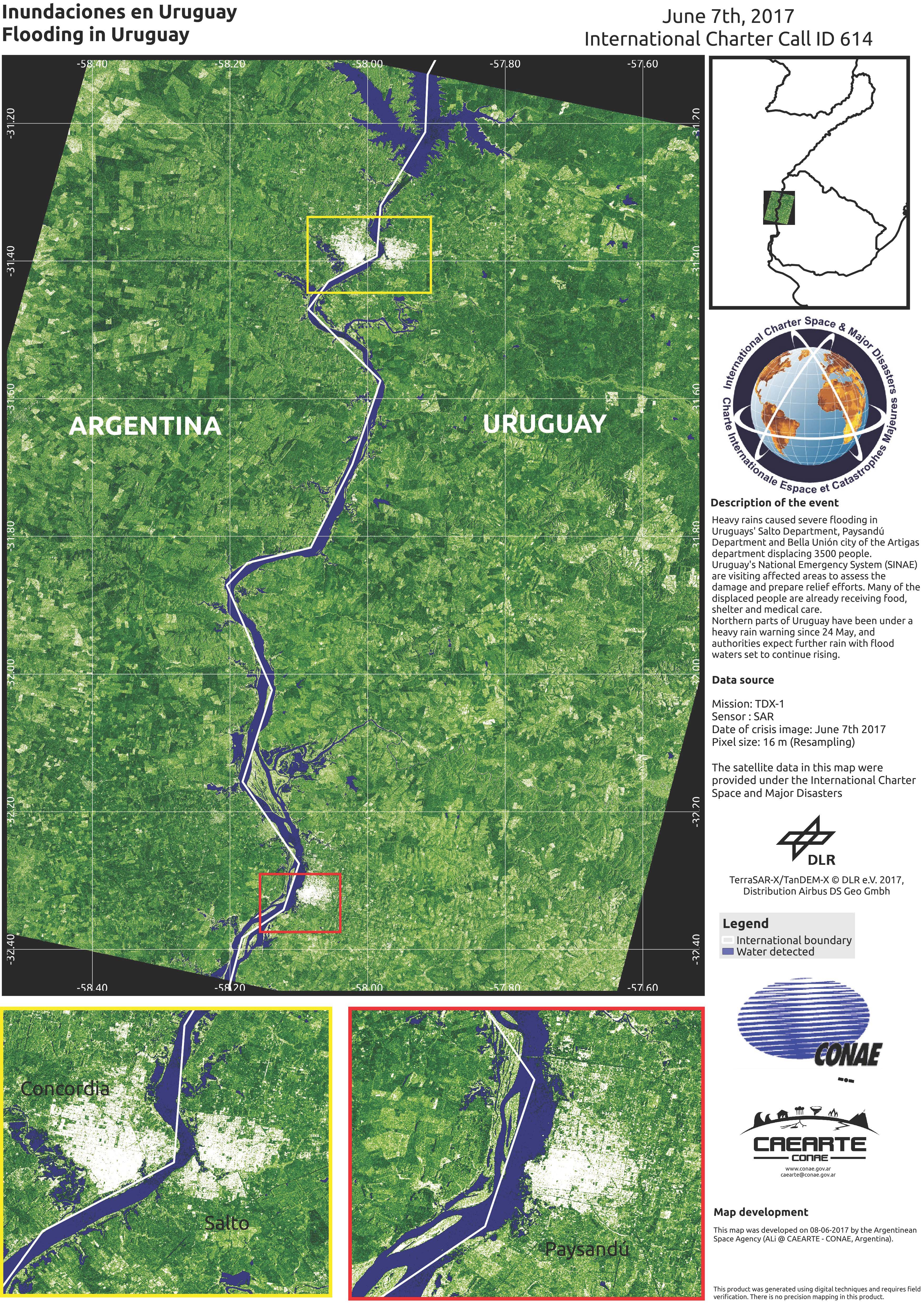
Flood in Uruguay
Heavy rains caused severe flooding in Uruguays' Salto Department, Paysandú Department and Bella Unión city of the Artigas department displacing 3500 people.
Uruguay's National Emergency System (SINAE) are visiting affected areas to assess the damage and prepare relief efforts. Many of the displaced people are already receiving food, shelter and medical care.
Northern parts of Uruguay have been under a heavy rain warning since 24 May, and authorities expect further rain with flood waters set to continue rising.
| Место события: | Uruguay |
| Date of Charter Activation: | 6 June 2017 |
| Время активации Хартии: | 15:17:00 |
| TЧасовой пояс в районе активации Хартии: | UTC+03:00 |
| Запрос на активацию поступил от: | Sistema Nacional de Emergencias - Presidencia de la República |
| Номер активации: | 535 |
| Менеждер проекта от: | CONAE |
Products
Comparison of flooding in Uruguay
Авторские права: RADARSAT-2 Data and Products © MacDonald, Dettwiler and Associates Ltd. (2017) - All Rights Reserved. RADARSAT is an official trademark of the Canadian Space Agency.
Map produced by CONAE
Information about the Product
Получено: Pre-disaster: 22/02/2017
Post-disaster: 08/06/2017
Источник: RADARSAT-2

 Вернуться к полному архиву активаций
