 English
 Spanish
 French
 Chinese
 Russian
 Portuguese
 Последняя Активация
Charter activations
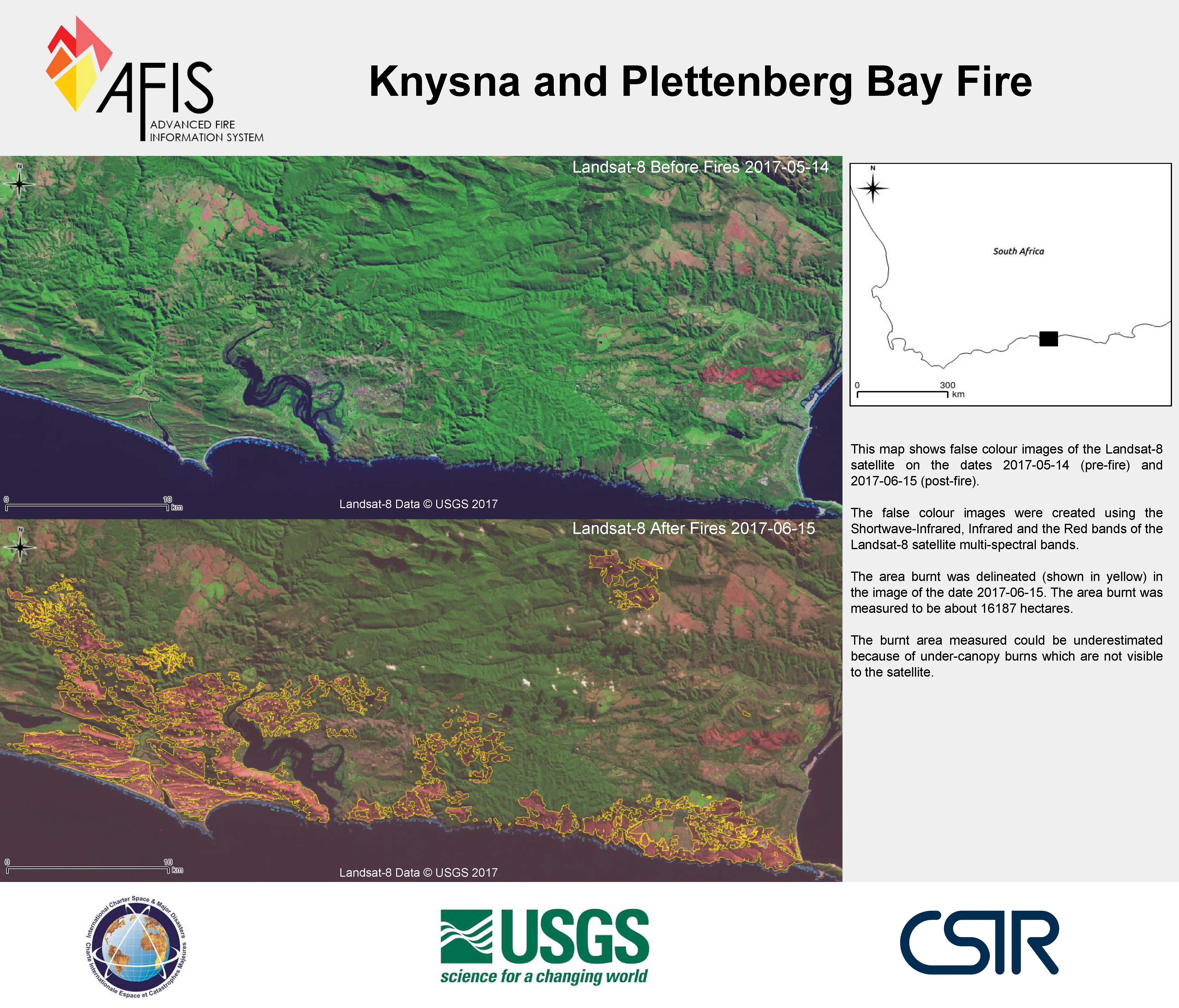
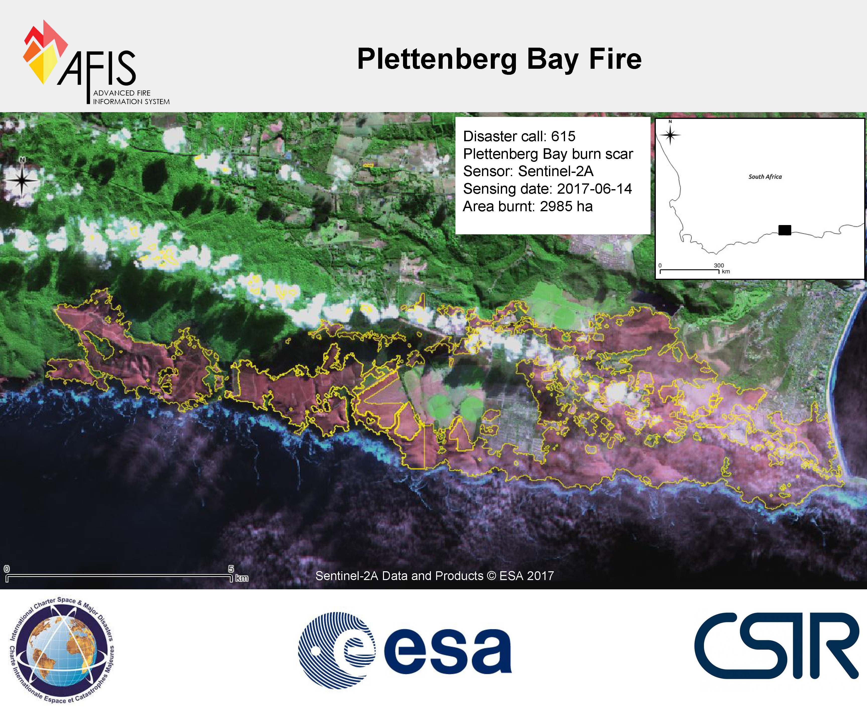
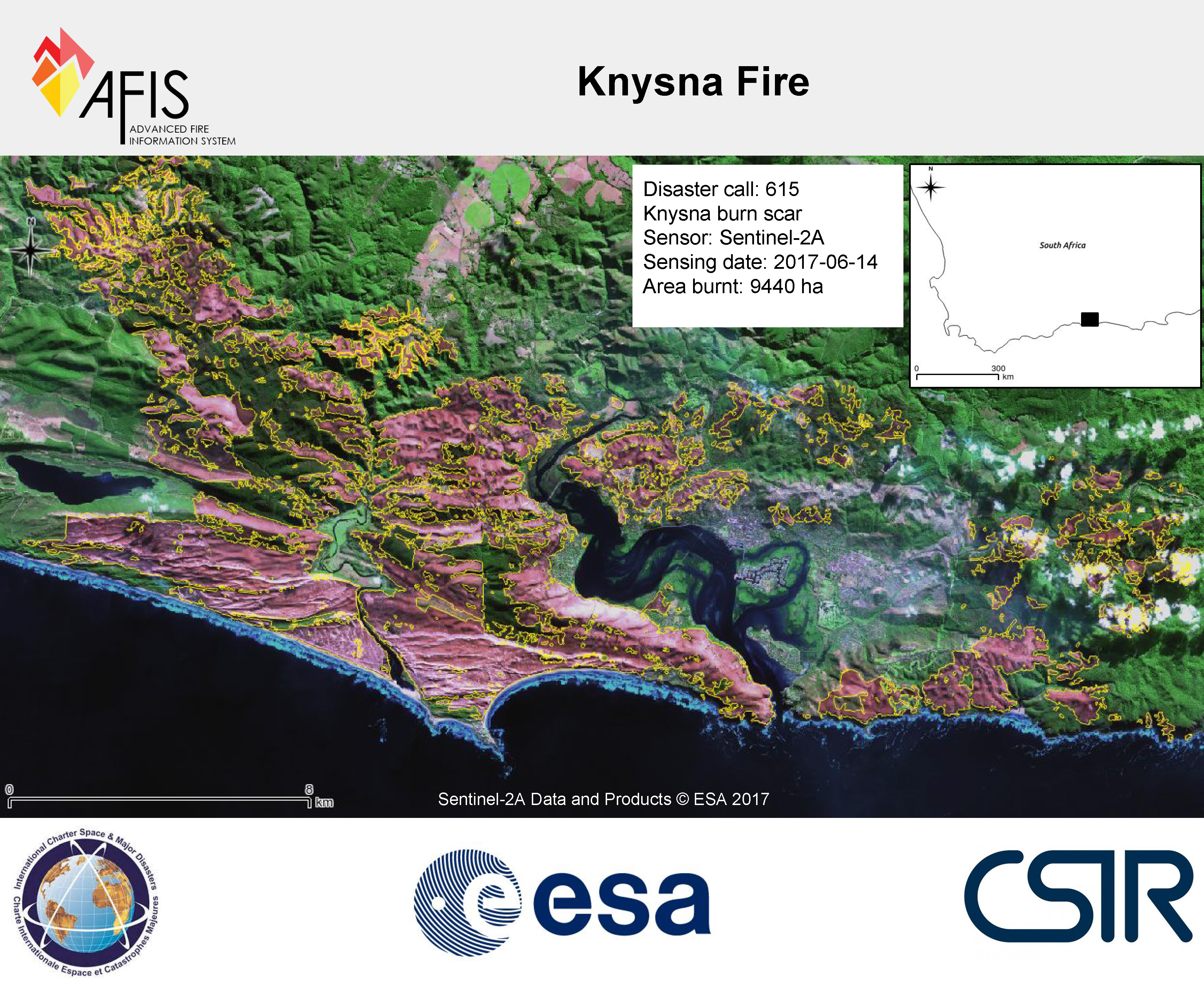
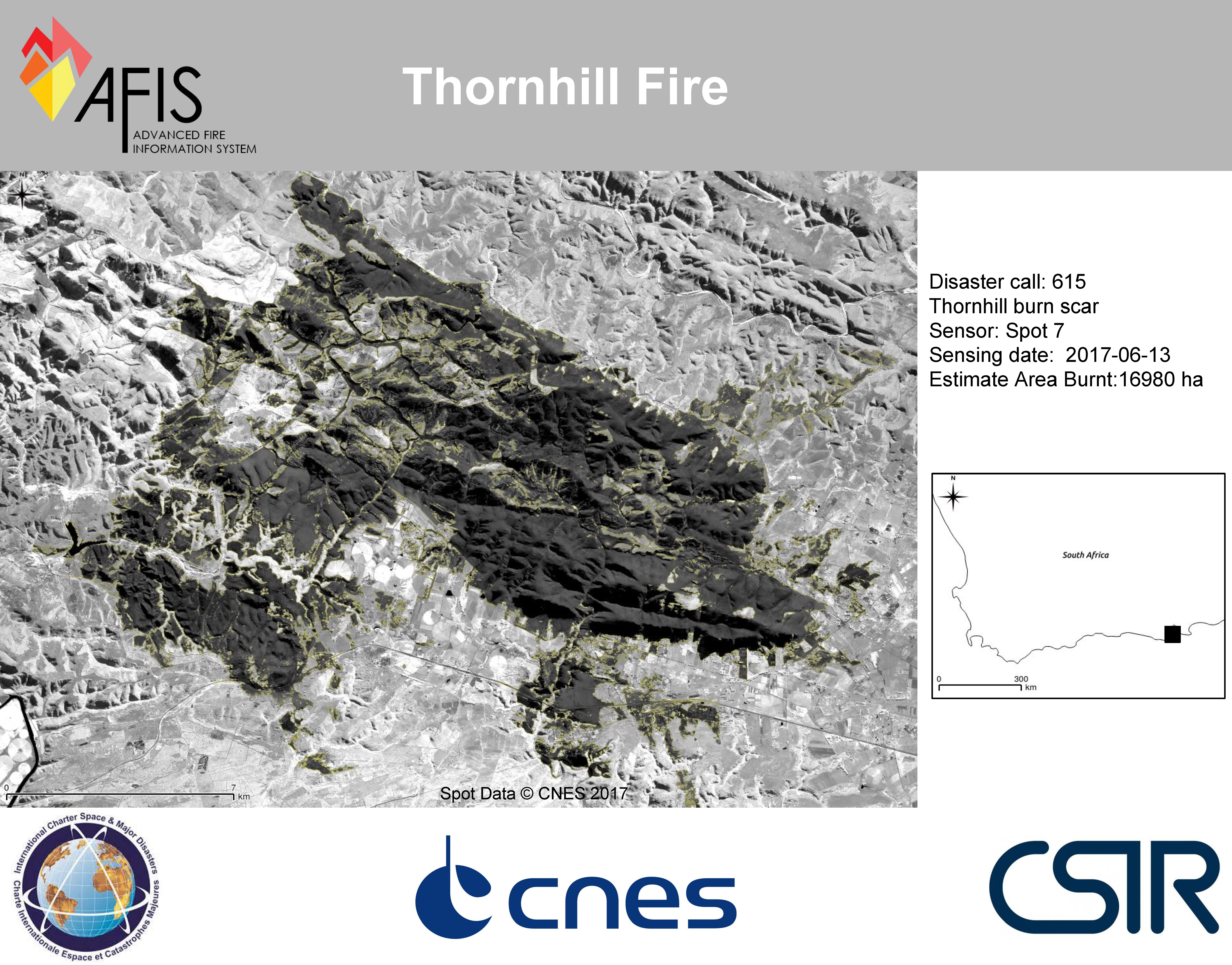
Fire in South Africa
Wildfires have devastated the Western and Southern Cape provinces of South Africa. Nine people have been killed and thousands were left homeless.
The disaster has been described as the worst fire the area has experienced on record.
While the exact cause of the fires has not yet been determined, they began following the worst storm the region has experienced in thirty years. The storm struck the coast of South Africa on the evening of 6 June and brought with it powerful winds which fuelled and spread the fires. This was in addition to the worst drought the Western Cape has experienced in over a century.
10,000 people were evacuated and over a thousand fire fighters worked to halt the fires. At one point the fire line stretched for 100km and continuing strong winds made the direction of the fires unpredictable and difficult to control. Two fire fighters died in the efforts to stop the blaze but it is believed that after four days of work the fires were successfully contained on 11 June. Nevertheless, residents have been advised not to return to their homes until authorities have completed damage assessments and confirmed that it is safe.
The town of Knysna was particularly affected, where almost 500 buildings had been destroyed. Many of those affected have lost all of their belongings in the devastating fires.
| Тип события: | Wildfire |
| Место события: | South Africa |
| Date of Charter Activation: | 12 June 2017 |
| Время активации Хартии: | 08:43:00 |
| TЧасовой пояс в районе активации Хартии: | UTC-05:00 |
| Запрос на активацию поступил от: | US Geological Survey on behalf of Directorate: Disaster Risk Reduction, Western Cape Government |
| Номер активации: | 536 |
| Менеждер проекта от: | Directorate: Disaster Risk Reduction, Western Cape Government |
Products
 Вернуться к полному архиву активаций

