 English
 Spanish
 French
 Chinese
 Russian
 Portuguese
 Latest Activation
Charter activations
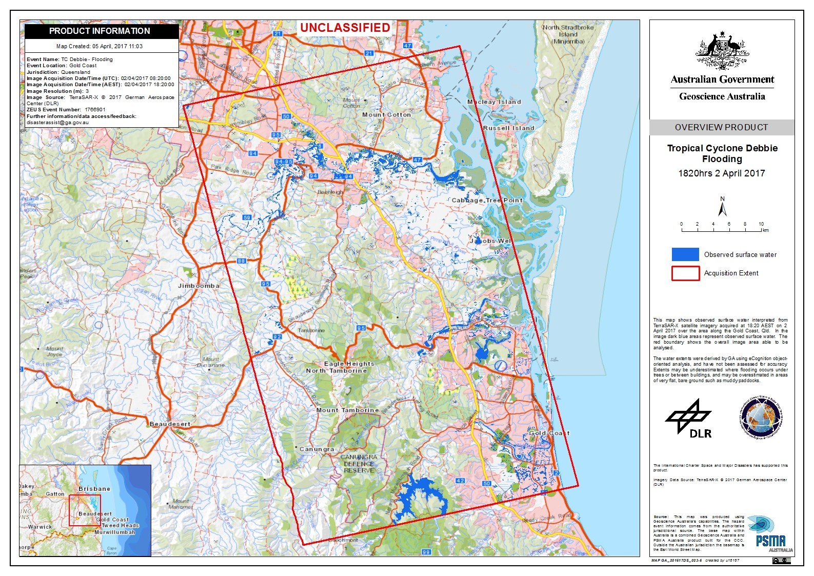
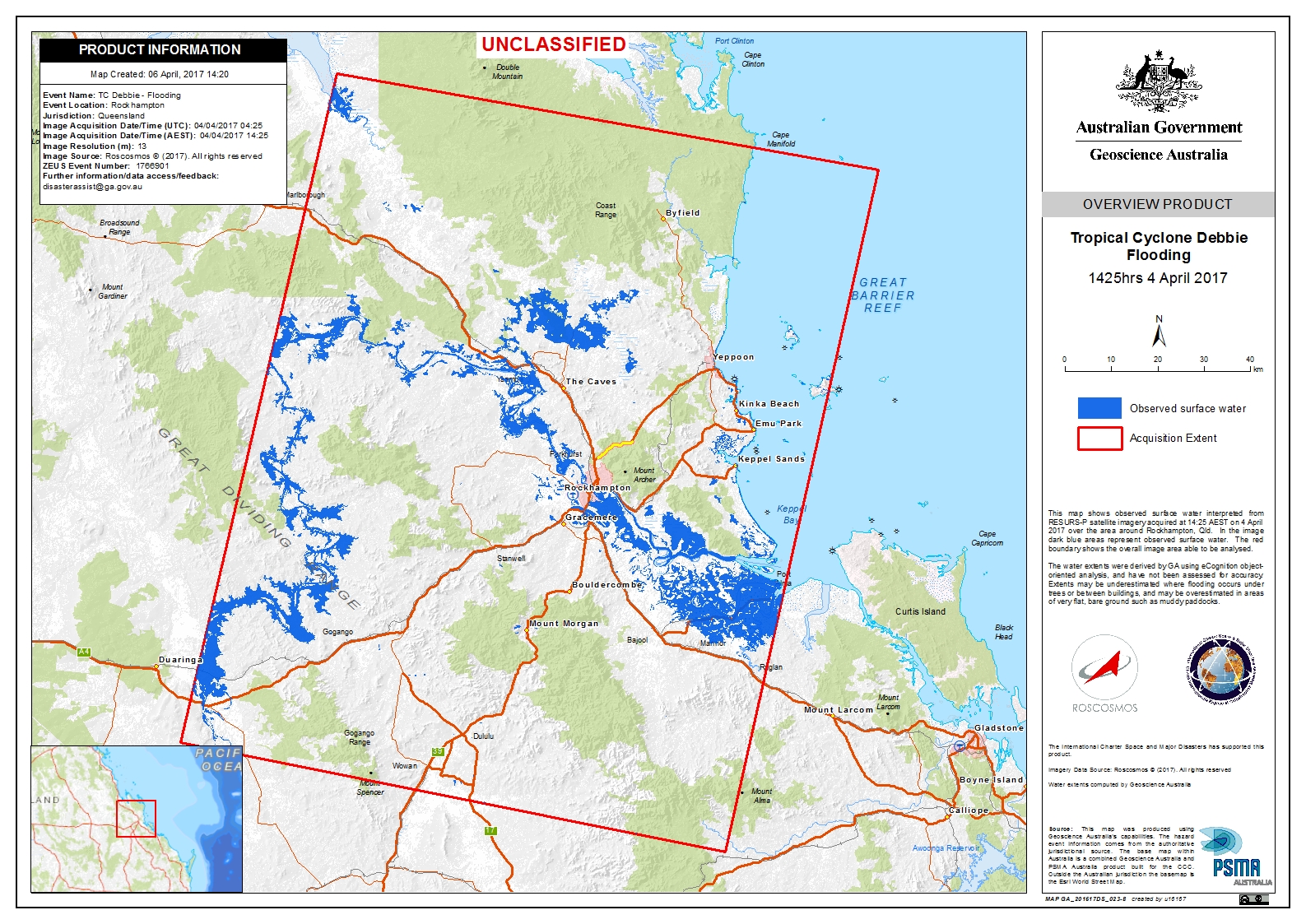
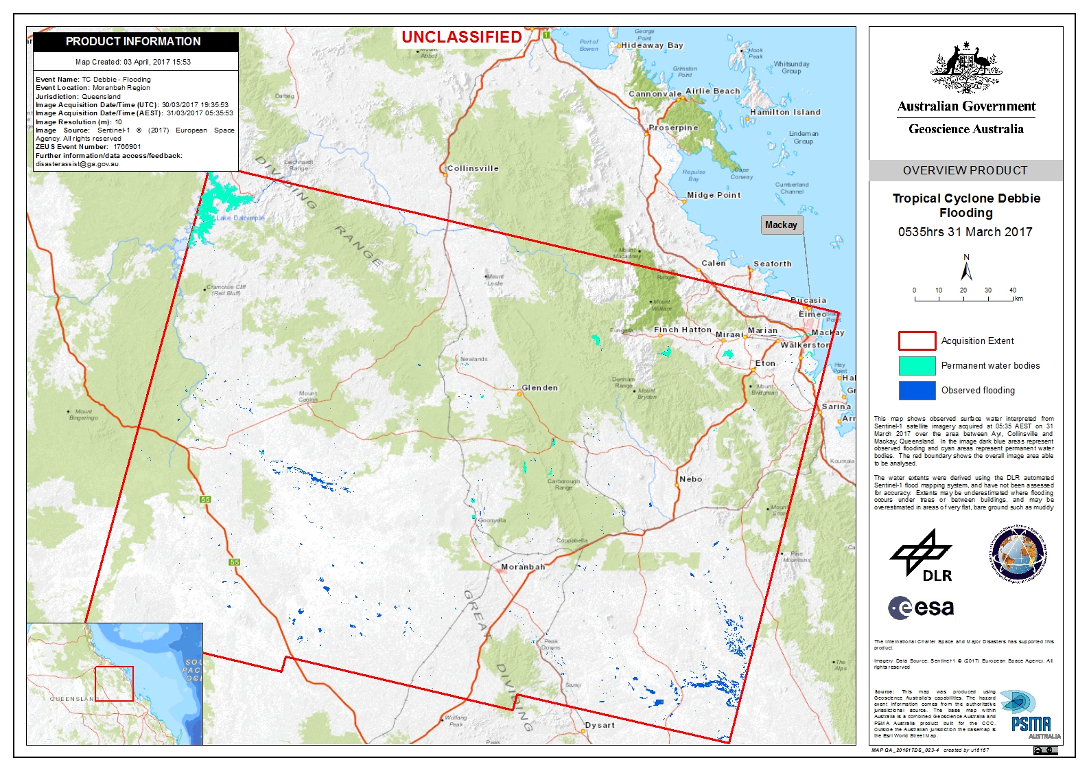
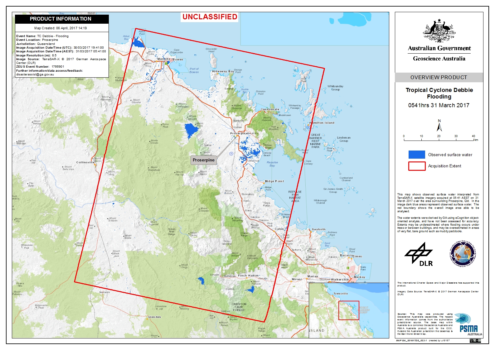
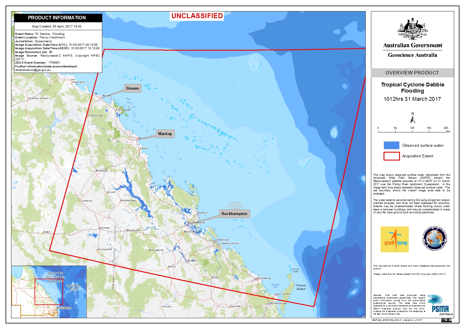
Cyclone Debbie in Australia
Cyclone Debbie made landfall in Queensland, Australia on 28 March, bringing heavy rainfall and flooding.
The powerful Category Four storm left three people dead and more than 25,000 were forced to evacuate their homes.
Debbie brought winds in excess of 263km/h and has caused damage to homes and infrastructure in the affected area. The storm has affected power lines, leaving tens of thousands without electricity and communications have also been disrupted. Some towns have been cut off by flash flooding, rendering roads impassable and delaying relief operations.
After making landfall, Debbie moved slowly in a south-west direction and while the storm weakened to Category Two, it continued to cause more flooding over the following days. It crossed the border into the neighbouring state of New South Wales where Debbie caused further damage and flooding.
There are concerns that the storm may even have damaged the Great Barrier Reef and analysts believe Debbie could cause one of the biggest floods Queensland has experienced in sixty years.
| Type of Event: | Ocean Storm - Cyclone |
| Location of Event: | Australia |
| Date of Charter Activation: | 29 March 2017 |
| Time of Charter Activation: | 13:19:00 |
| Time zone of Charter Activation: | UTC+11:00 |
| Charter Requestor: | Geoscience Australia on behalf of Emergency Management Australia |
| Activation ID: | 522 |
| Project Management: | Geoscience Australia |
Products
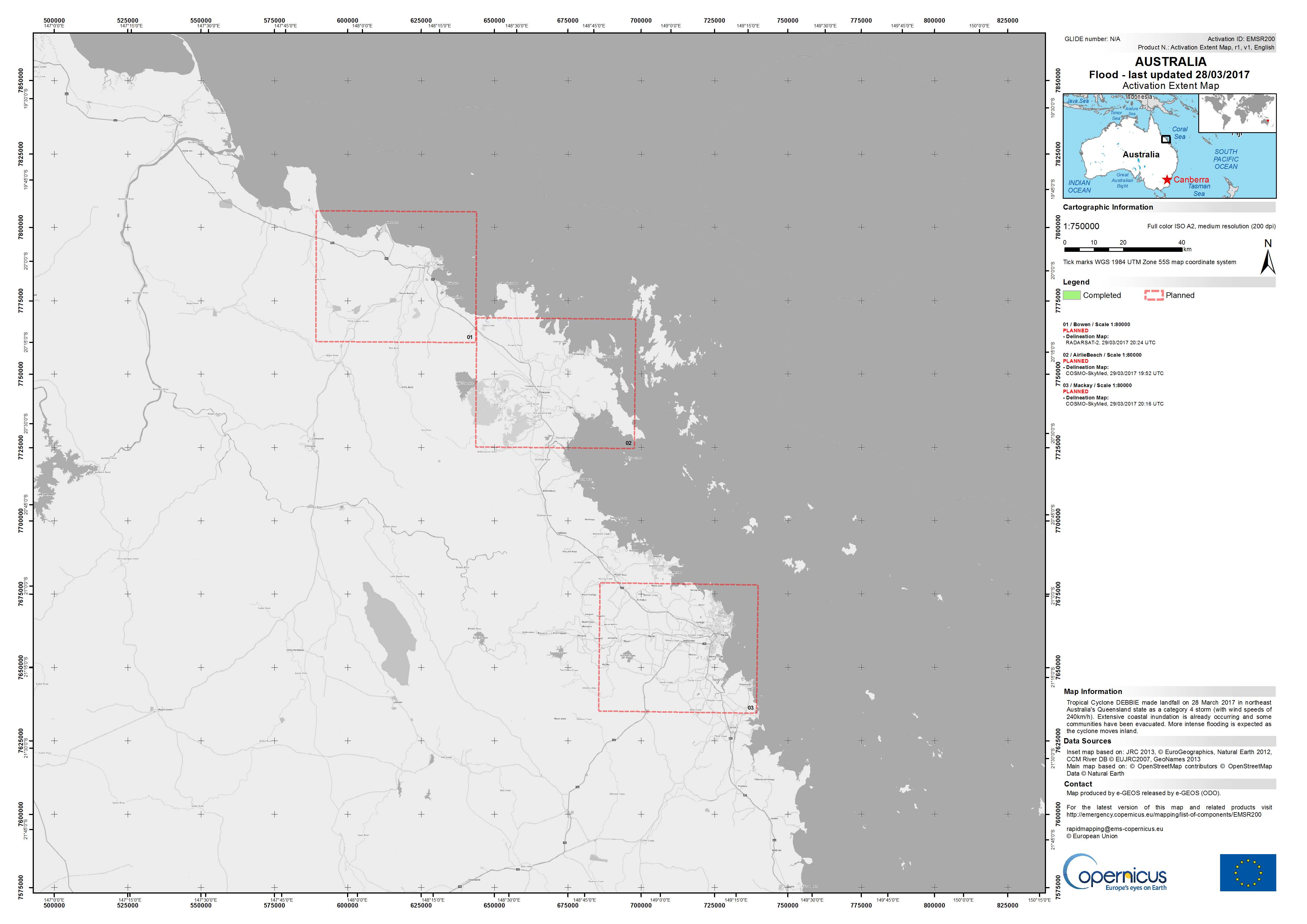
Areas affected by Cyclone Debbie in Queensland state
Copyright: RADARSAT-2 Data and Products © MacDonald, Dettwiler and Associates Ltd. (2016) - All Rights Reserved. RADARSAT is an official trademark of the Canadian Space Agency.
COSMO-SkyMed ©ASI (2017). All rights reserved
Map produced by e-GEOS
Information about the Product
Acquired: 29/03/2017
Source: RADARSAT-2 / COSMO-SkyMed
 Back to the full activation archive

